Property Record
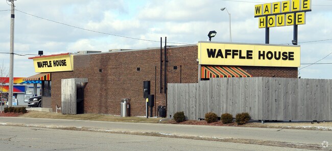
1069 E Main St, Greenwood, IN 46143


Property Detail
1069 E Main St
41-02-34-032-013.000-025
PT SW 1/4 S34 T14 R4
Restaurantdrivein
Johnson
B and X Area of moderate flood hazard, usually the area between the limits of the 100-year and 500-year floods.
Indiana
2024
0.34 AC
2025
Greenwood
610204
Indianapolis
1,587 SF
Indianapolis-Carmel-Greenwood, IN
NEARBY LISTINGS FOR SALE OR LEASE
DEMOGRAPHICS near 1069 E Main St
1 mile
3 mile
5 mile
2025 Total Population
7,053
65,683
151,031
2030 Population
7,312
67,790
154,870
Pop Growth 2025-2030
+ 3.67%
+ 3.21%
+ 2.54%
Average Age
39
38
38
2025 Total Households
3,244
26,257
57,954
HH Growth 2025-2030
+ 3.73%
+ 3.29%
+ 2.62%
Median Household Inc
$89,967
$81,025
$85,226
Avg Household Size
2.20
2.40
2.50
2025 Avg HH Vehicles
2.00
2.00
2.00
Median Home Value
$250,931
$266,925
$273,169
Median Year Built
1990
1993
1991
Nearby Places
Map Layers
Map Styles
 Street
 Aerial
Transit
 Traffic
 Biking
Places
Listings with unknown addresses are not visible on the map
- Restaurants
- Banks
- Shops
- Fitness
- Groceries
PUBLIC TRANSPORTATION
AIRPORT
Indianapolis International
Drive
Walk
Distance
Indianapolis International
37 min
23.8 mi
Freight Ports
Port of Toledo
Drive
Walk
Distance
Port of Toledo
282 min
235.7 mi
Nearby Properties
Address
Land Use
TOTAL SIZE
Lot Size
Zoning
Address
Land Use
TOTAL SIZE
Lot Size
Zoning
31,217 SF
105.06 AC
ZO01
Address
Land Use
TOTAL SIZE
Lot Size
Zoning
295,161 SF
70.54 AC
Address
Land Use
TOTAL SIZE
Lot Size
Zoning
816,376 SF
65.10 AC
Address
Land Use
TOTAL SIZE
Lot Size
Zoning
10,540 SF
49.19 AC
ZO01
Address
Land Use
TOTAL SIZE
Lot Size
Zoning
615,440 SF
78.64 AC
Address
Land Use
TOTAL SIZE
Lot Size
Zoning
670,880 SF
43.43 AC
Address
Land Use
TOTAL SIZE
Lot Size
Zoning
33,060 SF
20.01 AC
Address
Land Use
TOTAL SIZE
Lot Size
Zoning
420,084 SF
23.83 AC
Address
Land Use
TOTAL SIZE
Lot Size
Zoning
799,575 SF
37.56 AC
Address
Land Use
TOTAL SIZE
Lot Size
Zoning
5,576 SF
14.15 AC
ZO01
Address
Land Use
TOTAL SIZE
Lot Size
Zoning
446,500 SF
45.43 AC
Address
Land Use
TOTAL SIZE
Lot Size
Zoning
56,520 SF
35.65 AC
Address
Land Use
TOTAL SIZE
Lot Size
Zoning
493,560 SF
31.39 AC
Address
Land Use
TOTAL SIZE
Lot Size
Zoning
511,680 SF
37.57 AC
Address
Land Use
TOTAL SIZE
Lot Size
Zoning
667,500 SF
33.46 AC
Address
Land Use
TOTAL SIZE
Lot Size
Zoning
3,286 SF
26.39 AC
Address
Land Use
TOTAL SIZE
Lot Size
Zoning
581,612 SF
33.53 AC
Address
Land Use
TOTAL SIZE
Lot Size
Zoning
81,996 SF
8.56 AC
Address
Land Use
TOTAL SIZE
Lot Size
Zoning
4,970 SF
24.77 AC
Address
Land Use
TOTAL SIZE
Lot Size
Zoning
21,784 SF
30.75 AC
ZO01
Address
Land Use
TOTAL SIZE
Lot Size
Zoning
470,000 SF
22.75 AC
Address
Land Use
TOTAL SIZE
Lot Size
Zoning
5,401 SF
21.94 AC
ZO01
Address
Land Use
TOTAL SIZE
Lot Size
Zoning
181,458 SF
6 AC
Address
Land Use
TOTAL SIZE
Lot Size
Zoning
273,000 SF
22.28 AC
Address
Land Use
TOTAL SIZE
Lot Size
Zoning
1,968 SF
37.45 AC
Address
Land Use
TOTAL SIZE
Lot Size
Zoning
612,000 SF
31.01 AC
Address
Land Use
TOTAL SIZE
Lot Size
Zoning
226,129 SF
18.69 AC
ZO01
Address
Land Use
TOTAL SIZE
Lot Size
Zoning
331,200 SF
23.40 AC
Address
Land Use
TOTAL SIZE
Lot Size
Zoning
3,138 SF
24.71 AC
Address
Land Use
TOTAL SIZE
Lot Size
Zoning
98,294 SF
22.82 AC
ZO01
The World's #1 Commercial Real Estate Marketplace
Connect with us
© 2026 CoStar Group
The information above has been obtained from sources believed reliable. While we do not doubt its accuracy we have not verified it and make no guarantee, warranty or representation about it. It is your responsibility to independently confirm its accuracy and completeness. Any projections, opinions, assumptions, or estimates used are for example only and do not represent the current or future performance of the property. The value of this transaction to you depends on tax and other factors which should be evaluated by your tax, financial, and legal advisors. You and your advisors should conduct a careful, independent investigation of the property to determine to your satisfaction the suitability of the property for your needs.