Property Record
1069 Main St, Brewster, MA 02631
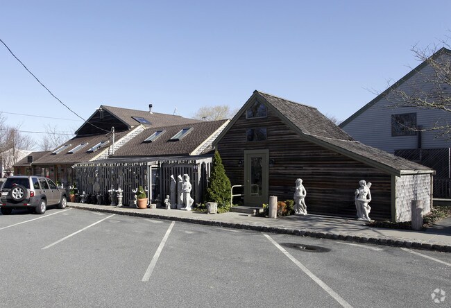


Property Detail
1069 Main St
Commercialnec
Barnstable
VILLAG
Massachusetts
AE The base floodplain where base flood elevations are provided. AE Zones are now used on new format FIRMs instead of A1-A30 Zones.
2.76 AC
2025
Cape Cod
2025
Other Market Areas
010800
Barnstable Town, MA
416 SF
BREW-000037-000000-000062
NEARBY LISTINGS FOR SALE OR LEASE
-
-
View all Brewster listings for sale on LoopNet.com
DEMOGRAPHICS near 1069 Main St
1 mile
3 mile
5 mile
2025 Total Population
1,063
8,879
25,197
2030 Population
1,095
9,117
25,504
Pop Growth 2025-2030
+ 3.01%
+ 2.68%
+ 1.22%
Average Age
54
53
52
2025 Total Households
511
4,260
11,603
HH Growth 2025-2030
+ 3.13%
+ 2.44%
+ 1.05%
Median Household Inc
$81,359
$87,075
$94,836
Avg Household Size
2.00
2.00
2.10
2025 Avg HH Vehicles
2.00
2.00
2.00
Median Home Value
$881,147
$772,035
$701,388
Median Year Built
1978
1982
1979
Nearby Places
Map Layers
Map Styles
 Street
 Aerial
Transit
 Traffic
 Biking
Places
Listings with unknown addresses are not visible on the map
- Restaurants
- Banks
- Shops
- Fitness
- Groceries
Nearby Properties
Address
Land Use
TOTAL SIZE
Lot Size
Zoning
Address
Land Use
TOTAL SIZE
Lot Size
Zoning
108,575 SF
0.48 AC
RESD.
Address
Land Use
TOTAL SIZE
Lot Size
Zoning
12.72 AC
R-60
Address
Land Use
TOTAL SIZE
Lot Size
Zoning
83,860 SF
9.96 AC
RESD.
Address
Land Use
TOTAL SIZE
Lot Size
Zoning
3.71 AC
Address
Land Use
TOTAL SIZE
Lot Size
Zoning
93,832 SF
22.68 AC
COMM H
Address
Land Use
TOTAL SIZE
Lot Size
Zoning
6,517 SF
0.14 AC
DCPC
Address
Land Use
TOTAL SIZE
Lot Size
Zoning
59,364 SF
28.65 AC
COMM H
Address
Land Use
TOTAL SIZE
Lot Size
Zoning
600 SF
6 AC
RESD.
Address
Land Use
TOTAL SIZE
Lot Size
Zoning
320 SF
9.01 AC
Address
Land Use
TOTAL SIZE
Lot Size
Zoning
8,432 SF
3.95 AC
RESD.
Address
Land Use
TOTAL SIZE
Lot Size
Zoning
Address
Land Use
TOTAL SIZE
Lot Size
Zoning
480 SF
3.33 AC
RESD.
Address
Land Use
TOTAL SIZE
Lot Size
Zoning
12,778 SF
14.40 AC
COMM H
Address
Land Use
TOTAL SIZE
Lot Size
Zoning
4 AC
R-60
Address
Land Use
TOTAL SIZE
Lot Size
Zoning
162.60 AC
Address
Land Use
TOTAL SIZE
Lot Size
Zoning
3,180 SF
2.05 AC
Address
Land Use
TOTAL SIZE
Lot Size
Zoning
4,762 SF
1.85 AC
RESD.
Address
Land Use
TOTAL SIZE
Lot Size
Zoning
135 AC
RESD.
Address
Land Use
TOTAL SIZE
Lot Size
Zoning
3,757 SF
0.47 AC
RESD.
Address
Land Use
TOTAL SIZE
Lot Size
Zoning
6,401 SF
7.07 AC
RESD.
Address
Land Use
TOTAL SIZE
Lot Size
Zoning
4,459 SF
10 AC
RESD.
Address
Land Use
TOTAL SIZE
Lot Size
Zoning
3,236 SF
0.57 AC
RESD.
Address
Land Use
TOTAL SIZE
Lot Size
Zoning
2,032 SF
0.79 AC
RESD.
Address
Land Use
TOTAL SIZE
Lot Size
Zoning
4.66 AC
R-60
Address
Land Use
TOTAL SIZE
Lot Size
Zoning
3,398 SF
1.43 AC
RESD.
Address
Land Use
TOTAL SIZE
Lot Size
Zoning
5,066 SF
38.27 AC
RESD.
Address
Land Use
TOTAL SIZE
Lot Size
Zoning
0.27 AC
R-60
Address
Land Use
TOTAL SIZE
Lot Size
Zoning
23,472 SF
13.52 AC
RESD.
Address
Land Use
TOTAL SIZE
Lot Size
Zoning
2,600 SF
0.65 AC
RESD.
Address
Land Use
TOTAL SIZE
Lot Size
Zoning
2,142 SF
0.69 AC
RESD.
The World's #1 Commercial Real Estate Marketplace
Connect with us
© 2026 CoStar Group
The information above has been obtained from sources believed reliable. While we do not doubt its accuracy we have not verified it and make no guarantee, warranty or representation about it. It is your responsibility to independently confirm its accuracy and completeness. Any projections, opinions, assumptions, or estimates used are for example only and do not represent the current or future performance of the property. The value of this transaction to you depends on tax and other factors which should be evaluated by your tax, financial, and legal advisors. You and your advisors should conduct a careful, independent investigation of the property to determine to your satisfaction the suitability of the property for your needs.