Property Record
1069 S 1600 W, Perry, UT 84302

Property Detail
1069 S 1600 W
Brigham City, UT-ID
LOT 09, POINTE PERRY SUBDIVISION, PH 02. PART OF SEC 27, T 09N, R 02W, SLM.
03-236-0022
BOX ELDER
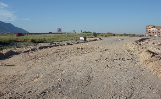
Commercialacreage
Utah
B and X Area of moderate flood hazard, usually the area between the limits of the 100-year and 500-year floods.
9
2025
2.35 AC
2025
Utah North Area
960500
Other Market Areas
NEARBY LISTINGS FOR SALE OR LEASE
DEMOGRAPHICS near 1069 S 1600 W
1 mile
3 mile
5 mile
2024 Total Population
12
18,971
27,814
2029 Population
13
20,461
30,026
Pop Growth 2024-2029
+ 8.33%
+ 7.85%
+ 7.95%
Average Age
35
36
36
2024 Total Households
4
6,402
9,331
HH Growth 2024-2029
0.00%
+ 7.89%
+ 7.95%
Median Household Inc
$99,999
$80,071
$80,859
Avg Household Size
2.50
2.90
2.90
2024 Avg HH Vehicles
3.00
2.00
2.00
Median Home Value
$450,000
$397,376
$398,897
Median Year Built
2010
1981
1978
Nearby Places
Map Layers
Map Styles
 Street
 Aerial
Transit
 Traffic
 Biking
Places
Listings with unknown addresses are not visible on the map
- Restaurants
- Banks
- Shops
- Fitness
- Groceries
SALE & LEASE HISTORY
LISTING DATE
SALE/LEASE

Sep 24, 2016
For Sale
Apr 10, 2017
For Sale
Nearby Properties
Address
Land Use
TOTAL SIZE
Lot Size
Zoning
Address
Land Use
TOTAL SIZE
Lot Size
Zoning
88.86 AC
Address
Land Use
TOTAL SIZE
Lot Size
Zoning
Address
Land Use
TOTAL SIZE
Lot Size
Zoning
219,000 SF
53.94 AC
Address
Land Use
TOTAL SIZE
Lot Size
Zoning
17,172 SF
5.64 AC
Address
Land Use
TOTAL SIZE
Lot Size
Zoning
184,435 SF
9.95 AC
Address
Land Use
TOTAL SIZE
Lot Size
Zoning
92,100 SF
6.83 AC
Address
Land Use
TOTAL SIZE
Lot Size
Zoning
41,584 SF
10.78 AC
Address
Land Use
TOTAL SIZE
Lot Size
Zoning
19.04 AC
Address
Land Use
TOTAL SIZE
Lot Size
Zoning
318.85 AC
Address
Land Use
TOTAL SIZE
Lot Size
Zoning
3.31 AC
Address
Land Use
TOTAL SIZE
Lot Size
Zoning
1.43 AC
Address
Land Use
TOTAL SIZE
Lot Size
Zoning
4.45 AC
Address
Land Use
TOTAL SIZE
Lot Size
Zoning
170.94 AC
Address
Land Use
TOTAL SIZE
Lot Size
Zoning
6,570 SF
9.11 AC
Address
Land Use
TOTAL SIZE
Lot Size
Zoning
2.88 AC
Address
Land Use
TOTAL SIZE
Lot Size
Zoning
32,698 SF
2.41 AC
Address
Land Use
TOTAL SIZE
Lot Size
Zoning
31,882 SF
5.10 AC
Address
Land Use
TOTAL SIZE
Lot Size
Zoning
3.60 AC
Address
Land Use
TOTAL SIZE
Lot Size
Zoning
3.92 AC
Address
Land Use
TOTAL SIZE
Lot Size
Zoning
39,674 SF
2.73 AC
Address
Land Use
TOTAL SIZE
Lot Size
Zoning
28,191 SF
2.29 AC
Address
Land Use
TOTAL SIZE
Lot Size
Zoning
30,978 SF
1.49 AC
Address
Land Use
TOTAL SIZE
Lot Size
Zoning
13,014 SF
1.40 AC
Address
Land Use
TOTAL SIZE
Lot Size
Zoning
11,070 SF
5.95 AC
Address
Land Use
TOTAL SIZE
Lot Size
Zoning
Address
Land Use
TOTAL SIZE
Lot Size
Zoning
7,945 SF
4.80 AC
Address
Land Use
TOTAL SIZE
Lot Size
Zoning
23,186 SF
3.56 AC
Address
Land Use
TOTAL SIZE
Lot Size
Zoning
10,264 SF
2.15 AC
Address
Land Use
TOTAL SIZE
Lot Size
Zoning
11,580 SF
1.83 AC
Address
Land Use
TOTAL SIZE
Lot Size
Zoning
41,928 SF
3.18 AC
The World's #1 Commercial Real Estate Marketplace
Connect with us
© 2026 CoStar Group
The information above has been obtained from sources believed reliable. While we do not doubt its accuracy we have not verified it and make no guarantee, warranty or representation about it. It is your responsibility to independently confirm its accuracy and completeness. Any projections, opinions, assumptions, or estimates used are for example only and do not represent the current or future performance of the property. The value of this transaction to you depends on tax and other factors which should be evaluated by your tax, financial, and legal advisors. You and your advisors should conduct a careful, independent investigation of the property to determine to your satisfaction the suitability of the property for your needs.