Property Record
107 B Ave, Valdosta, GA 31601
NEARBY LISTINGS FOR SALE OR LEASE
Property Detail
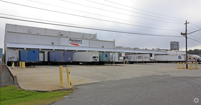
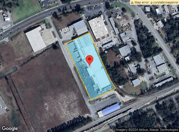
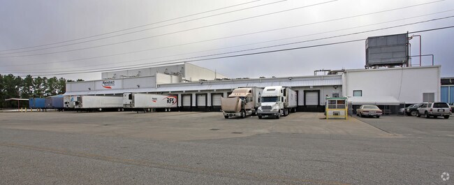
107 B Ave
Valdosta, GA
St Augustine South
0086D-072
LTS 4, 6 & 8 & S 1/2 LT 3 /2
Distributionwarehouseregional
Lowndes
X
Georgia
13185C0210E
4,6,8
2024
4.63 AC
2024
Valdosta/Lake Park
010900
Other Market Areas
109,920 SF
DEMOGRAPHICS near 107 B Ave
1 Mile
3 Mile
5 Mile
2024 Total Population
3,120
31,142
58,941
2029 Population
3,253
32,449
61,249
Pop Growth 2024-2029
+ 4.26%
+ 4.20%
+ 3.92%
Average Age
36
34
35
2024 Total Households
1,187
11,878
23,303
HH Growth 2024-2029
+ 4.72%
+ 4.50%
+ 4.09%
Median Household Inc
$21,992
$26,423
$30,256
Avg Household Size
2.30
2.30
2.30
2024 Avg HH Vehicles
2.00
1.00
2.00
Median Home Value
$109,630
$135,856
$145,818
Median Year Built
1978
1978
1984
Nearby Places
Map Layers
Map Styles
 Street
 Aerial
- Restaurants
- Banks
- Shops
- Fitness
- Groceries
PUBLIC TRANSPORTATION
AIRPORT
Valdosta Regional
DRIVE
WALK
Distance
Valdosta Regional
8 min
4.4 mi
Nearby Properties
Address
Land Use
TOTAL SIZE
Lot Size
Zoning
Address
Land Use
TOTAL SIZE
Lot Size
Zoning
1,200 SF
73.36 AC
M-2
Address
Land Use
TOTAL SIZE
Lot Size
Zoning
459,770 SF
31.50 AC
C-H
Address
Land Use
TOTAL SIZE
Lot Size
Zoning
115,460 SF
13.09 AC
R-M
Address
Land Use
TOTAL SIZE
Lot Size
Zoning
210,020 SF
4.22 AC
C-C
Address
Land Use
TOTAL SIZE
Lot Size
Zoning
1,686 SF
18.88 AC
R-M
Address
Land Use
TOTAL SIZE
Lot Size
Zoning
414,158 SF
40 AC
M-1
Address
Land Use
TOTAL SIZE
Lot Size
Zoning
163,083 SF
17.16 AC
C-H
Address
Land Use
TOTAL SIZE
Lot Size
Zoning
150,802 SF
11.97 AC
M-1
Address
Land Use
TOTAL SIZE
Lot Size
Zoning
210,000 SF
81.43 AC
M-2
Address
Land Use
TOTAL SIZE
Lot Size
Zoning
203,741 SF
22.55 AC
C-H
Address
Land Use
TOTAL SIZE
Lot Size
Zoning
2,496 SF
63.73 AC
M-2
Address
Land Use
TOTAL SIZE
Lot Size
Zoning
120,720 SF
11.31 AC
C-H
Address
Land Use
TOTAL SIZE
Lot Size
Zoning
32,886 SF
5.45 AC
C-C
Address
Land Use
TOTAL SIZE
Lot Size
Zoning
104,544 SF
20.31 AC
R-M
Address
Land Use
TOTAL SIZE
Lot Size
Zoning
104,423 SF
2.62 AC
C-H
Address
Land Use
TOTAL SIZE
Lot Size
Zoning
142,140 SF
24.29 AC
DR-10
Address
Land Use
TOTAL SIZE
Lot Size
Zoning
101,792 SF
14.09 AC
C-H
Address
Land Use
TOTAL SIZE
Lot Size
Zoning
97,568 SF
3.63 AC
C-H
Address
Land Use
TOTAL SIZE
Lot Size
Zoning
89,977 SF
11.16 AC
C-H
Address
Land Use
TOTAL SIZE
Lot Size
Zoning
101,774 SF
3.55 AC
C-H
Address
Land Use
TOTAL SIZE
Lot Size
Zoning
50,016 SF
3.79 AC
C-C
Address
Land Use
TOTAL SIZE
Lot Size
Zoning
120,400 SF
9.12 AC
M-1
Address
Land Use
TOTAL SIZE
Lot Size
Zoning
100,812 SF
6.43 AC
R-M
Address
Land Use
TOTAL SIZE
Lot Size
Zoning
88,545 SF
9.09 AC
C-H
Address
Land Use
TOTAL SIZE
Lot Size
Zoning
80,062 SF
3 AC
C-H
Address
Land Use
TOTAL SIZE
Lot Size
Zoning
55,599 SF
4.14 AC
C-H
Address
Land Use
TOTAL SIZE
Lot Size
Zoning
76,250 SF
3.05 AC
C-H
Address
Land Use
TOTAL SIZE
Lot Size
Zoning
78,048 SF
9.18 AC
R-P
Address
Land Use
TOTAL SIZE
Lot Size
Zoning
59,044 SF
8.35 AC
C-C
Address
Land Use
TOTAL SIZE
Lot Size
Zoning
143,560 SF
M-1
The World's #1 Commercial Real Estate Marketplace
Connect with us
© 2025 CoStar Group
The information above has been obtained from sources believed reliable. While we do not doubt its accuracy we have not verified it and make no guarantee, warranty or representation about it. It is your responsibility to independently confirm its accuracy and completeness. Any projections, opinions, assumptions, or estimates used are for example only and do not represent the current or future performance of the property. The value of this transaction to you depends on tax and other factors which should be evaluated by your tax, financial, and legal advisors. You and your advisors should conduct a careful, independent investigation of the property to determine to your satisfaction the suitability of the property for your needs.