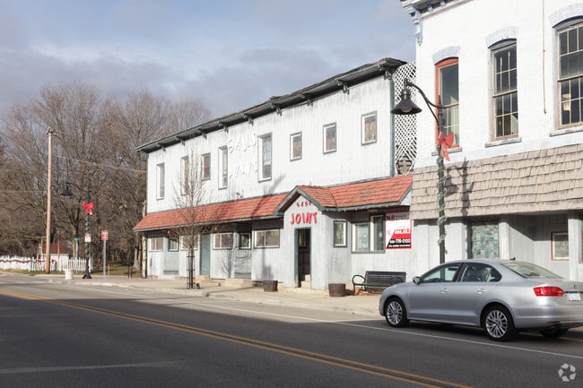
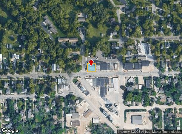
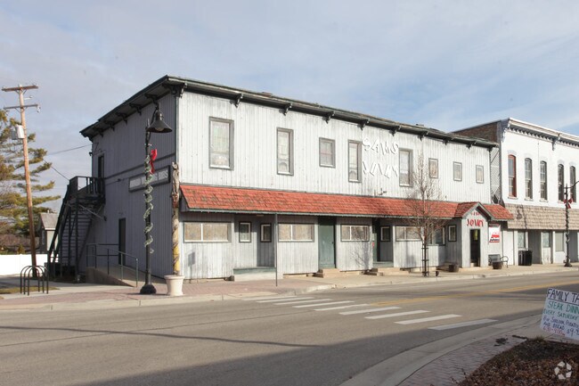
Property Record
107 E Main St Se, Caledonia, MI 49316
NEARBY LISTINGS FOR SALE OR LEASE
-
-
View all Caledonia listings for sale on LoopNet.com
Property Detail
107 E Main St Se
Grand Rapids-Wyoming-Kentwood, MI
Kinseys Plat Of Caledonia Station
41-23-29-402-017
412329402017 W 80 FT OF LOT 7 BLK 5 ALSO S 12 FT OF W 32 FT OF LOT 6 BLK 5 ALSO S 12 FT OF E 26 FT OF W 80 FT OF LOT 6 BLK 5
Restaurantbuilding
Kent
X
Michigan
26005C0150G
6-7
2024
0.17 AC
2025
SE Kent County/Caledonia
014810
West Michigan
7,400 SF
DEMOGRAPHICS near 107 E Main St Se
1 Mile
3 Mile
5 Mile
2024 Total Population
2,561
11,502
23,766
2029 Population
2,599
11,725
24,288
Pop Growth 2024-2029
+ 1.48%
+ 1.94%
+ 2.20%
Average Age
36
38
38
2024 Total Households
902
3,804
7,883
HH Growth 2024-2029
+ 1.55%
+ 2.08%
+ 2.27%
Median Household Inc
$99,605
$97,566
$99,734
Avg Household Size
2.80
2.80
2.90
2024 Avg HH Vehicles
2.00
2.00
2.00
Median Home Value
$289,318
$309,668
$312,626
Median Year Built
1994
1999
1996
Nearby Places
Map Layers
Map Styles
 Street
 Aerial
- Restaurants
- Banks
- Shops
- Fitness
- Groceries
PUBLIC TRANSPORTATION
AIRPORT
Gerald R Ford International
DRIVE
WALK
Distance
Gerald R Ford International
15 min
6.9 mi
Nearby Properties
Address
Land Use
TOTAL SIZE
Lot Size
Zoning
Address
Land Use
TOTAL SIZE
Lot Size
Zoning
5,744 SF
112.32 AC
MHC
Address
Land Use
TOTAL SIZE
Lot Size
Zoning
8.80 AC
R3
Address
Land Use
TOTAL SIZE
Lot Size
Zoning
40,863 SF
5.33 AC
PUD
Address
Land Use
TOTAL SIZE
Lot Size
Zoning
33,742 SF
6.71 AC
C2
Address
Land Use
TOTAL SIZE
Lot Size
Zoning
3,424 SF
120 AC
A
Address
Land Use
TOTAL SIZE
Lot Size
Zoning
36,778 SF
5.72 AC
PUD
Address
Land Use
TOTAL SIZE
Lot Size
Zoning
29,125 SF
2.96 AC
PUD
Address
Land Use
TOTAL SIZE
Lot Size
Zoning
36,360 SF
4.35 AC
PUD
Address
Land Use
TOTAL SIZE
Lot Size
Zoning
14,674 SF
2.09 AC
PUD
Address
Land Use
TOTAL SIZE
Lot Size
Zoning
32,290 SF
3.41 AC
PUD
Address
Land Use
TOTAL SIZE
Lot Size
Zoning
41,220 SF
6.08 AC
R3
Address
Land Use
TOTAL SIZE
Lot Size
Zoning
17,312 SF
2.80 AC
PUD
Address
Land Use
TOTAL SIZE
Lot Size
Zoning
11.63 AC
PUD
Address
Land Use
TOTAL SIZE
Lot Size
Zoning
12,376 SF
2.38 AC
C2
Address
Land Use
TOTAL SIZE
Lot Size
Zoning
5.28 AC
PUD
Address
Land Use
TOTAL SIZE
Lot Size
Zoning
5.76 AC
PUD
Address
Land Use
TOTAL SIZE
Lot Size
Zoning
4,774 SF
10.60 AC
C2
Address
Land Use
TOTAL SIZE
Lot Size
Zoning
1,825 SF
128.19 AC
A
Address
Land Use
TOTAL SIZE
Lot Size
Zoning
15,996 SF
1.76 AC
C1
Address
Land Use
TOTAL SIZE
Lot Size
Zoning
13,682 SF
2.92 AC
PUD
Address
Land Use
TOTAL SIZE
Lot Size
Zoning
2,254 SF
114.24 AC
A
Address
Land Use
TOTAL SIZE
Lot Size
Zoning
77.33 AC
A
Address
Land Use
TOTAL SIZE
Lot Size
Zoning
9,138 SF
2.45 AC
PUD
Address
Land Use
TOTAL SIZE
Lot Size
Zoning
14,010 SF
3.81 AC
PUD
Address
Land Use
TOTAL SIZE
Lot Size
Zoning
4,339 SF
63.28 AC
RR
Address
Land Use
TOTAL SIZE
Lot Size
Zoning
75.41 AC
Address
Land Use
TOTAL SIZE
Lot Size
Zoning
12,840 SF
1.60 AC
PUD
Address
Land Use
TOTAL SIZE
Lot Size
Zoning
47.47 AC
Address
Land Use
TOTAL SIZE
Lot Size
Zoning
9,818 SF
3.36 AC
PUD
Address
Land Use
TOTAL SIZE
Lot Size
Zoning
12,000 SF
1.18 AC
PUD
The World's #1 Commercial Real Estate Marketplace
Connect with us
© 2026 CoStar Group
The information above has been obtained from sources believed reliable. While we do not doubt its accuracy we have not verified it and make no guarantee, warranty or representation about it. It is your responsibility to independently confirm its accuracy and completeness. Any projections, opinions, assumptions, or estimates used are for example only and do not represent the current or future performance of the property. The value of this transaction to you depends on tax and other factors which should be evaluated by your tax, financial, and legal advisors. You and your advisors should conduct a careful, independent investigation of the property to determine to your satisfaction the suitability of the property for your needs.