Property Record
107 S Laurel St, Springfield, GA 31329


NEARBY LISTINGS FOR SALE OR LEASE
Property Detail
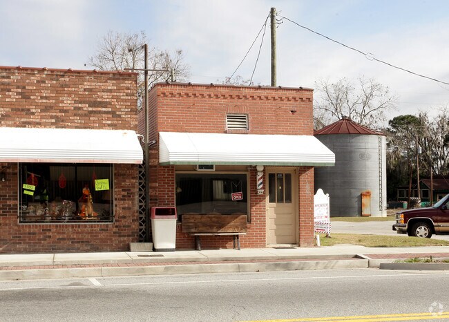
107 S Laurel St
S1020-00000-059-000
.31 AC
Storebuilding
Effingham
X
Georgia
13103C0256E
0.31 AC
2025
Effingham County
2025
Savannah
030205
Savannah, GA
1,941 SF
DEMOGRAPHICS near 107 S Laurel St
1 mile
3 mile
5 mile
2024 Total Population
2,992
6,867
13,750
2029 Population
3,473
7,982
16,050
Pop Growth 2024-2029
+ 16.08%
+ 16.24%
+ 16.73%
Average Age
38
37
37
2024 Total Households
1,007
2,343
4,729
HH Growth 2024-2029
+ 16.09%
+ 16.22%
+ 16.71%
Median Household Inc
$62,806
$63,291
$70,151
Avg Household Size
2.80
2.80
2.80
2024 Avg HH Vehicles
2.00
2.00
2.00
Median Home Value
$206,838
$226,080
$229,122
Median Year Built
1990
1998
2001
Nearby Places
Map Layers
Map Styles
 Street
 Aerial
Transit
 Traffic
 Biking
Places
Listings with unknown addresses are not visible on the map
- Restaurants
- Banks
- Shops
- Fitness
- Groceries
PUBLIC TRANSPORTATION
AIRPORT
Savannah/Hilton Head International
Drive
Walk
Distance
Savannah/Hilton Head International
35 min
23.6 mi
Freight Ports
Georgia Ports - Savannah
Drive
Walk
Distance
Georgia Ports - Savannah
32 min
22.1 mi
Nearby Properties
Address
Land Use
TOTAL SIZE
Lot Size
Zoning
Address
Land Use
TOTAL SIZE
Lot Size
Zoning
6,914 SF
11.15 AC
B-1
Address
Land Use
TOTAL SIZE
Lot Size
Zoning
52,779 SF
0.82 AC
B-2
Address
Land Use
TOTAL SIZE
Lot Size
Zoning
65.51 AC
AR-1
Address
Land Use
TOTAL SIZE
Lot Size
Zoning
51.58 AC
AR-1
Address
Land Use
TOTAL SIZE
Lot Size
Zoning
10,118 SF
16.75 AC
R-3
Address
Land Use
TOTAL SIZE
Lot Size
Zoning
42,403 SF
30 AC
AR-1
Address
Land Use
TOTAL SIZE
Lot Size
Zoning
12,840 SF
24 AC
AR-1
Address
Land Use
TOTAL SIZE
Lot Size
Zoning
21,445 SF
1.60 AC
B-2
Address
Land Use
TOTAL SIZE
Lot Size
Zoning
10,200 SF
6.92 AC
B-1
Address
Land Use
TOTAL SIZE
Lot Size
Zoning
58 AC
AR-1
Address
Land Use
TOTAL SIZE
Lot Size
Zoning
14,472 SF
2.27 AC
B-1
Address
Land Use
TOTAL SIZE
Lot Size
Zoning
4.86 AC
B-1
Address
Land Use
TOTAL SIZE
Lot Size
Zoning
5,400 SF
19.28 AC
AR-1
Address
Land Use
TOTAL SIZE
Lot Size
Zoning
27,762 SF
1.45 AC
R-1
Address
Land Use
TOTAL SIZE
Lot Size
Zoning
30,000 SF
18.19 AC
I-1
Address
Land Use
TOTAL SIZE
Lot Size
Zoning
1,539 SF
16.30 AC
B-1
Address
Land Use
TOTAL SIZE
Lot Size
Zoning
5,066 SF
2.67 AC
B-1
Address
Land Use
TOTAL SIZE
Lot Size
Zoning
12.39 AC
R-1
Address
Land Use
TOTAL SIZE
Lot Size
Zoning
137.58 AC
R-6
Address
Land Use
TOTAL SIZE
Lot Size
Zoning
31,850 SF
7.15 AC
B-1
Address
Land Use
TOTAL SIZE
Lot Size
Zoning
10,857 SF
1.45 AC
B-1
Address
Land Use
TOTAL SIZE
Lot Size
Zoning
13,902 SF
3.85 AC
I-1
Address
Land Use
TOTAL SIZE
Lot Size
Zoning
20,776 SF
0.92 AC
R-1
Address
Land Use
TOTAL SIZE
Lot Size
Zoning
18,968 SF
9.57 AC
R-1
Address
Land Use
TOTAL SIZE
Lot Size
Zoning
11,036 SF
6.15 AC
R-1
Address
Land Use
TOTAL SIZE
Lot Size
Zoning
17,855 SF
1.16 AC
B-2
Address
Land Use
TOTAL SIZE
Lot Size
Zoning
14.57 AC
B-1
Address
Land Use
TOTAL SIZE
Lot Size
Zoning
4,902 SF
1.99 AC
B-1
Address
Land Use
TOTAL SIZE
Lot Size
Zoning
13,036 SF
3.33 AC
B-1
Address
Land Use
TOTAL SIZE
Lot Size
Zoning
5,949 SF
3.26 AC
AR-1
The World's #1 Commercial Real Estate Marketplace
Connect with us
© 2026 CoStar Group
The information above has been obtained from sources believed reliable. While we do not doubt its accuracy we have not verified it and make no guarantee, warranty or representation about it. It is your responsibility to independently confirm its accuracy and completeness. Any projections, opinions, assumptions, or estimates used are for example only and do not represent the current or future performance of the property. The value of this transaction to you depends on tax and other factors which should be evaluated by your tax, financial, and legal advisors. You and your advisors should conduct a careful, independent investigation of the property to determine to your satisfaction the suitability of the property for your needs.