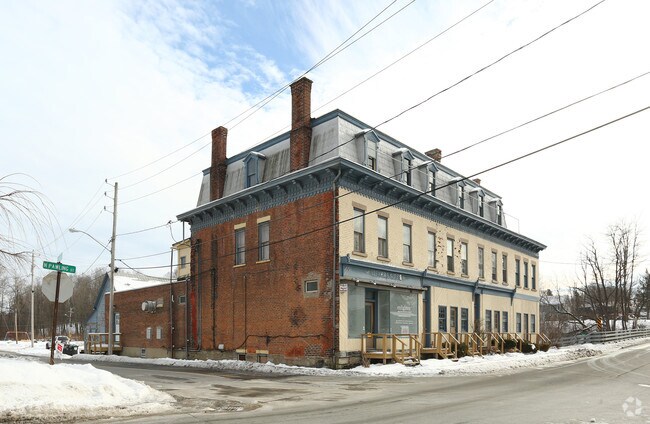
Property Record
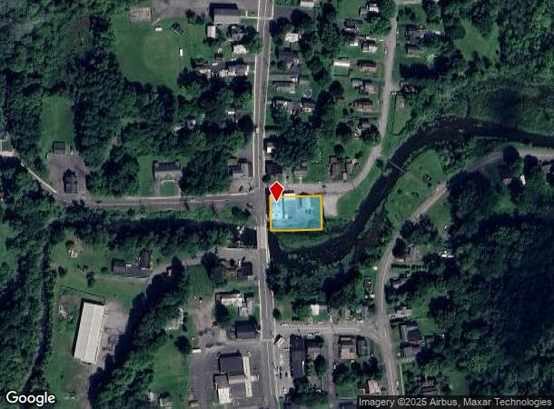
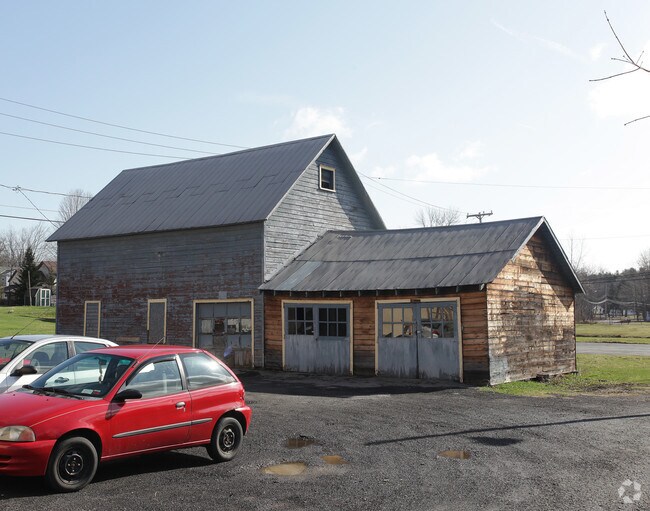
107 S Pawling St, Hagaman, NY 12086
NEARBY LISTINGS FOR SALE OR LEASE
Property Detail
107 S Pawling St
272003-025-050-0001-009-000-0000
Montgomery
Commercialnec
New York
A
9.000
36057C0210E
0.39 AC
2025
Montgomery County
2024
Albany/Schenectady/Troy
072100
Amsterdam, NY
DEMOGRAPHICS near 107 S Pawling St
1 Mile
3 Mile
5 Mile
2024 Total Population
1,406
14,050
28,505
2029 Population
1,398
14,059
28,435
Pop Growth 2024-2029
(0.57%)
+ 0.06%
(0.25%)
Average Age
47
42
42
2024 Total Households
625
5,909
11,844
HH Growth 2024-2029
(0.48%)
+ 0.08%
(0.21%)
Median Household Inc
$64,930
$52,592
$51,212
Avg Household Size
2.20
2.30
2.30
2024 Avg HH Vehicles
2.00
2.00
2.00
Median Home Value
$155,097
$136,348
$143,694
Median Year Built
1955
1950
1949
Nearby Places
- Restaurants
- Banks
- Shops
- Fitness
- Groceries
PUBLIC TRANSPORTATION
AIRPORT
Albany International
DRIVE
WALK
Distance
Albany International
45 min
29.4 mi
Freight Ports
Albany, NY Port
DRIVE
WALK
Distance
Albany, NY Port
1 min
31.3 mi
SALE & LEASE HISTORY
LISTING DATE
SALE/LEASE

Jul 31, 2018
For Sale
Nearby Properties
Address
Land Use
TOTAL SIZE
Lot Size
Zoning
Address
Land Use
TOTAL SIZE
Lot Size
Zoning
27,576 SF
42.80 AC
07 - MIXED
Address
Land Use
TOTAL SIZE
Lot Size
Zoning
26.20 AC
Address
Land Use
TOTAL SIZE
Lot Size
Zoning
66,137 SF
45.40 AC
05 - COMME
Address
Land Use
TOTAL SIZE
Lot Size
Zoning
14,730 SF
8.70 AC
03 - MULTI
Address
Land Use
TOTAL SIZE
Lot Size
Zoning
99.30 AC
B1
Address
Land Use
TOTAL SIZE
Lot Size
Zoning
70 AC
02
Address
Land Use
TOTAL SIZE
Lot Size
Zoning
5,800 SF
28 AC
B1
Address
Land Use
TOTAL SIZE
Lot Size
Zoning
13,770 SF
19.90 AC
03 - MULTI
Address
Land Use
TOTAL SIZE
Lot Size
Zoning
720 SF
23.30 AC
03 - MULTI
Address
Land Use
TOTAL SIZE
Lot Size
Zoning
13,770 SF
9.10 AC
03 - MULTI
Address
Land Use
TOTAL SIZE
Lot Size
Zoning
18.10 AC
Address
Land Use
TOTAL SIZE
Lot Size
Zoning
1.10 AC
03 - MULTI
Address
Land Use
TOTAL SIZE
Lot Size
Zoning
9.30 AC
B1
Address
Land Use
TOTAL SIZE
Lot Size
Zoning
21,485 SF
64.22 AC
05 - COMME
Address
Land Use
TOTAL SIZE
Lot Size
Zoning
Address
Land Use
TOTAL SIZE
Lot Size
Zoning
15.80 AC
B1
Address
Land Use
TOTAL SIZE
Lot Size
Zoning
37.60 AC
Address
Land Use
TOTAL SIZE
Lot Size
Zoning
Address
Land Use
TOTAL SIZE
Lot Size
Zoning
134,563 SF
12.90 AC
Address
Land Use
TOTAL SIZE
Lot Size
Zoning
135,223 SF
5.30 AC
05 - COMME
Address
Land Use
TOTAL SIZE
Lot Size
Zoning
126,842 SF
11.50 AC
B1
Address
Land Use
TOTAL SIZE
Lot Size
Zoning
16.50 AC
Address
Land Use
TOTAL SIZE
Lot Size
Zoning
Address
Land Use
TOTAL SIZE
Lot Size
Zoning
0.01 AC
AC
Address
Land Use
TOTAL SIZE
Lot Size
Zoning
3,680 SF
1.20 AC
05 - COMME
Address
Land Use
TOTAL SIZE
Lot Size
Zoning
11,348 SF
1.20 AC
05 - COMME
Address
Land Use
TOTAL SIZE
Lot Size
Zoning
13,449 SF
4.60 AC
05 - COMME
Address
Land Use
TOTAL SIZE
Lot Size
Zoning
1,767 SF
0.27 AC
05 - COMME
Address
Land Use
TOTAL SIZE
Lot Size
Zoning
18,158 SF
7.60 AC
05 - COMME
Address
Land Use
TOTAL SIZE
Lot Size
Zoning
81.80 AC
R1
The World's #1 Commercial Real Estate Marketplace
Connect with us
© 2025 CoStar Group
The information above has been obtained from sources believed reliable. While we do not doubt its accuracy we have not verified it and make no guarantee, warranty or representation about it. It is your responsibility to independently confirm its accuracy and completeness. Any projections, opinions, assumptions, or estimates used are for example only and do not represent the current or future performance of the property. The value of this transaction to you depends on tax and other factors which should be evaluated by your tax, financial, and legal advisors. You and your advisors should conduct a careful, independent investigation of the property to determine to your satisfaction the suitability of the property for your needs.