Property Record
107 Stephen St, Lemont, IL 60439
NEARBY LISTINGS FOR SALE OR LEASE
-
-
View all Lemont listings for sale on LoopNet.com
Property Detail
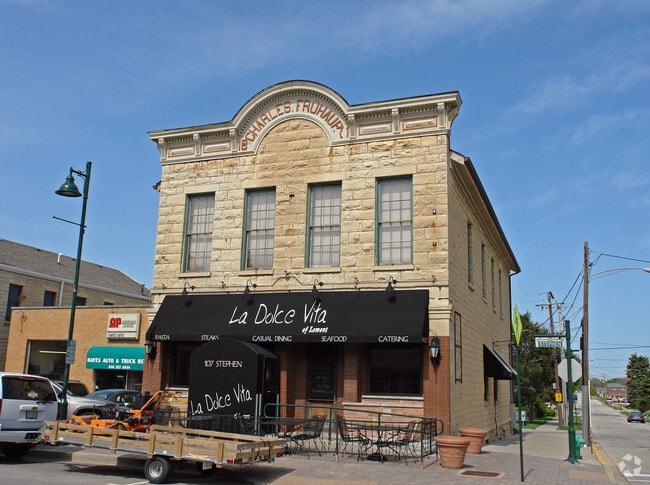
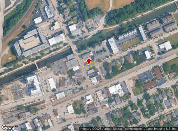
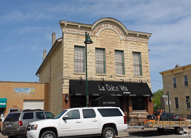
107 Stephen St
Chicago-Naperville-Elgin, IL-IN-WI
Nortons Sub
22-20-405-005-0000
CHAS (FREEHAUFS) RESUB OF LT 3 & PT OF LT 4 IN BLK 1 SW OF NORTONS SUB N OF TALCOTT & E OF STEVENS ST WH SE SEC 20-37-11
Storebuilding
Cook
X
Illinois
17043C0286J
3,4
2023
0.74 AC
2024
Joliet/Central Will
824004
Chicago
5,836 SF
DEMOGRAPHICS near 107 Stephen St
1 Mile
3 Mile
5 Mile
2024 Total Population
6,972
24,641
109,491
2029 Population
6,746
23,898
107,747
Pop Growth 2024-2029
(3.24%)
(3.02%)
(1.59%)
Average Age
43
43
41
2024 Total Households
2,736
8,884
39,542
HH Growth 2024-2029
(3.58%)
(3.31%)
(1.68%)
Median Household Inc
$100,855
$112,273
$94,347
Avg Household Size
2.50
2.70
2.70
2024 Avg HH Vehicles
2.00
2.00
2.00
Median Home Value
$346,217
$390,537
$323,127
Median Year Built
1982
1990
1980
Nearby Places
Map Layers
Map Styles
 Street
 Aerial
- Restaurants
- Banks
- Shops
- Fitness
- Groceries
PUBLIC TRANSPORTATION
COMMUTER RAIL
Lemont Station (Heritage Corridor Line - Northeast Illinois Regional Commuter Railroad (Metra))
DRIVE
WALK
Distance
Lemont Station (Heritage Corridor Line - Northeast Illinois Regional Commuter Railroad (Metra))
1 min
5 min
0.3 mi
DRIVE
WALK
Distance
10 min
4.6 mi
AIRPORT
Chicago Midway International
DRIVE
WALK
Distance
Chicago Midway International
30 min
16.6 mi
Chicago O'Hare International
DRIVE
WALK
Distance
Chicago O'Hare International
58 min
28.4 mi
Nearby Properties
Address
Land Use
TOTAL SIZE
Lot Size
Zoning
Address
Land Use
TOTAL SIZE
Lot Size
Zoning
32.82 AC
Address
Land Use
TOTAL SIZE
Lot Size
Zoning
373,827 SF
21.30 AC
Address
Land Use
TOTAL SIZE
Lot Size
Zoning
759,709 SF
41.75 AC
Address
Land Use
TOTAL SIZE
Lot Size
Zoning
48.48 AC
Address
Land Use
TOTAL SIZE
Lot Size
Zoning
49.91 AC
Address
Land Use
TOTAL SIZE
Lot Size
Zoning
334,656 SF
17.72 AC
I
Address
Land Use
TOTAL SIZE
Lot Size
Zoning
264,310 SF
12.21 AC
I
Address
Land Use
TOTAL SIZE
Lot Size
Zoning
18.82 AC
Address
Land Use
TOTAL SIZE
Lot Size
Zoning
513,805 SF
23.84 AC
Address
Land Use
TOTAL SIZE
Lot Size
Zoning
165.89 AC
Address
Land Use
TOTAL SIZE
Lot Size
Zoning
506,726 SF
28.54 AC
Address
Land Use
TOTAL SIZE
Lot Size
Zoning
490,436 SF
22.22 AC
Address
Land Use
TOTAL SIZE
Lot Size
Zoning
500,160 SF
25.07 AC
Address
Land Use
TOTAL SIZE
Lot Size
Zoning
351,257 SF
16.39 AC
I
Address
Land Use
TOTAL SIZE
Lot Size
Zoning
432,522 SF
20.38 AC
Address
Land Use
TOTAL SIZE
Lot Size
Zoning
396,546 SF
20.33 AC
I
Address
Land Use
TOTAL SIZE
Lot Size
Zoning
367,990 SF
17.32 AC
I
Address
Land Use
TOTAL SIZE
Lot Size
Zoning
Address
Land Use
TOTAL SIZE
Lot Size
Zoning
263,010 SF
13.56 AC
I
Address
Land Use
TOTAL SIZE
Lot Size
Zoning
416,640 SF
24.17 AC
Address
Land Use
TOTAL SIZE
Lot Size
Zoning
356,521 SF
16.32 AC
Address
Land Use
TOTAL SIZE
Lot Size
Zoning
148,044 SF
10.44 AC
Address
Land Use
TOTAL SIZE
Lot Size
Zoning
348,410 SF
18.15 AC
Address
Land Use
TOTAL SIZE
Lot Size
Zoning
357,450 SF
11.65 AC
Address
Land Use
TOTAL SIZE
Lot Size
Zoning
144,312 SF
11.95 AC
I
Address
Land Use
TOTAL SIZE
Lot Size
Zoning
121.17 AC
Address
Land Use
TOTAL SIZE
Lot Size
Zoning
230,668 SF
12.55 AC
I
Address
Land Use
TOTAL SIZE
Lot Size
Zoning
119,270 SF
7 AC
I
Address
Land Use
TOTAL SIZE
Lot Size
Zoning
372,304 SF
19.22 AC
Address
Land Use
TOTAL SIZE
Lot Size
Zoning
11,640 SF
14.89 AC
The World's #1 Commercial Real Estate Marketplace
Connect with us
© 2025 CoStar Group
The information above has been obtained from sources believed reliable. While we do not doubt its accuracy we have not verified it and make no guarantee, warranty or representation about it. It is your responsibility to independently confirm its accuracy and completeness. Any projections, opinions, assumptions, or estimates used are for example only and do not represent the current or future performance of the property. The value of this transaction to you depends on tax and other factors which should be evaluated by your tax, financial, and legal advisors. You and your advisors should conduct a careful, independent investigation of the property to determine to your satisfaction the suitability of the property for your needs.