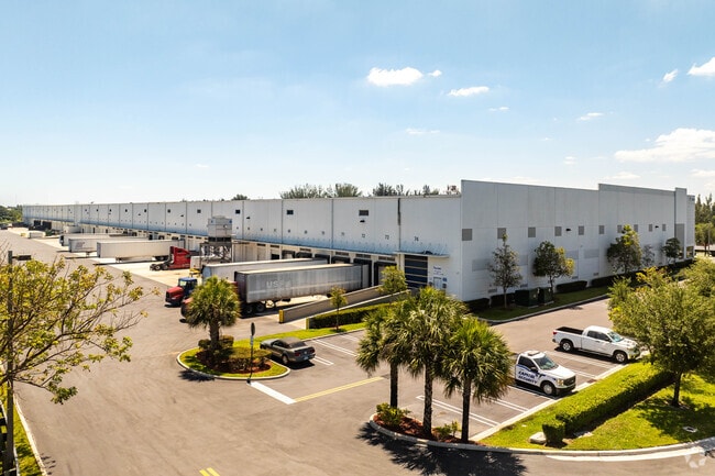
Property Record
10701 Nw 140Th St, Hialeah Gardens, FL 33018


NEARBY LISTINGS FOR SALE OR LEASE
Property Detail
10701 Nw 140Th St
Miami-Miami Beach-Kendall, FL
M/L Sub
27-2019-001-0610
19 52 40 15.98 AC M/L SUB OF PB 2-17 TR 54 LESS E100FT FOR CANAL R/W & LESS W35FT S35FT & EXT AREA OF CURVE IN SW COR FOR R/W & TRACT 53 LESS E100FT & LESS W35FT & LESS N35FT & LESS EXT AREA OF CURVE IN NW COR FOR R/W LOT SIZE 696582 SQ FT M/L
Warehouse
Miami/Dade
AH
Florida
12086C0113L
54
2024
15.99 AC
2025
Medley
012701
South Florida
256,156 SF
DEMOGRAPHICS near 10701 Nw 140Th St
1 Mile
3 Mile
5 Mile
2024 Total Population
1,062
66,838
250,991
2029 Population
1,042
65,183
245,047
Pop Growth 2024-2029
(1.88%)
(2.48%)
(2.37%)
Average Age
44
41
40
2024 Total Households
301
20,190
81,759
HH Growth 2024-2029
(2.33%)
(3.04%)
(2.81%)
Median Household Inc
$116,368
$77,040
$63,157
Avg Household Size
3.40
3.20
3.00
2024 Avg HH Vehicles
3.00
2.00
2.00
Median Home Value
$370,865
$355,275
$368,918
Median Year Built
1988
1995
1990
Nearby Places
Map Layers
Map Styles
 Street
 Aerial
- Restaurants
- Banks
- Shops
- Fitness
- Groceries
PUBLIC TRANSPORTATION
COMMUTER RAIL
Opa-Locka (Tri-County Commuter - South Florida Regional Transportation Authority (Tri-Rail))
DRIVE
WALK
Distance
Opa-Locka (Tri-County Commuter - South Florida Regional Transportation Authority (Tri-Rail))
14 min
9.1 mi
AIRPORT
Miami International
DRIVE
WALK
Distance
Miami International
26 min
12.8 mi
Fort Lauderdale/Hollywood International
DRIVE
WALK
Distance
Fort Lauderdale/Hollywood International
33 min
27.4 mi
Freight Ports
Port of Miami
DRIVE
WALK
Distance
Port of Miami
1 min
14.9 mi
SALE & LEASE HISTORY
LISTING DATE
SALE/LEASE

Sep 25, 2016
For Lease
Oct 17, 2022
For Lease
Jan 08, 2018
For Lease
Jan 02, 2025
For Lease
Nearby Properties
Address
Land Use
TOTAL SIZE
Lot Size
Zoning
Address
Land Use
TOTAL SIZE
Lot Size
Zoning
636,721 SF
52.61 AC
2800
Address
Land Use
TOTAL SIZE
Lot Size
Zoning
483,328 SF
63.80 AC
7701
Address
Land Use
TOTAL SIZE
Lot Size
Zoning
572,062 SF
38.15 AC
9400
Address
Land Use
TOTAL SIZE
Lot Size
Zoning
724,587 SF
48.54 AC
7701
Address
Land Use
TOTAL SIZE
Lot Size
Zoning
439,520 SF
20.20 AC
9400
Address
Land Use
TOTAL SIZE
Lot Size
Zoning
595,768 SF
33.42 AC
7600
Address
Land Use
TOTAL SIZE
Lot Size
Zoning
725,624 SF
34.80 AC
7300
Address
Land Use
TOTAL SIZE
Lot Size
Zoning
526,059 SF
18.99 AC
6407
Address
Land Use
TOTAL SIZE
Lot Size
Zoning
469,837 SF
26 AC
7600
Address
Land Use
TOTAL SIZE
Lot Size
Zoning
812,314 SF
44 AC
7600
Address
Land Use
TOTAL SIZE
Lot Size
Zoning
509,271 SF
28.69 AC
7701
Address
Land Use
TOTAL SIZE
Lot Size
Zoning
399,805 SF
14.02 AC
8000
Address
Land Use
TOTAL SIZE
Lot Size
Zoning
374,816 SF
21.41 AC
7701
Address
Land Use
TOTAL SIZE
Lot Size
Zoning
359,483 SF
11.34 AC
8000
Address
Land Use
TOTAL SIZE
Lot Size
Zoning
223,543 SF
39.40 AC
6407
Address
Land Use
TOTAL SIZE
Lot Size
Zoning
307,032 SF
20.08 AC
7701
Address
Land Use
TOTAL SIZE
Lot Size
Zoning
537,862 SF
22.21 AC
7701
Address
Land Use
TOTAL SIZE
Lot Size
Zoning
333,414 SF
24.20 AC
7701
Address
Land Use
TOTAL SIZE
Lot Size
Zoning
345,413 SF
10.48 AC
9000
Address
Land Use
TOTAL SIZE
Lot Size
Zoning
298,578 SF
15.95 AC
7701
Address
Land Use
TOTAL SIZE
Lot Size
Zoning
382,421 SF
19.66 AC
3700
Address
Land Use
TOTAL SIZE
Lot Size
Zoning
672,678 SF
38.88 AC
7100
Address
Land Use
TOTAL SIZE
Lot Size
Zoning
627,014 SF
48.58 AC
7100
Address
Land Use
TOTAL SIZE
Lot Size
Zoning
400,062 SF
33.33 AC
0101
Address
Land Use
TOTAL SIZE
Lot Size
Zoning
267,601 SF
16.81 AC
7100
Address
Land Use
TOTAL SIZE
Lot Size
Zoning
235,248 SF
12.31 AC
7600
Address
Land Use
TOTAL SIZE
Lot Size
Zoning
230,147 SF
15 AC
7701
Address
Land Use
TOTAL SIZE
Lot Size
Zoning
230,169 SF
10.62 AC
7600
Address
Land Use
TOTAL SIZE
Lot Size
Zoning
320,597 SF
14.52 AC
7701
Address
Land Use
TOTAL SIZE
Lot Size
Zoning
145,352 SF
18.49 AC
7700
The World's #1 Commercial Real Estate Marketplace
Connect with us
© 2026 CoStar Group
The information above has been obtained from sources believed reliable. While we do not doubt its accuracy we have not verified it and make no guarantee, warranty or representation about it. It is your responsibility to independently confirm its accuracy and completeness. Any projections, opinions, assumptions, or estimates used are for example only and do not represent the current or future performance of the property. The value of this transaction to you depends on tax and other factors which should be evaluated by your tax, financial, and legal advisors. You and your advisors should conduct a careful, independent investigation of the property to determine to your satisfaction the suitability of the property for your needs.