Property Record
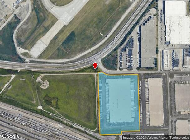
10701 Seymour Ave, Franklin Park, IL 60131

NEARBY LISTINGS FOR SALE OR LEASE
Property Detail
10701 Seymour Ave
12-20-101-027-0000
Seymour Subdivision Being
Industrialgeneral
Cook
X
Illinois
17031C0359J
18.81 AC
2023
West Cook North
2025
Chicago
980000
Chicago-Naperville-Elgin, IL-IN-WI
335,230 SF
DEMOGRAPHICS near 10701 Seymour Ave
1 Mile
3 Mile
5 Mile
2024 Total Population
2,753
70,142
304,871
2029 Population
2,665
68,200
295,593
Pop Growth 2024-2029
(3.20%)
(2.77%)
(3.04%)
Average Age
39
40
41
2024 Total Households
983
24,069
108,228
HH Growth 2024-2029
(3.36%)
(3.02%)
(3.32%)
Median Household Inc
$76,304
$68,595
$76,148
Avg Household Size
2.70
2.80
2.70
2024 Avg HH Vehicles
2.00
2.00
2.00
Median Home Value
$238,802
$244,260
$287,764
Median Year Built
1959
1960
1960
Nearby Places
Map Layers
Map Styles
 Street
 Aerial
- Restaurants
- Banks
- Shops
- Fitness
- Groceries
PUBLIC TRANSPORTATION
COMMUTER RAIL
Mannheim Station (Milwaukee District West Line - Northeast Illinois Regional Commuter Railroad (Metra))
DRIVE
WALK
Distance
Mannheim Station (Milwaukee District West Line - Northeast Illinois Regional Commuter Railroad (Metra))
4 min
1.3 mi
Schiller Park Station (North Central Service - Northeast Illinois Regional Commuter Railroad (Metra))
DRIVE
WALK
Distance
Schiller Park Station (North Central Service - Northeast Illinois Regional Commuter Railroad (Metra))
11 min
3.4 mi
AIRPORT
Chicago O'Hare International
DRIVE
WALK
Distance
Chicago O'Hare International
8 min
4.8 mi
Chicago Midway International
DRIVE
WALK
Distance
Chicago Midway International
33 min
17.4 mi
Freight Ports
Port Milwaukee
DRIVE
WALK
Distance
Port Milwaukee
92 min
78.3 mi
Nearby Properties
Address
Land Use
TOTAL SIZE
Lot Size
Zoning
Address
Land Use
TOTAL SIZE
Lot Size
Zoning
820,106 SF
14.78 AC
Address
Land Use
TOTAL SIZE
Lot Size
Zoning
Address
Land Use
TOTAL SIZE
Lot Size
Zoning
1,089,750 SF
59.83 AC
I
Address
Land Use
TOTAL SIZE
Lot Size
Zoning
733,433 SF
10.93 AC
Address
Land Use
TOTAL SIZE
Lot Size
Zoning
833,077 SF
11.90 AC
Address
Land Use
TOTAL SIZE
Lot Size
Zoning
250,870 SF
19.23 AC
Address
Land Use
TOTAL SIZE
Lot Size
Zoning
Address
Land Use
TOTAL SIZE
Lot Size
Zoning
2.62 AC
Address
Land Use
TOTAL SIZE
Lot Size
Zoning
595,800 SF
9.40 AC
Address
Land Use
TOTAL SIZE
Lot Size
Zoning
422,063 SF
18.88 AC
Address
Land Use
TOTAL SIZE
Lot Size
Zoning
Address
Land Use
TOTAL SIZE
Lot Size
Zoning
4,100 SF
PD 0
Address
Land Use
TOTAL SIZE
Lot Size
Zoning
969,696 SF
44.30 AC
Address
Land Use
TOTAL SIZE
Lot Size
Zoning
249,433 SF
4.57 AC
Address
Land Use
TOTAL SIZE
Lot Size
Zoning
1,160,629 SF
Address
Land Use
TOTAL SIZE
Lot Size
Zoning
372,935 SF
7.34 AC
Address
Land Use
TOTAL SIZE
Lot Size
Zoning
28.36 AC
Address
Land Use
TOTAL SIZE
Lot Size
Zoning
14.35 AC
Address
Land Use
TOTAL SIZE
Lot Size
Zoning
396,650 SF
19.12 AC
Address
Land Use
TOTAL SIZE
Lot Size
Zoning
Address
Land Use
TOTAL SIZE
Lot Size
Zoning
4,100 SF
PD 0
Address
Land Use
TOTAL SIZE
Lot Size
Zoning
403,815 SF
0.77 AC
Address
Land Use
TOTAL SIZE
Lot Size
Zoning
668,072 SF
4.19 AC
Address
Land Use
TOTAL SIZE
Lot Size
Zoning
334,000 SF
1.77 AC
Address
Land Use
TOTAL SIZE
Lot Size
Zoning
221,692 SF
2.12 AC
Address
Land Use
TOTAL SIZE
Lot Size
Zoning
548,206 SF
21.13 AC
Address
Land Use
TOTAL SIZE
Lot Size
Zoning
Address
Land Use
TOTAL SIZE
Lot Size
Zoning
Address
Land Use
TOTAL SIZE
Lot Size
Zoning
121,117 SF
3.09 AC
Address
Land Use
TOTAL SIZE
Lot Size
Zoning
520,000 SF
2.96 AC
The World's #1 Commercial Real Estate Marketplace
Connect with us
© 2026 CoStar Group
The information above has been obtained from sources believed reliable. While we do not doubt its accuracy we have not verified it and make no guarantee, warranty or representation about it. It is your responsibility to independently confirm its accuracy and completeness. Any projections, opinions, assumptions, or estimates used are for example only and do not represent the current or future performance of the property. The value of this transaction to you depends on tax and other factors which should be evaluated by your tax, financial, and legal advisors. You and your advisors should conduct a careful, independent investigation of the property to determine to your satisfaction the suitability of the property for your needs.