Property Record
10715 Shopton Rd W, Charlotte, NC 28278
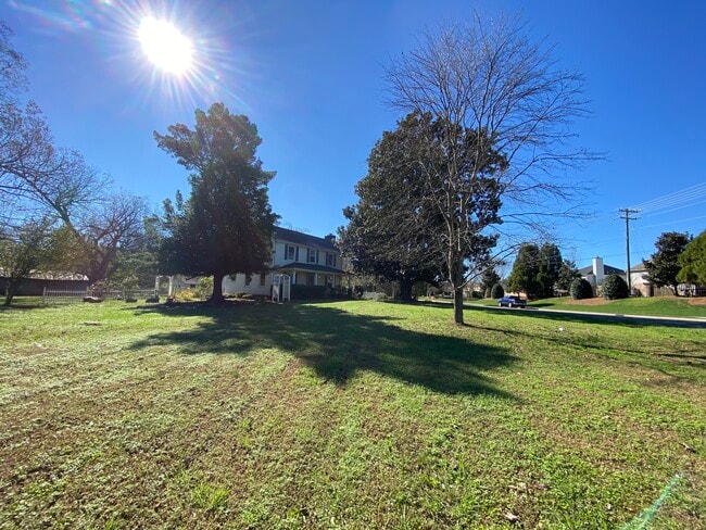
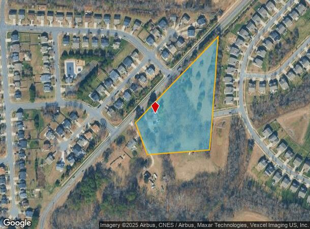
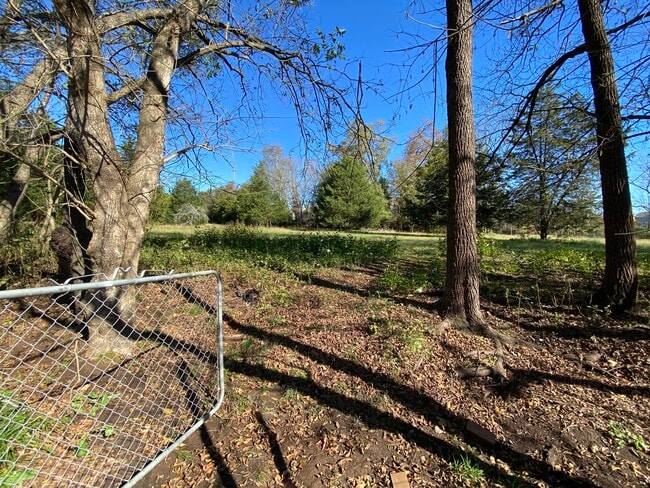
This Property Is For Sale
NEARBY LISTINGS FOR SALE OR LEASE
Property Detail
10715 Shopton Rd W
Charlotte-Concord-Gastonia, NC-SC
Lake Wylie/Catawba River
199-201-02
Mecklenburg
Sfr
North Carolina
X
4.60 AC
3710450100L
Airport
1,944 SF
Charlotte
DEMOGRAPHICS near 10715 Shopton Rd W
1 Mile
3 Mile
5 Mile
2024 Total Population
10,044
39,198
92,000
2029 Population
10,485
41,698
98,405
Pop Growth 2024-2029
+ 4.39%
+ 6.38%
+ 6.96%
Average Age
36
38
37
2024 Total Households
3,669
14,898
36,675
HH Growth 2024-2029
+ 4.39%
+ 6.30%
+ 7.06%
Median Household Inc
$98,479
$89,419
$85,044
Avg Household Size
2.70
2.60
2.40
2024 Avg HH Vehicles
2.00
2.00
2.00
Median Home Value
$342,428
$317,760
$310,676
Median Year Built
2010
2005
2004
Nearby Places
Map Layers
Map Styles
 Street
 Aerial
- Restaurants
- Banks
- Shops
- Fitness
- Groceries
PUBLIC TRANSPORTATION
AIRPORT
Charlotte/Douglas International
DRIVE
WALK
Distance
Charlotte/Douglas International
15 min
6.5 mi
Concord-Padgett Regional
DRIVE
WALK
Distance
Concord-Padgett Regional
36 min
28.1 mi
Freight Ports
North Charleston Terminal
DRIVE
WALK
Distance
North Charleston Terminal
222 min
193.2 mi
Nearby Properties
Address
Land Use
TOTAL SIZE
Lot Size
Zoning
Address
Land Use
TOTAL SIZE
Lot Size
Zoning
459,020 SF
42 AC
R3
Address
Land Use
TOTAL SIZE
Lot Size
Zoning
1,255,063 SF
292.46 AC
I2
Address
Land Use
TOTAL SIZE
Lot Size
Zoning
315,386 SF
26.83 AC
MX1
Address
Land Use
TOTAL SIZE
Lot Size
Zoning
399,178 SF
17.59 AC
Address
Land Use
TOTAL SIZE
Lot Size
Zoning
289,148 SF
17.12 AC
Address
Land Use
TOTAL SIZE
Lot Size
Zoning
292,097 SF
16.26 AC
CC
Address
Land Use
TOTAL SIZE
Lot Size
Zoning
293,943 SF
12.90 AC
Address
Land Use
TOTAL SIZE
Lot Size
Zoning
272,801 SF
12.90 AC
Address
Land Use
TOTAL SIZE
Lot Size
Zoning
280,293 SF
25.47 AC
R3
Address
Land Use
TOTAL SIZE
Lot Size
Zoning
229,094 SF
7.29 AC
R3
Address
Land Use
TOTAL SIZE
Lot Size
Zoning
899,731 SF
73.49 AC
Address
Land Use
TOTAL SIZE
Lot Size
Zoning
254,393 SF
12.48 AC
Address
Land Use
TOTAL SIZE
Lot Size
Zoning
415,871 SF
66.17 AC
R3
Address
Land Use
TOTAL SIZE
Lot Size
Zoning
32.80 AC
MUDD-O
Address
Land Use
TOTAL SIZE
Lot Size
Zoning
200,765 SF
7.71 AC
Address
Land Use
TOTAL SIZE
Lot Size
Zoning
220,232 SF
15.45 AC
R15MFCD
Address
Land Use
TOTAL SIZE
Lot Size
Zoning
603,600 SF
55.87 AC
Address
Land Use
TOTAL SIZE
Lot Size
Zoning
221,746 SF
8.82 AC
O-2(CD)
Address
Land Use
TOTAL SIZE
Lot Size
Zoning
163,002 SF
5.65 AC
R17MF
Address
Land Use
TOTAL SIZE
Lot Size
Zoning
182,235 SF
18.29 AC
R17MF
Address
Land Use
TOTAL SIZE
Lot Size
Zoning
559,210 SF
45.69 AC
I1
Address
Land Use
TOTAL SIZE
Lot Size
Zoning
408,876 SF
42.31 AC
I-1(CD)
Address
Land Use
TOTAL SIZE
Lot Size
Zoning
178,803 SF
8.98 AC
O-2(CD)
Address
Land Use
TOTAL SIZE
Lot Size
Zoning
403,200 SF
56.47 AC
Address
Land Use
TOTAL SIZE
Lot Size
Zoning
120,608 SF
4.40 AC
CC
Address
Land Use
TOTAL SIZE
Lot Size
Zoning
132,794 SF
9.01 AC
O-1(CD)
Address
Land Use
TOTAL SIZE
Lot Size
Zoning
372,112 SF
23.47 AC
I1
Address
Land Use
TOTAL SIZE
Lot Size
Zoning
464,440 SF
34.96 AC
R-3
Address
Land Use
TOTAL SIZE
Lot Size
Zoning
354,640 SF
20.06 AC
Address
Land Use
TOTAL SIZE
Lot Size
Zoning
360,500 SF
37.93 AC
I-2
The World's #1 Commercial Real Estate Marketplace
Connect with us
© 2025 CoStar Group
The information above has been obtained from sources believed reliable. While we do not doubt its accuracy we have not verified it and make no guarantee, warranty or representation about it. It is your responsibility to independently confirm its accuracy and completeness. Any projections, opinions, assumptions, or estimates used are for example only and do not represent the current or future performance of the property. The value of this transaction to you depends on tax and other factors which should be evaluated by your tax, financial, and legal advisors. You and your advisors should conduct a careful, independent investigation of the property to determine to your satisfaction the suitability of the property for your needs.