Property Record
10729 N Main St, Archdale, NC 27263
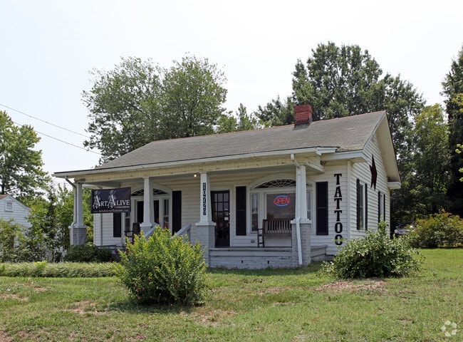
This Property Is For Sale
Current Lease Availabilities
NEARBY LISTINGS FOR SALE OR LEASE
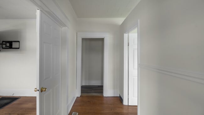
Property Detail
10729 N Main St
Greensboro-High Point, NC
S Main St
7718-36-3938
Randolph
Sfr
North Carolina
X
0.17 AC
3710771800J
NW Randolph Cnty/Archdale
1,030 SF
Greensboro/Winston-Salem
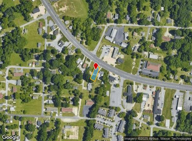
DEMOGRAPHICS near 10729 N Main St
1 Mile
3 Mile
5 Mile
2024 Total Population
4,752
23,955
73,628
2029 Population
4,865
24,427
75,008
Pop Growth 2024-2029
+ 2.38%
+ 1.97%
+ 1.87%
Average Age
41
41
39
2024 Total Households
2,093
9,631
27,931
HH Growth 2024-2029
+ 2.39%
+ 1.96%
+ 2.00%
Median Household Inc
$55,687
$54,426
$46,579
Avg Household Size
2.20
2.40
2.40
2024 Avg HH Vehicles
2.00
2.00
2.00
Median Home Value
$127,922
$148,669
$144,340
Median Year Built
1980
1975
1974
Nearby Places
Map Layers
Map Styles
 Street
 Aerial
- Restaurants
- Banks
- Shops
- Fitness
- Groceries
PUBLIC TRANSPORTATION
COMMUTER RAIL
High Point Station (Piedmont - North Carolina by Train (NC Train))
DRIVE
WALK
Distance
High Point Station (Piedmont - North Carolina by Train (NC Train))
8 min
4.2 mi
AIRPORT
Piedmont Triad International
DRIVE
WALK
Distance
Piedmont Triad International
32 min
21.1 mi
Nearby Properties
Address
Land Use
TOTAL SIZE
Lot Size
Zoning
Address
Land Use
TOTAL SIZE
Lot Size
Zoning
355,633 SF
63.42 AC
HI
Address
Land Use
TOTAL SIZE
Lot Size
Zoning
204,276 SF
68.51 AC
M-2
Address
Land Use
TOTAL SIZE
Lot Size
Zoning
196,353 SF
13.76 AC
RC
Address
Land Use
TOTAL SIZE
Lot Size
Zoning
156,010 SF
36.21 AC
M-1
Address
Land Use
TOTAL SIZE
Lot Size
Zoning
127,800 SF
57.35 AC
M-1
Address
Land Use
TOTAL SIZE
Lot Size
Zoning
159,944 SF
13.95 AC
RS-40
Address
Land Use
TOTAL SIZE
Lot Size
Zoning
245,194 SF
23.44 AC
LI
Address
Land Use
TOTAL SIZE
Lot Size
Zoning
107,417 SF
6.46 AC
RM-26
Address
Land Use
TOTAL SIZE
Lot Size
Zoning
101,612 SF
15.82 AC
RM-16
Address
Land Use
TOTAL SIZE
Lot Size
Zoning
299,394 SF
8.60 AC
M-2
Address
Land Use
TOTAL SIZE
Lot Size
Zoning
90,000 SF
15.36 AC
M-2
Address
Land Use
TOTAL SIZE
Lot Size
Zoning
170,516 SF
17.08 AC
RC
Address
Land Use
TOTAL SIZE
Lot Size
Zoning
10,810 SF
158.27 AC
PNR
Address
Land Use
TOTAL SIZE
Lot Size
Zoning
7,680 SF
9.95 AC
GRD
Address
Land Use
TOTAL SIZE
Lot Size
Zoning
27,310 SF
20.06 AC
HI
Address
Land Use
TOTAL SIZE
Lot Size
Zoning
69,094 SF
5.47 AC
M-2
Address
Land Use
TOTAL SIZE
Lot Size
Zoning
109,950 SF
28.29 AC
M-1
Address
Land Use
TOTAL SIZE
Lot Size
Zoning
28.20 AC
RR
Address
Land Use
TOTAL SIZE
Lot Size
Zoning
98,287 SF
14.50 AC
RM-16
Address
Land Use
TOTAL SIZE
Lot Size
Zoning
52,061 SF
3.03 AC
LI
Address
Land Use
TOTAL SIZE
Lot Size
Zoning
7,168 SF
7.51 AC
GRD
Address
Land Use
TOTAL SIZE
Lot Size
Zoning
45,224 SF
8.03 AC
OI
Address
Land Use
TOTAL SIZE
Lot Size
Zoning
73,658 SF
8.45 AC
B-1
Address
Land Use
TOTAL SIZE
Lot Size
Zoning
104,623 SF
55.13 AC
RR
Address
Land Use
TOTAL SIZE
Lot Size
Zoning
234,080 SF
14.88 AC
HI
Address
Land Use
TOTAL SIZE
Lot Size
Zoning
9.70 AC
RR
Address
Land Use
TOTAL SIZE
Lot Size
Zoning
48,913 SF
2.25 AC
B-1
Address
Land Use
TOTAL SIZE
Lot Size
Zoning
99,649 SF
15.58 AC
HI
Address
Land Use
TOTAL SIZE
Lot Size
Zoning
74,290 SF
7.31 AC
RC
Address
Land Use
TOTAL SIZE
Lot Size
Zoning
47,822 SF
5.76 AC
SU R-10
The World's #1 Commercial Real Estate Marketplace
Connect with us
© 2026 CoStar Group
The information above has been obtained from sources believed reliable. While we do not doubt its accuracy we have not verified it and make no guarantee, warranty or representation about it. It is your responsibility to independently confirm its accuracy and completeness. Any projections, opinions, assumptions, or estimates used are for example only and do not represent the current or future performance of the property. The value of this transaction to you depends on tax and other factors which should be evaluated by your tax, financial, and legal advisors. You and your advisors should conduct a careful, independent investigation of the property to determine to your satisfaction the suitability of the property for your needs.