Property Record
1074 W 32Nd St, Holland, MI 49423


NEARBY LISTINGS FOR SALE OR LEASE
Property Detail
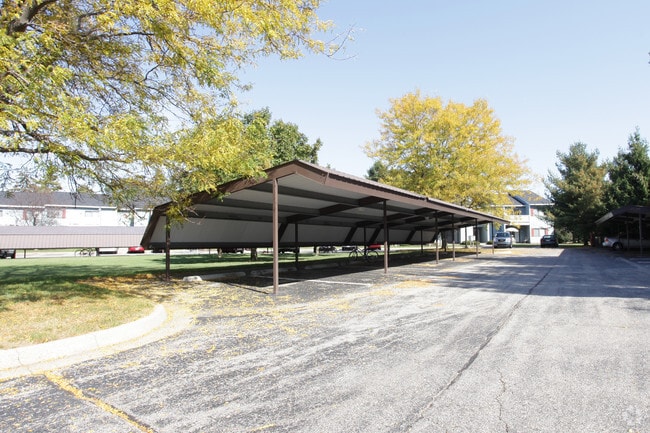
1074 W 32Nd St
11-001-022-00
COM NW COR TH S 89DEG 42'22 E 778.63' E TO POB; TH S 89DEG 42'22 E 403.63'; TH S 22DEG 25'49 E 238.50'; TH S 89DEG 42'22 E 65'; TH S 00DEG 15'41 E 405'; TH S 89DEG 42'22 E 195'; TH N 00DEG 15'41 W 200'; TH S 89DEG 42'22 E 100'; TH S 00DEG 15'41 E 200
Multifamilydwelling
Allegan
A
Michigan
26005C0020G
15.03 AC
2024
Allegan County
2025
West Michigan
032600
Holland, MI
122,026 SF
DEMOGRAPHICS near 1074 W 32Nd St
1 Mile
3 Mile
5 Mile
2024 Total Population
4,436
40,591
73,921
2029 Population
4,601
42,291
77,058
Pop Growth 2024-2029
+ 3.72%
+ 4.19%
+ 4.24%
Average Age
44
40
40
2024 Total Households
1,869
15,189
27,819
HH Growth 2024-2029
+ 3.64%
+ 4.31%
+ 4.38%
Median Household Inc
$75,765
$80,027
$74,211
Avg Household Size
2.40
2.50
2.50
2024 Avg HH Vehicles
2.00
2.00
2.00
Median Home Value
$268,568
$260,910
$247,313
Median Year Built
1975
1969
1977
Nearby Places
Map Layers
Map Styles
 Street
 Aerial
- Restaurants
- Banks
- Shops
- Fitness
- Groceries
PUBLIC TRANSPORTATION
COMMUTER RAIL
Holland Amtrak Station (Pere Marquette - Amtrak)
DRIVE
WALK
Distance
Holland Amtrak Station (Pere Marquette - Amtrak)
10 min
4.3 mi
Freight Ports
Port Milwaukee
DRIVE
WALK
Distance
Port Milwaukee
278 min
235.8 mi
Nearby Properties
Address
Land Use
TOTAL SIZE
Lot Size
Zoning
Address
Land Use
TOTAL SIZE
Lot Size
Zoning
556,819 SF
85.45 AC
Address
Land Use
TOTAL SIZE
Lot Size
Zoning
154,107 SF
Address
Land Use
TOTAL SIZE
Lot Size
Zoning
589,649 SF
92.65 AC
Address
Land Use
TOTAL SIZE
Lot Size
Zoning
137,732 SF
12.94 AC
C-2
Address
Land Use
TOTAL SIZE
Lot Size
Zoning
177,800 SF
12.34 AC
I-2
Address
Land Use
TOTAL SIZE
Lot Size
Zoning
114,088 SF
10.79 AC
PRD
Address
Land Use
TOTAL SIZE
Lot Size
Zoning
181,754 SF
13.44 AC
R3
Address
Land Use
TOTAL SIZE
Lot Size
Zoning
372,017 SF
17.60 AC
R-2
Address
Land Use
TOTAL SIZE
Lot Size
Zoning
73,700 SF
Address
Land Use
TOTAL SIZE
Lot Size
Zoning
158,661 SF
17.28 AC
Address
Land Use
TOTAL SIZE
Lot Size
Zoning
146,357 SF
20.04 AC
Address
Land Use
TOTAL SIZE
Lot Size
Zoning
22,344 SF
8.16 AC
R-3
Address
Land Use
TOTAL SIZE
Lot Size
Zoning
386,644 SF
22.74 AC
I
Address
Land Use
TOTAL SIZE
Lot Size
Zoning
201,907 SF
15.96 AC
I-2
Address
Land Use
TOTAL SIZE
Lot Size
Zoning
140,700 SF
20.28 AC
Address
Land Use
TOTAL SIZE
Lot Size
Zoning
133,887 SF
13.50 AC
NA
Address
Land Use
TOTAL SIZE
Lot Size
Zoning
33,605 SF
0.25 AC
C-3
Address
Land Use
TOTAL SIZE
Lot Size
Zoning
77,643 SF
3.79 AC
C-2
Address
Land Use
TOTAL SIZE
Lot Size
Zoning
238,987 SF
38.35 AC
NA
Address
Land Use
TOTAL SIZE
Lot Size
Zoning
42,831 SF
0.67 AC
C-3
Address
Land Use
TOTAL SIZE
Lot Size
Zoning
17,854 SF
3.94 AC
C-2
Address
Land Use
TOTAL SIZE
Lot Size
Zoning
59,836 SF
6.70 AC
NA
Address
Land Use
TOTAL SIZE
Lot Size
Zoning
99,082 SF
5.05 AC
I-2
Address
Land Use
TOTAL SIZE
Lot Size
Zoning
5.54 AC
Address
Land Use
TOTAL SIZE
Lot Size
Zoning
44,595 SF
0.44 AC
C-3
Address
Land Use
TOTAL SIZE
Lot Size
Zoning
41,872 SF
1.49 AC
I-1
Address
Land Use
TOTAL SIZE
Lot Size
Zoning
108,970 SF
10.40 AC
I2
Address
Land Use
TOTAL SIZE
Lot Size
Zoning
134,166 SF
9.18 AC
NA
Address
Land Use
TOTAL SIZE
Lot Size
Zoning
82,800 SF
6.15 AC
R-5
The World's #1 Commercial Real Estate Marketplace
Connect with us
© 2026 CoStar Group
The information above has been obtained from sources believed reliable. While we do not doubt its accuracy we have not verified it and make no guarantee, warranty or representation about it. It is your responsibility to independently confirm its accuracy and completeness. Any projections, opinions, assumptions, or estimates used are for example only and do not represent the current or future performance of the property. The value of this transaction to you depends on tax and other factors which should be evaluated by your tax, financial, and legal advisors. You and your advisors should conduct a careful, independent investigation of the property to determine to your satisfaction the suitability of the property for your needs.