Property Record
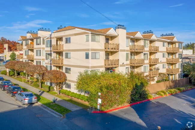
10740 8Th Ave Ne, Seattle, WA 98125
NEARBY LISTINGS FOR SALE OR LEASE
Property Detail
10740 8Th Ave Ne
292604-9063
W 125 FT OF N 1/2 OF NE 1/4 OF SW 1/4 OF SE 1/4 LESS N 180 FT LESS CO RD
Apartment
King
X
Washington
53033C0329G
292604
2025
0.33 AC
2024
Maple Leaf
001202
Seattle/Puget Sound
35,432 SF
Seattle-Tacoma-Bellevue, WA
DEMOGRAPHICS near 10740 8Th Ave Ne
1 Mile
3 Mile
5 Mile
2024 Total Population
26,035
202,961
427,304
2029 Population
26,324
204,979
431,354
Pop Growth 2024-2029
+ 1.11%
+ 0.99%
+ 0.95%
Average Age
39
39
39
2024 Total Households
11,893
88,824
186,288
HH Growth 2024-2029
+ 1.14%
+ 1.04%
+ 0.96%
Median Household Inc
$89,096
$108,296
$114,993
Avg Household Size
2.10
2.20
2.20
2024 Avg HH Vehicles
2.00
2.00
2.00
Median Home Value
$762,868
$855,147
$880,912
Median Year Built
1972
1967
1971
Nearby Places
Map Layers
Map Styles
 Street
 Aerial
- Restaurants
- Banks
- Shops
- Fitness
- Groceries
PUBLIC TRANSPORTATION
COMMUTER RAIL
King Street (Seattle) Station (Sounder South Line - Central Puget Sound Regional Transit Authority Rail (Link Light Rail/Sounder))
DRIVE
WALK
Distance
King Street (Seattle) Station (Sounder South Line - Central Puget Sound Regional Transit Authority Rail (Link Light Rail/Sounder))
16 min
8.9 mi
AIRPORT
Seattle Paine Field International
DRIVE
WALK
Distance
Seattle Paine Field International
26 min
16.7 mi
Seattle-Tacoma International
DRIVE
WALK
Distance
Seattle-Tacoma International
34 min
22.1 mi
Nearby Properties
Address
Land Use
TOTAL SIZE
Lot Size
Zoning
Address
Land Use
TOTAL SIZE
Lot Size
Zoning
7,549 SF
59.34 AC
MIO-105-LR
Address
Land Use
TOTAL SIZE
Lot Size
Zoning
223,047 SF
0.18 AC
NC2P-75 (M
Address
Land Use
TOTAL SIZE
Lot Size
Zoning
382,762 SF
7.14 AC
NR3
Address
Land Use
TOTAL SIZE
Lot Size
Zoning
172,297 SF
4.21 AC
NC3-95 (M)
Address
Land Use
TOTAL SIZE
Lot Size
Zoning
10,090 SF
11.73 AC
NC3-95 (M)
Address
Land Use
TOTAL SIZE
Lot Size
Zoning
162,182 SF
9.10 AC
LR2 (M)
Address
Land Use
TOTAL SIZE
Lot Size
Zoning
205,000 SF
13.89 AC
NR3
Address
Land Use
TOTAL SIZE
Lot Size
Zoning
2,874 SF
21.94 AC
NR3
Address
Land Use
TOTAL SIZE
Lot Size
Zoning
207,576 SF
5.98 AC
MR (M)
Address
Land Use
TOTAL SIZE
Lot Size
Zoning
160,593 SF
1.57 AC
NC3P-75 (M
Address
Land Use
TOTAL SIZE
Lot Size
Zoning
183,056 SF
1.95 AC
C1-55 (M)
Address
Land Use
TOTAL SIZE
Lot Size
Zoning
168,619 SF
7.79 AC
NC3-145 (M
Address
Land Use
TOTAL SIZE
Lot Size
Zoning
1,040 SF
18.74 AC
NR3
Address
Land Use
TOTAL SIZE
Lot Size
Zoning
17.65 AC
NR3
Address
Land Use
TOTAL SIZE
Lot Size
Zoning
119,405 SF
0.97 AC
NC3-95 (M)
Address
Land Use
TOTAL SIZE
Lot Size
Zoning
119,102 SF
2.59 AC
LR3 (M)
Address
Land Use
TOTAL SIZE
Lot Size
Zoning
54,224 SF
2.22 AC
NC3-55 (M)
Address
Land Use
TOTAL SIZE
Lot Size
Zoning
170,408 SF
1.85 AC
NC3-75 (M)
Address
Land Use
TOTAL SIZE
Lot Size
Zoning
131,236 SF
19.14 AC
R6
Address
Land Use
TOTAL SIZE
Lot Size
Zoning
193,120 SF
6.19 AC
NC3P-75 (M
Address
Land Use
TOTAL SIZE
Lot Size
Zoning
288,283 SF
3.94 AC
NC3-75 (M)
Address
Land Use
TOTAL SIZE
Lot Size
Zoning
46,513 SF
5.90 AC
SM-NG 145
Address
Land Use
TOTAL SIZE
Lot Size
Zoning
188,597 SF
8.79 AC
NR3
Address
Land Use
TOTAL SIZE
Lot Size
Zoning
235,163 SF
18.39 AC
NR2
Address
Land Use
TOTAL SIZE
Lot Size
Zoning
7,074 SF
22.07 AC
NR3
Address
Land Use
TOTAL SIZE
Lot Size
Zoning
14.11 AC
NR3
Address
Land Use
TOTAL SIZE
Lot Size
Zoning
234,128 SF
1.57 AC
NC3-145 (M
Address
Land Use
TOTAL SIZE
Lot Size
Zoning
179,340 SF
6.27 AC
LR2 (M)
Address
Land Use
TOTAL SIZE
Lot Size
Zoning
168,504 SF
6.34 AC
LR2 (M)
Address
Land Use
TOTAL SIZE
Lot Size
Zoning
97,381 SF
7.78 AC
NR3
The World's #1 Commercial Real Estate Marketplace
Connect with us
© 2025 CoStar Group
The information above has been obtained from sources believed reliable. While we do not doubt its accuracy we have not verified it and make no guarantee, warranty or representation about it. It is your responsibility to independently confirm its accuracy and completeness. Any projections, opinions, assumptions, or estimates used are for example only and do not represent the current or future performance of the property. The value of this transaction to you depends on tax and other factors which should be evaluated by your tax, financial, and legal advisors. You and your advisors should conduct a careful, independent investigation of the property to determine to your satisfaction the suitability of the property for your needs.