Property Record
10746 S 204Th Ave, Gretna, NE 68028


NEARBY LISTINGS FOR SALE OR LEASE
Property Detail
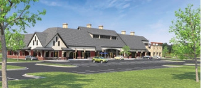
10746 S 204Th Ave
Omaha-Council Bluffs, NE-IA
Royal View Apartment Community Replat 1
011598255
LOT 1 ROYAL VIEW APARTMENT COMMUNITY REPLAT 1 (1.684 AC) (REDEVELOPMENT AUTHORITY RECORD)
Commercialnec
Sarpy
X
Nebraska
31153C0038H
1
2024
1.68 AC
2025
Southwest Omaha
010632
Omaha/Council Bluffs
2,068 SF
DEMOGRAPHICS near 10746 S 204Th Ave
1 Mile
3 Mile
5 Mile
2024 Total Population
4,930
29,053
73,144
2029 Population
5,354
31,994
77,573
Pop Growth 2024-2029
+ 8.60%
+ 10.12%
+ 6.06%
Average Age
36
35
36
2024 Total Households
1,700
9,628
24,422
HH Growth 2024-2029
+ 8.65%
+ 10.20%
+ 6.19%
Median Household Inc
$113,529
$133,101
$125,516
Avg Household Size
2.90
3.00
3.00
2024 Avg HH Vehicles
2.00
2.00
2.00
Median Home Value
$284,637
$344,724
$310,849
Median Year Built
2004
2010
2005
Nearby Places
Map Layers
Map Styles
 Street
 Aerial
- Restaurants
- Banks
- Shops
- Fitness
- Groceries
PUBLIC TRANSPORTATION
AIRPORT
Eppley Airfield
DRIVE
WALK
Distance
Eppley Airfield
40 min
26.1 mi
Freight Ports
Tulsa Port Of Catoosa
DRIVE
WALK
Distance
Tulsa Port Of Catoosa
478 min
426.9 mi
SALE & LEASE HISTORY
LISTING DATE
SALE/LEASE

Oct 04, 2016
For Lease
Nearby Properties
Address
Land Use
TOTAL SIZE
Lot Size
Zoning
Address
Land Use
TOTAL SIZE
Lot Size
Zoning
72.91 AC
Address
Land Use
TOTAL SIZE
Lot Size
Zoning
2,295 SF
11.77 AC
Address
Land Use
TOTAL SIZE
Lot Size
Zoning
12.60 AC
Address
Land Use
TOTAL SIZE
Lot Size
Zoning
13,312 SF
9.27 AC
Address
Land Use
TOTAL SIZE
Lot Size
Zoning
193,490 SF
9.35 AC
Address
Land Use
TOTAL SIZE
Lot Size
Zoning
387,400 SF
6.13 AC
Address
Land Use
TOTAL SIZE
Lot Size
Zoning
38,154 SF
10.65 AC
Address
Land Use
TOTAL SIZE
Lot Size
Zoning
1,288 SF
157.59 AC
AG
Address
Land Use
TOTAL SIZE
Lot Size
Zoning
52,791 SF
8.09 AC
Address
Land Use
TOTAL SIZE
Lot Size
Zoning
36,145 SF
2 AC
Address
Land Use
TOTAL SIZE
Lot Size
Zoning
107,577 SF
4.24 AC
Address
Land Use
TOTAL SIZE
Lot Size
Zoning
13.44 AC
Address
Land Use
TOTAL SIZE
Lot Size
Zoning
6,404 SF
4.61 AC
Address
Land Use
TOTAL SIZE
Lot Size
Zoning
6.78 AC
Address
Land Use
TOTAL SIZE
Lot Size
Zoning
39,264 SF
1.67 AC
RG35
Address
Land Use
TOTAL SIZE
Lot Size
Zoning
9,083 SF
2.56 AC
Address
Land Use
TOTAL SIZE
Lot Size
Zoning
7,384 SF
153.55 AC
AG
Address
Land Use
TOTAL SIZE
Lot Size
Zoning
11,534 SF
74.14 AC
AG
Address
Land Use
TOTAL SIZE
Lot Size
Zoning
8,800 SF
0.34 AC
AG
Address
Land Use
TOTAL SIZE
Lot Size
Zoning
67,737 SF
4.01 AC
Address
Land Use
TOTAL SIZE
Lot Size
Zoning
11,666 SF
4.15 AC
Address
Land Use
TOTAL SIZE
Lot Size
Zoning
63,241 SF
3.13 AC
Address
Land Use
TOTAL SIZE
Lot Size
Zoning
57,700 SF
10.04 AC
Address
Land Use
TOTAL SIZE
Lot Size
Zoning
1,344 SF
10.41 AC
Address
Land Use
TOTAL SIZE
Lot Size
Zoning
9,560 SF
2.99 AC
Address
Land Use
TOTAL SIZE
Lot Size
Zoning
3,943 SF
75.50 AC
Address
Land Use
TOTAL SIZE
Lot Size
Zoning
44,001 SF
3.93 AC
Address
Land Use
TOTAL SIZE
Lot Size
Zoning
32,763 SF
3 AC
Address
Land Use
TOTAL SIZE
Lot Size
Zoning
21,122 SF
3.68 AC
Address
Land Use
TOTAL SIZE
Lot Size
Zoning
3,500 SF
3.34 AC
The World's #1 Commercial Real Estate Marketplace
Connect with us
© 2025 CoStar Group
The information above has been obtained from sources believed reliable. While we do not doubt its accuracy we have not verified it and make no guarantee, warranty or representation about it. It is your responsibility to independently confirm its accuracy and completeness. Any projections, opinions, assumptions, or estimates used are for example only and do not represent the current or future performance of the property. The value of this transaction to you depends on tax and other factors which should be evaluated by your tax, financial, and legal advisors. You and your advisors should conduct a careful, independent investigation of the property to determine to your satisfaction the suitability of the property for your needs.