Property Record
1075 N Main St, Springville, UT 84663
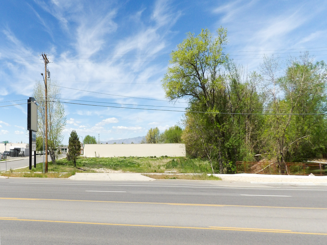

Property Detail
1075 N Main St
Provo-Orem-Lehi, UT
LOT 7, PLAT A, CREEKSIDE BUSINESS PARK SUBDV. AREA 1.085 AC.
36-998-0007
Utah
Restaurantdrivein
Utah
2024
7
2025
1.09 AC
002902
Utah County
7,203 SF
Salt Lake City
NEARBY LISTINGS FOR SALE OR LEASE
DEMOGRAPHICS near 1075 N Main St
1 mile
3 mile
5 mile
2025 Total Population
8,911
43,286
123,004
2030 Population
9,733
47,360
135,840
Pop Growth 2025-2030
+ 9.22%
+ 9.41%
+ 10.44%
Average Age
33
33
31
2025 Total Households
2,640
12,837
37,808
HH Growth 2025-2030
+ 9.85%
+ 10.10%
+ 11.21%
Median Household Inc
$99,462
$94,361
$77,231
Avg Household Size
3.30
3.30
3.10
2025 Avg HH Vehicles
2.00
2.00
2.00
Median Home Value
$448,223
$484,310
$519,237
Median Year Built
1993
1996
1994
Nearby Places
Map Layers
Map Styles
 Street
 Aerial
Layers
 Traffic
 Biking
Places
Listings with unknown addresses are not visible on the map
- Restaurants
- Banks
- Shops
- Fitness
- Groceries
PUBLIC TRANSPORTATION
COMMUTER RAIL
Drive
Walk
Distance
8 min
4.6 mi
Drive
Walk
Distance
9 min
4.8 mi
AIRPORT
Provo Municipal
Drive
Walk
Distance
Provo Municipal
13 min
7.3 mi
SALE & LEASE HISTORY
LISTING DATE
SALE/LEASE

May 07, 2020
For Sale
Nearby Properties
Address
Land Use
TOTAL SIZE
Lot Size
Zoning
Address
Land Use
TOTAL SIZE
Lot Size
Zoning
138,990 SF
2.87 AC
Address
Land Use
TOTAL SIZE
Lot Size
Zoning
69,236 SF
30.28 AC
Address
Land Use
TOTAL SIZE
Lot Size
Zoning
286,188 SF
13.63 AC
Address
Land Use
TOTAL SIZE
Lot Size
Zoning
269,742 SF
16.30 AC
Address
Land Use
TOTAL SIZE
Lot Size
Zoning
671,002 SF
59.02 AC
Address
Land Use
TOTAL SIZE
Lot Size
Zoning
370,735 SF
18.54 AC
Address
Land Use
TOTAL SIZE
Lot Size
Zoning
301,852 SF
20.24 AC
Address
Land Use
TOTAL SIZE
Lot Size
Zoning
177,428 SF
9.83 AC
Address
Land Use
TOTAL SIZE
Lot Size
Zoning
210,644 SF
19.55 AC
Address
Land Use
TOTAL SIZE
Lot Size
Zoning
125,729 SF
12.84 AC
Address
Land Use
TOTAL SIZE
Lot Size
Zoning
29,819 SF
13.51 AC
Address
Land Use
TOTAL SIZE
Lot Size
Zoning
386,576 SF
128.19 AC
Address
Land Use
TOTAL SIZE
Lot Size
Zoning
240,674 SF
19.41 AC
Address
Land Use
TOTAL SIZE
Lot Size
Zoning
238,651 SF
14.45 AC
Address
Land Use
TOTAL SIZE
Lot Size
Zoning
151,447 SF
16.14 AC
Address
Land Use
TOTAL SIZE
Lot Size
Zoning
141,566 SF
7.89 AC
Address
Land Use
TOTAL SIZE
Lot Size
Zoning
231,991 SF
13.76 AC
Address
Land Use
TOTAL SIZE
Lot Size
Zoning
79,260 SF
5.24 AC
Address
Land Use
TOTAL SIZE
Lot Size
Zoning
151,447 SF
8.61 AC
Address
Land Use
TOTAL SIZE
Lot Size
Zoning
128,650 SF
10 AC
Address
Land Use
TOTAL SIZE
Lot Size
Zoning
120,613 SF
5.13 AC
Address
Land Use
TOTAL SIZE
Lot Size
Zoning
170,273 SF
9.19 AC
Address
Land Use
TOTAL SIZE
Lot Size
Zoning
136,548 SF
7.67 AC
Address
Land Use
TOTAL SIZE
Lot Size
Zoning
103,642 SF
6.29 AC
Address
Land Use
TOTAL SIZE
Lot Size
Zoning
100,937 SF
6.71 AC
Address
Land Use
TOTAL SIZE
Lot Size
Zoning
112,709 SF
8.10 AC
Address
Land Use
TOTAL SIZE
Lot Size
Zoning
155,605 SF
18.90 AC
Address
Land Use
TOTAL SIZE
Lot Size
Zoning
72,453 SF
14.17 AC
Address
Land Use
TOTAL SIZE
Lot Size
Zoning
92,788 SF
5.53 AC
Address
Land Use
TOTAL SIZE
Lot Size
Zoning
113,013 SF
5.89 AC
The World's #1 Commercial Real Estate Marketplace
Connect with us
© 2026 CoStar Group
The information above has been obtained from sources believed reliable. While we do not doubt its accuracy we have not verified it and make no guarantee, warranty or representation about it. It is your responsibility to independently confirm its accuracy and completeness. Any projections, opinions, assumptions, or estimates used are for example only and do not represent the current or future performance of the property. The value of this transaction to you depends on tax and other factors which should be evaluated by your tax, financial, and legal advisors. You and your advisors should conduct a careful, independent investigation of the property to determine to your satisfaction the suitability of the property for your needs.