Property Record
10750 Sw 5Th St, Beaverton, OR 97005

Save to a Folder
{{folder.Name}}
{{folder.ListingIds.length}} Properties
{{folder.ListingIds.length}} Property
Create a New Folder
Property Detail
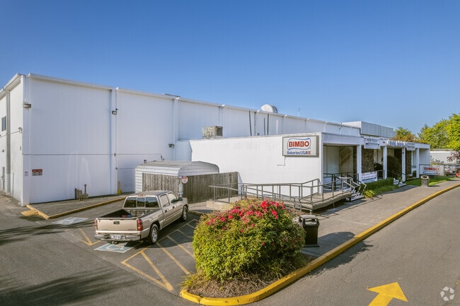
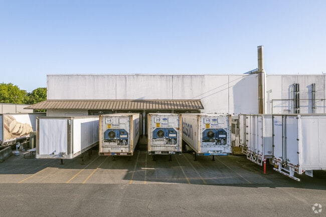
10750 Sw 5Th St
R0113718
ACRES 6.06
Industrialgeneral
WASHINGTON
IND
Oregon
AE The base floodplain where base flood elevations are provided. AE Zones are now used on new format FIRMs instead of A1-A30 Zones.
6.06 AC
2024
217 Corridor/Beaverton
2026
Portland
030401
Portland-Vancouver-Hillsboro, OR-WA
NEARBY LISTINGS FOR SALE OR LEASE
DEMOGRAPHICS near 10750 Sw 5Th St
1 mile
3 mile
5 mile
2025 Total Population
13,681
133,129
358,152
2030 Population
13,832
134,138
360,339
Pop Growth 2025-2030
+ 1.10%
+ 0.76%
+ 0.61%
Average Age
39
41
41
2025 Total Households
5,633
55,594
142,108
HH Growth 2025-2030
+ 1.24%
+ 0.87%
+ 0.63%
Median Household Inc
$76,545
$96,708
$106,887
Avg Household Size
2.30
2.30
2.50
2025 Avg HH Vehicles
2.00
2.00
2.00
Median Home Value
$634,628
$664,751
$678,483
Median Year Built
1971
1976
1983
Nearby Places
Map Layers
Map Styles
 Street
 Aerial
Layers
 Traffic
 Biking
Places
Listings with unknown addresses are not visible on the map
- Restaurants
- Banks
- Shops
- Fitness
- Groceries
PUBLIC TRANSPORTATION
COMMUTER RAIL
Beaverton Transit Center (West Side Express) (Westside Express Service - Tri-County Metropolitan Transportation District of Oregon Rail (TriMet Rail))
Drive
Walk
Distance
Beaverton Transit Center (West Side Express) (Westside Express Service - Tri-County Metropolitan Transportation District of Oregon Rail (TriMet Rail))
5 min
1.4 mi
Hall/Nimbus (Westside Express Service - Tri-County Metropolitan Transportation District of Oregon Rail (TriMet Rail))
Drive
Walk
Distance
Hall/Nimbus (Westside Express Service - Tri-County Metropolitan Transportation District of Oregon Rail (TriMet Rail))
7 min
3.0 mi
AIRPORT
Portland International
Drive
Walk
Distance
Portland International
35 min
21.1 mi
Freight Ports
Port of Portland
Drive
Walk
Distance
Port of Portland
18 min
10.1 mi
Nearby Properties
Address
Land Use
TOTAL SIZE
Lot Size
Zoning
Address
Land Use
TOTAL SIZE
Lot Size
Zoning
0.05 AC
IND
Address
Land Use
TOTAL SIZE
Lot Size
Zoning
2,936,291 SF
72.49 AC
TO:EMP
Address
Land Use
TOTAL SIZE
Lot Size
Zoning
0.08 AC
IND
Address
Land Use
TOTAL SIZE
Lot Size
Zoning
58.68 AC
IND
Address
Land Use
TOTAL SIZE
Lot Size
Zoning
716,311 SF
75.07 AC
TO:EMP
Address
Land Use
TOTAL SIZE
Lot Size
Zoning
888,084 SF
31.12 AC
MUC
Address
Land Use
TOTAL SIZE
Lot Size
Zoning
303,158 SF
18.18 AC
R10
Address
Land Use
TOTAL SIZE
Lot Size
Zoning
1,031,421 SF
22.20 AC
SC-HDR
Address
Land Use
TOTAL SIZE
Lot Size
Zoning
461,858 SF
36.37 AC
CS
Address
Land Use
TOTAL SIZE
Lot Size
Zoning
1,380,937 SF
36.42 AC
INST
Address
Land Use
TOTAL SIZE
Lot Size
Zoning
8,967 SF
13.12 AC
GC
Address
Land Use
TOTAL SIZE
Lot Size
Zoning
44.66 AC
IND
Address
Land Use
TOTAL SIZE
Lot Size
Zoning
359,574 SF
6.75 AC
R-9
Address
Land Use
TOTAL SIZE
Lot Size
Zoning
179,180 SF
36.77 AC
INST
Address
Land Use
TOTAL SIZE
Lot Size
Zoning
152,339 SF
28.70 AC
R1
Address
Land Use
TOTAL SIZE
Lot Size
Zoning
155,201 SF
4.04 AC
R7
Address
Land Use
TOTAL SIZE
Lot Size
Zoning
120,400 SF
16.28 AC
TC-HDR
Address
Land Use
TOTAL SIZE
Lot Size
Zoning
256,070 SF
32.39 AC
R7
Address
Land Use
TOTAL SIZE
Lot Size
Zoning
234,391 SF
0.13 AC
CS
Address
Land Use
TOTAL SIZE
Lot Size
Zoning
62,647 SF
9.65 AC
R7
Address
Land Use
TOTAL SIZE
Lot Size
Zoning
43,537 SF
3.59 AC
MUC
Address
Land Use
TOTAL SIZE
Lot Size
Zoning
37.55 AC
IND
Address
Land Use
TOTAL SIZE
Lot Size
Zoning
372,200 SF
34.75 AC
CS
Address
Land Use
TOTAL SIZE
Lot Size
Zoning
214,045 SF
21.70 AC
R2
Address
Land Use
TOTAL SIZE
Lot Size
Zoning
285,650 SF
26.94 AC
INST
Address
Land Use
TOTAL SIZE
Lot Size
Zoning
11,736 SF
2.85 AC
MUE-1
Address
Land Use
TOTAL SIZE
Lot Size
Zoning
423,095 SF
21.51 AC
R1
Address
Land Use
TOTAL SIZE
Lot Size
Zoning
270,237 SF
22.44 AC
R-15
Address
Land Use
TOTAL SIZE
Lot Size
Zoning
62,693 SF
16.43 AC
CC
Address
Land Use
TOTAL SIZE
Lot Size
Zoning
431,653 SF
10.76 AC
R1
The World's #1 Commercial Real Estate Marketplace
Connect with us
© 2026 CoStar Group
The information above has been obtained from sources believed reliable. While we do not doubt its accuracy we have not verified it and make no guarantee, warranty or representation about it. It is your responsibility to independently confirm its accuracy and completeness. Any projections, opinions, assumptions, or estimates used are for example only and do not represent the current or future performance of the property. The value of this transaction to you depends on tax and other factors which should be evaluated by your tax, financial, and legal advisors. You and your advisors should conduct a careful, independent investigation of the property to determine to your satisfaction the suitability of the property for your needs.