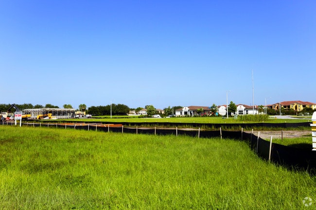
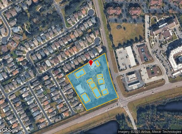
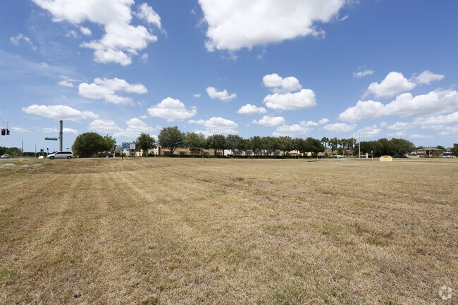
Property Record
10751 Maple Creek Dr, New Port Richey, FL 34655

NEARBY LISTINGS FOR SALE OR LEASE
Property Detail
10751 Maple Creek Dr
Tampa-St. Petersburg-Clearwater, FL
Fox Wood
31-26-17-0060-00000-00H0
FOXWOOD PHASE FIVE PB 38 PGS 108-117 TRACT H SUBJ TO PERPETUAL ESMT TO PASCO COUNTY PER OR 7671 PG 276 & OR 7671 PG 282 & OR 7568 PG 130 LESS POR DESC IN 7387 PG 1255, OR 7416 PG 1741 & OR 7387 PG 1224,OR 7561 PG 643,OR 7734 PG 797,OR 7869 PG 1683,OR
Officebuilding
Pasco
X
Florida
12101C0367F
h
2024
4.33 AC
2025
Pasco County
031601
Tampa/St Petersburg
16,980 SF
DEMOGRAPHICS near 10751 Maple Creek Dr
1 Mile
3 Mile
5 Mile
2024 Total Population
7,962
35,551
85,657
2029 Population
9,593
42,994
101,991
Pop Growth 2024-2029
+ 20.48%
+ 20.94%
+ 19.07%
Average Age
45
42
43
2024 Total Households
3,081
13,727
33,789
HH Growth 2024-2029
+ 20.45%
+ 20.90%
+ 19.07%
Median Household Inc
$97,624
$90,802
$82,165
Avg Household Size
2.60
2.60
2.50
2024 Avg HH Vehicles
2.00
2.00
2.00
Median Home Value
$375,208
$350,245
$331,646
Median Year Built
2006
2004
1997
Nearby Places
- Restaurants
- Banks
- Shops
- Fitness
- Groceries
PUBLIC TRANSPORTATION
AIRPORT
Tampa International
DRIVE
WALK
Distance
Tampa International
38 min
26.0 mi
St Pete-Clearwater International
DRIVE
WALK
Distance
St Pete-Clearwater International
48 min
26.9 mi
Freight Ports
Port of Tampa Bay
DRIVE
WALK
Distance
Port of Tampa Bay
50 min
31.4 mi
Nearby Properties
Address
Land Use
TOTAL SIZE
Lot Size
Zoning
Address
Land Use
TOTAL SIZE
Lot Size
Zoning
430,820 SF
19.14 AC
MPUD
Address
Land Use
TOTAL SIZE
Lot Size
Zoning
417,700 SF
28.91 AC
MPUD
Address
Land Use
TOTAL SIZE
Lot Size
Zoning
339,446 SF
16.29 AC
MPUD
Address
Land Use
TOTAL SIZE
Lot Size
Zoning
290,535 SF
14.91 AC
MPUD
Address
Land Use
TOTAL SIZE
Lot Size
Zoning
403,054 SF
117.69 AC
MPUD
Address
Land Use
TOTAL SIZE
Lot Size
Zoning
203,571 SF
13.82 AC
C2
Address
Land Use
TOTAL SIZE
Lot Size
Zoning
190,854 SF
14.90 AC
MPUD
Address
Land Use
TOTAL SIZE
Lot Size
Zoning
143,332 SF
17.40 AC
C2
Address
Land Use
TOTAL SIZE
Lot Size
Zoning
152,300 SF
2.82 AC
MF3
Address
Land Use
TOTAL SIZE
Lot Size
Zoning
1,017 AC
AR
Address
Land Use
TOTAL SIZE
Lot Size
Zoning
113,034 SF
15.21 AC
MPUD
Address
Land Use
TOTAL SIZE
Lot Size
Zoning
654.52 AC
AR
Address
Land Use
TOTAL SIZE
Lot Size
Zoning
114,831 SF
7.98 AC
MF2
Address
Land Use
TOTAL SIZE
Lot Size
Zoning
59,874 SF
7.73 AC
MPUD
Address
Land Use
TOTAL SIZE
Lot Size
Zoning
116,607 SF
3.88 AC
MPUD
Address
Land Use
TOTAL SIZE
Lot Size
Zoning
83,958 SF
18.56 AC
MPUD
Address
Land Use
TOTAL SIZE
Lot Size
Zoning
80,957 SF
17.71 AC
MPUD
Address
Land Use
TOTAL SIZE
Lot Size
Zoning
70,248 SF
27.90 AC
R4
Address
Land Use
TOTAL SIZE
Lot Size
Zoning
89,242 SF
14.28 AC
MPUD
Address
Land Use
TOTAL SIZE
Lot Size
Zoning
217,376 SF
22.12 AC
C2
Address
Land Use
TOTAL SIZE
Lot Size
Zoning
53,744 SF
10.64 AC
MPUD
Address
Land Use
TOTAL SIZE
Lot Size
Zoning
61,760 SF
11.47 AC
MPUD
Address
Land Use
TOTAL SIZE
Lot Size
Zoning
245.25 AC
PRM
Address
Land Use
TOTAL SIZE
Lot Size
Zoning
85,547 SF
16.13 AC
MPUD
Address
Land Use
TOTAL SIZE
Lot Size
Zoning
109,894 SF
7.95 AC
C2
Address
Land Use
TOTAL SIZE
Lot Size
Zoning
106,039 SF
3.03 AC
MPUD
Address
Land Use
TOTAL SIZE
Lot Size
Zoning
74,679 SF
5.93 AC
MPUD
Address
Land Use
TOTAL SIZE
Lot Size
Zoning
85,600 SF
13.40 AC
C2
Address
Land Use
TOTAL SIZE
Lot Size
Zoning
89,308 SF
0.58 AC
C2
The World's #1 Commercial Real Estate Marketplace
Connect with us
© 2025 CoStar Group
The information above has been obtained from sources believed reliable. While we do not doubt its accuracy we have not verified it and make no guarantee, warranty or representation about it. It is your responsibility to independently confirm its accuracy and completeness. Any projections, opinions, assumptions, or estimates used are for example only and do not represent the current or future performance of the property. The value of this transaction to you depends on tax and other factors which should be evaluated by your tax, financial, and legal advisors. You and your advisors should conduct a careful, independent investigation of the property to determine to your satisfaction the suitability of the property for your needs.