Property Record
10757 Energy St, Hanford, CA 93230


NEARBY LISTINGS FOR SALE OR LEASE
Property Detail
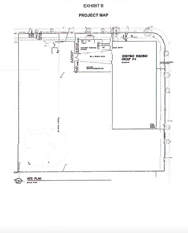
10757 Energy St
Hanford-Corcoran, CA
Hanford
018-242-070-000
10757 ENERGY ST HANFORD
Lightindustrial
Kings
X
California
06031C0195C
2.56 AC
2024
Hanford/Armona
2025
Fresno
001200
DEMOGRAPHICS near 10757 Energy St
1 Mile
3 Mile
5 Mile
2024 Total Population
19
10,482
41,026
2029 Population
19
10,584
41,688
Pop Growth 2024-2029
0.00%
+ 0.97%
+ 1.61%
Average Age
38
34
35
2024 Total Households
6
2,956
12,821
HH Growth 2024-2029
0.00%
+ 0.98%
+ 1.65%
Median Household Inc
$74,999
$53,797
$54,425
Avg Household Size
2.80
3.40
3.00
2024 Avg HH Vehicles
3.00
2.00
2.00
Median Home Value
$450,000
$241,320
$269,223
Median Year Built
1974
1988
1978
Nearby Places
Map Layers
Map Styles
 Street
 Aerial
- Restaurants
- Banks
- Shops
- Fitness
- Groceries
PUBLIC TRANSPORTATION
COMMUTER RAIL
Hanford (San Joaquins - Amtrak)
DRIVE
WALK
Distance
Hanford (San Joaquins - Amtrak)
8 min
4.2 mi
Freight Ports
Port of Stockton
DRIVE
WALK
Distance
Port of Stockton
199 min
177.8 mi
SALE & LEASE HISTORY
LISTING DATE
SALE/LEASE

Sep 24, 2016
For Sale
Jun 28, 2017
For Lease
Aug 26, 2021
For Lease
Apr 04, 2017
For Sale
Nearby Properties
Address
Land Use
TOTAL SIZE
Lot Size
Zoning
Address
Land Use
TOTAL SIZE
Lot Size
Zoning
63.26 AC
I-H
Address
Land Use
TOTAL SIZE
Lot Size
Zoning
50 AC
MH
Address
Land Use
TOTAL SIZE
Lot Size
Zoning
1,042,000 SF
67.05 AC
MH
Address
Land Use
TOTAL SIZE
Lot Size
Zoning
75.42 AC
MH
Address
Land Use
TOTAL SIZE
Lot Size
Zoning
18.54 AC
I-H
Address
Land Use
TOTAL SIZE
Lot Size
Zoning
169,750 SF
21.54 AC
H1
Address
Land Use
TOTAL SIZE
Lot Size
Zoning
2,544 SF
159.94 AC
AG20
Address
Land Use
TOTAL SIZE
Lot Size
Zoning
5.73 AC
HI
Address
Land Use
TOTAL SIZE
Lot Size
Zoning
64,973 SF
8.39 AC
H1
Address
Land Use
TOTAL SIZE
Lot Size
Zoning
20 AC
I-H
Address
Land Use
TOTAL SIZE
Lot Size
Zoning
80 AC
AG20
Address
Land Use
TOTAL SIZE
Lot Size
Zoning
984,192 SF
67.69 AC
H1
Address
Land Use
TOTAL SIZE
Lot Size
Zoning
24,000 SF
38.74 AC
H1
Address
Land Use
TOTAL SIZE
Lot Size
Zoning
141,960 SF
16.95 AC
H1
Address
Land Use
TOTAL SIZE
Lot Size
Zoning
1,741 SF
309.76 AC
AG20
Address
Land Use
TOTAL SIZE
Lot Size
Zoning
888 SF
108 AC
AL10
Address
Land Use
TOTAL SIZE
Lot Size
Zoning
92.30 AC
MH
Address
Land Use
TOTAL SIZE
Lot Size
Zoning
5.70 AC
H1
Address
Land Use
TOTAL SIZE
Lot Size
Zoning
918 SF
316.50 AC
AG20
Address
Land Use
TOTAL SIZE
Lot Size
Zoning
155 AC
AG20
Address
Land Use
TOTAL SIZE
Lot Size
Zoning
32.90 AC
L1
Address
Land Use
TOTAL SIZE
Lot Size
Zoning
32,459 SF
2.71 AC
R-H
Address
Land Use
TOTAL SIZE
Lot Size
Zoning
4,776 SF
2.55 AC
R16
Address
Land Use
TOTAL SIZE
Lot Size
Zoning
9,665 SF
20 AC
ML
Address
Land Use
TOTAL SIZE
Lot Size
Zoning
70,700 SF
21 AC
H1
Address
Land Use
TOTAL SIZE
Lot Size
Zoning
44,520 SF
4.87 AC
NC
Address
Land Use
TOTAL SIZE
Lot Size
Zoning
25,000 SF
6.26 AC
H1
Address
Land Use
TOTAL SIZE
Lot Size
Zoning
2,290 SF
154.71 AC
AG20
The World's #1 Commercial Real Estate Marketplace
Connect with us
© 2025 CoStar Group
The information above has been obtained from sources believed reliable. While we do not doubt its accuracy we have not verified it and make no guarantee, warranty or representation about it. It is your responsibility to independently confirm its accuracy and completeness. Any projections, opinions, assumptions, or estimates used are for example only and do not represent the current or future performance of the property. The value of this transaction to you depends on tax and other factors which should be evaluated by your tax, financial, and legal advisors. You and your advisors should conduct a careful, independent investigation of the property to determine to your satisfaction the suitability of the property for your needs.