Property Record
1077 Dairy Rd, Troy, NC 27371

NEARBY LISTINGS FOR SALE OR LEASE
Property Detail
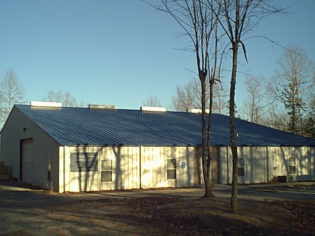
1077 Dairy Rd
7527-00-18-5718
Uwharrie Dance Center
Commercialnec
UWHARRIE CUSTOM UWHARRIE CUSTOM
X
Montgomery
3710752700J
North Carolina
2024
2.76 AC
2025
North Carolina Southeast Area
960202
Other Market Areas
6,880 SF
DEMOGRAPHICS near 1077 Dairy Rd
1 Mile
3 Mile
5 Mile
2024 Total Population
273
3,437
6,364
2029 Population
271
3,424
6,358
Pop Growth 2024-2029
(0.73%)
(0.38%)
(0.09%)
Average Age
40
41
41
2024 Total Households
114
1,377
2,450
HH Growth 2024-2029
(0.88%)
(0.73%)
(0.53%)
Median Household Inc
$40,417
$43,321
$44,779
Avg Household Size
2.40
2.40
2.40
2024 Avg HH Vehicles
2.00
2.00
2.00
Median Home Value
$151,282
$147,558
$142,595
Median Year Built
1970
1974
1975
Nearby Places
Map Layers
Map Styles
 Street
 Aerial
- Restaurants
- Banks
- Shops
- Fitness
- Groceries
Nearby Properties
Address
Land Use
TOTAL SIZE
Lot Size
Zoning
Address
Land Use
TOTAL SIZE
Lot Size
Zoning
126,675 SF
6.83 AC
INDUSTRIAL
Address
Land Use
TOTAL SIZE
Lot Size
Zoning
80,056 SF
55.12 AC
SCHOOL
Address
Land Use
TOTAL SIZE
Lot Size
Zoning
44,307 SF
10.65 AC
SCHOOL
Address
Land Use
TOTAL SIZE
Lot Size
Zoning
44,501 SF
2.04 AC
Address
Land Use
TOTAL SIZE
Lot Size
Zoning
36,736 SF
1.60 AC
Address
Land Use
TOTAL SIZE
Lot Size
Zoning
69,728 SF
8.08 AC
Address
Land Use
TOTAL SIZE
Lot Size
Zoning
23,018 SF
1.83 AC
CHURCH
Address
Land Use
TOTAL SIZE
Lot Size
Zoning
39,200 SF
8.10 AC
Address
Land Use
TOTAL SIZE
Lot Size
Zoning
16,753 SF
9.49 AC
Address
Land Use
TOTAL SIZE
Lot Size
Zoning
5,080 SF
0.24 AC
Address
Land Use
TOTAL SIZE
Lot Size
Zoning
97,235 SF
9.81 AC
INDUSTRIAL
Address
Land Use
TOTAL SIZE
Lot Size
Zoning
6,606 SF
7.61 AC
APARTMENTS
Address
Land Use
TOTAL SIZE
Lot Size
Zoning
26,848 SF
0.83 AC
CHURCH
Address
Land Use
TOTAL SIZE
Lot Size
Zoning
6,580 SF
8.85 AC
APARTMENTS
Address
Land Use
TOTAL SIZE
Lot Size
Zoning
36,238 SF
3.05 AC
Address
Land Use
TOTAL SIZE
Lot Size
Zoning
9,000 SF
0.89 AC
FIRE STATI
Address
Land Use
TOTAL SIZE
Lot Size
Zoning
5,679 SF
2 AC
BANK
Address
Land Use
TOTAL SIZE
Lot Size
Zoning
3,488 SF
2.01 AC
FAST FOOD
Address
Land Use
TOTAL SIZE
Lot Size
Zoning
73,237 SF
12.25 AC
INDUSTRIAL
Address
Land Use
TOTAL SIZE
Lot Size
Zoning
11,337 SF
0.64 AC
Address
Land Use
TOTAL SIZE
Lot Size
Zoning
8,141 SF
4.78 AC
MEDICAL OF
Address
Land Use
TOTAL SIZE
Lot Size
Zoning
8,520 SF
8.05 AC
CHURCH
Address
Land Use
TOTAL SIZE
Lot Size
Zoning
634.10 AC
Address
Land Use
TOTAL SIZE
Lot Size
Zoning
23,416 SF
197.34 AC
Address
Land Use
TOTAL SIZE
Lot Size
Zoning
3,356 SF
6.81 AC
APARTMENTS
Address
Land Use
TOTAL SIZE
Lot Size
Zoning
6,344 SF
2.55 AC
MEDICAL OF
Address
Land Use
TOTAL SIZE
Lot Size
Zoning
8,004 SF
0.75 AC
Address
Land Use
TOTAL SIZE
Lot Size
Zoning
4,888 SF
0.91 AC
BANK
Address
Land Use
TOTAL SIZE
Lot Size
Zoning
8,000 SF
0.89 AC
Address
Land Use
TOTAL SIZE
Lot Size
Zoning
62,748 SF
5.95 AC
INDUSTRIAL
The World's #1 Commercial Real Estate Marketplace
Connect with us
© 2025 CoStar Group
The information above has been obtained from sources believed reliable. While we do not doubt its accuracy we have not verified it and make no guarantee, warranty or representation about it. It is your responsibility to independently confirm its accuracy and completeness. Any projections, opinions, assumptions, or estimates used are for example only and do not represent the current or future performance of the property. The value of this transaction to you depends on tax and other factors which should be evaluated by your tax, financial, and legal advisors. You and your advisors should conduct a careful, independent investigation of the property to determine to your satisfaction the suitability of the property for your needs.