Property Record
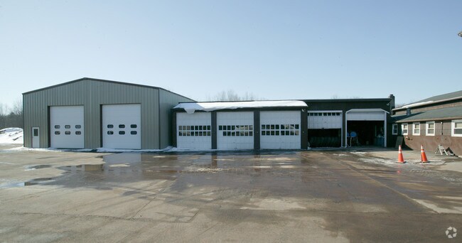
1077 Strong Rd, South Windsor, CT 06074
NEARBY LISTINGS FOR SALE OR LEASE
Property Detail
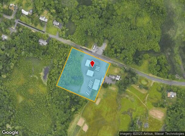
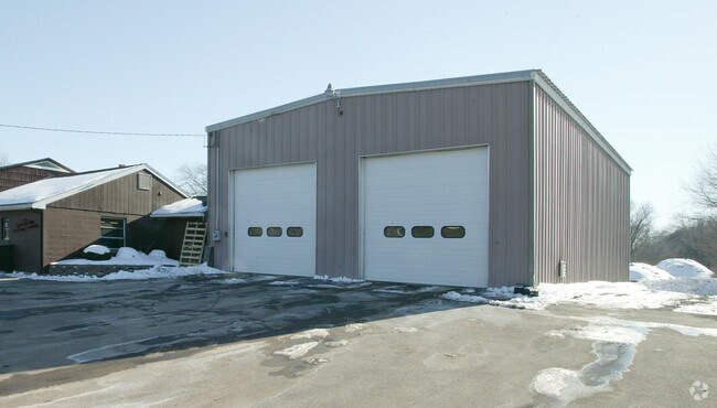
1077 Strong Rd
SWIN-000075-000002-000004
Hartford
Commercialnec
Connecticut
X
4
09003C0379F
3.55 AC
2024
South Windsor
2025
Hartford
487400
Hartford-West Hartford-East Hartford, CT
DEMOGRAPHICS near 1077 Strong Rd
1 Mile
3 Mile
5 Mile
2024 Total Population
2,253
31,323
110,091
2029 Population
2,252
31,267
109,485
Pop Growth 2024-2029
(0.04%)
(0.18%)
(0.55%)
Average Age
42
40
41
2024 Total Households
823
12,554
45,305
HH Growth 2024-2029
0.00%
(0.14%)
(0.60%)
Median Household Inc
$123,996
$114,912
$84,157
Avg Household Size
2.60
2.50
2.40
2024 Avg HH Vehicles
2.00
2.00
2.00
Median Home Value
$294,463
$302,309
$236,653
Median Year Built
1974
1983
1969
Nearby Places
Map Layers
Map Styles
 Street
 Aerial
- Restaurants
- Banks
- Shops
- Fitness
- Groceries
PUBLIC TRANSPORTATION
COMMUTER RAIL
DRIVE
WALK
Distance
19 min
9.1 mi
DRIVE
WALK
Distance
17 min
9.4 mi
AIRPORT
Bradley International
DRIVE
WALK
Distance
Bradley International
32 min
15.3 mi
Freight Ports
Port of New Haven
DRIVE
WALK
Distance
Port of New Haven
64 min
46.6 mi
Nearby Properties
Address
Land Use
TOTAL SIZE
Lot Size
Zoning
Address
Land Use
TOTAL SIZE
Lot Size
Zoning
194,971 SF
162.43 AC
IND
Address
Land Use
TOTAL SIZE
Lot Size
Zoning
467,349 SF
13.83 AC
CUD
Address
Land Use
TOTAL SIZE
Lot Size
Zoning
248,364 SF
47.28 AC
A20
Address
Land Use
TOTAL SIZE
Lot Size
Zoning
20,384 SF
40 AC
PRD
Address
Land Use
TOTAL SIZE
Lot Size
Zoning
28,608 SF
25.37 AC
CUD
Address
Land Use
TOTAL SIZE
Lot Size
Zoning
43.60 AC
PRD
Address
Land Use
TOTAL SIZE
Lot Size
Zoning
12,068 SF
21.79 AC
CUD
Address
Land Use
TOTAL SIZE
Lot Size
Zoning
659,693 SF
102.30 AC
I
Address
Land Use
TOTAL SIZE
Lot Size
Zoning
238.11 AC
GD
Address
Land Use
TOTAL SIZE
Lot Size
Zoning
29,744 SF
29.50 AC
PRD
Address
Land Use
TOTAL SIZE
Lot Size
Zoning
10.59 AC
GD
Address
Land Use
TOTAL SIZE
Lot Size
Zoning
175,936 SF
18.28 AC
GD
Address
Land Use
TOTAL SIZE
Lot Size
Zoning
26.65 AC
GB
Address
Land Use
TOTAL SIZE
Lot Size
Zoning
301,011 SF
60.83 AC
I
Address
Land Use
TOTAL SIZE
Lot Size
Zoning
421,152 SF
45.95 AC
CD
Address
Land Use
TOTAL SIZE
Lot Size
Zoning
498,105 SF
29.55 AC
IND
Address
Land Use
TOTAL SIZE
Lot Size
Zoning
149,322 SF
16.76 AC
A30
Address
Land Use
TOTAL SIZE
Lot Size
Zoning
101,317 SF
24.91 AC
RR
Address
Land Use
TOTAL SIZE
Lot Size
Zoning
111,800 SF
5.80 AC
GD
Address
Land Use
TOTAL SIZE
Lot Size
Zoning
302,370 SF
16.43 AC
I
Address
Land Use
TOTAL SIZE
Lot Size
Zoning
156,929 SF
43 AC
GD
Address
Land Use
TOTAL SIZE
Lot Size
Zoning
19.60 AC
GB
Address
Land Use
TOTAL SIZE
Lot Size
Zoning
416,640 SF
30 AC
I
Address
Land Use
TOTAL SIZE
Lot Size
Zoning
68,988 SF
9.17 AC
GB
Address
Land Use
TOTAL SIZE
Lot Size
Zoning
62,487 SF
14.35 AC
CD
Address
Land Use
TOTAL SIZE
Lot Size
Zoning
43,394 SF
35 AC
A30
Address
Land Use
TOTAL SIZE
Lot Size
Zoning
153,247 SF
19.85 AC
I
Address
Land Use
TOTAL SIZE
Lot Size
Zoning
11.14 AC
CD
Address
Land Use
TOTAL SIZE
Lot Size
Zoning
81,412 SF
9.20 AC
GD
Address
Land Use
TOTAL SIZE
Lot Size
Zoning
127,089 SF
12.89 AC
GD
The World's #1 Commercial Real Estate Marketplace
Connect with us
© 2025 CoStar Group
The information above has been obtained from sources believed reliable. While we do not doubt its accuracy we have not verified it and make no guarantee, warranty or representation about it. It is your responsibility to independently confirm its accuracy and completeness. Any projections, opinions, assumptions, or estimates used are for example only and do not represent the current or future performance of the property. The value of this transaction to you depends on tax and other factors which should be evaluated by your tax, financial, and legal advisors. You and your advisors should conduct a careful, independent investigation of the property to determine to your satisfaction the suitability of the property for your needs.