Property Record
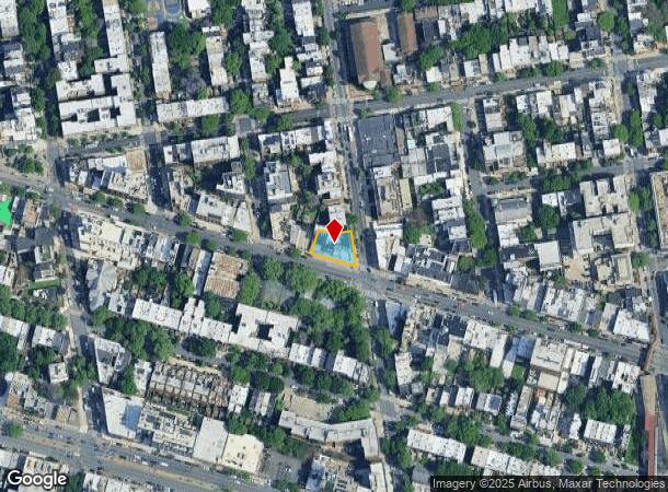
1071 Fulton St, Brooklyn, NY 11238
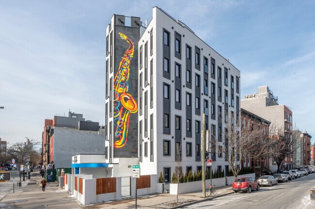
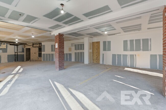

This Property Is For Sale
Current Lease Availabilities
NEARBY LISTINGS FOR SALE OR LEASE
Property Detail
1071 Fulton St
01993-0003
Kings
Cooperative
New York
X
3
3604970212F
0.17 AC
2024
Clinton Hill
2025
Long Island (New York)
022700
New York-Jersey City-White Plains, NY-NJ
21,632 SF
DEMOGRAPHICS near 1071 Fulton St
1 mile
3 mile
5 mile
2024 Total Population
191,697
1,321,693
2,822,277
2029 Population
182,253
1,250,993
2,642,017
Pop Growth 2024-2029
(4.93%)
(5.35%)
(6.39%)
Average Age
37
38
38
2024 Total Households
81,074
522,979
1,119,829
HH Growth 2024-2029
(5.48%)
(5.79%)
(6.62%)
Median Household Inc
$96,209
$75,806
$80,672
Avg Household Size
2.30
2.40
2.40
2024 Avg HH Vehicles
.00
.00
.00
Median Home Value
$1,026,935
$965,324
$867,718
Median Year Built
1947
1948
1949
Nearby Places
Map Layers
Map Styles
 Street
 Aerial
Transit
 Traffic
 Biking
Places
Listings with unknown addresses are not visible on the map
- Restaurants
- Banks
- Shops
- Fitness
- Groceries
PUBLIC TRANSPORTATION
TRANSIT/SUBWAY
Franklin Avenue (A,C,S Line) (A - New York MTA Subway (The Subway), C - New York MTA Subway (The Subway), Franklin Avenue Shuttle - New York MTA Subway (The Subway))
Drive
Walk
Distance
Franklin Avenue (A,C,S Line) (A - New York MTA Subway (The Subway), C - New York MTA Subway (The Subway), Franklin Avenue Shuttle - New York MTA Subway (The Subway))
0 min
3 min
0.2 mi
Clinton-Washington Avenues (A,C Line) (A - New York MTA Subway (The Subway), C - New York MTA Subway (The Subway))
Drive
Walk
Distance
Clinton-Washington Avenues (A,C Line) (A - New York MTA Subway (The Subway), C - New York MTA Subway (The Subway))
1 min
7 min
0.4 mi
Nostrand Avenue (A,C Line) (A - New York MTA Subway (The Subway), C - New York MTA Subway (The Subway))
Drive
Walk
Distance
Nostrand Avenue (A,C Line) (A - New York MTA Subway (The Subway), C - New York MTA Subway (The Subway))
1 min
9 min
0.5 mi
Classon Avenue (G - New York MTA Subway (The Subway))
Drive
Walk
Distance
Classon Avenue (G - New York MTA Subway (The Subway))
1 min
9 min
0.5 mi
Park Place (S Line) (Franklin Avenue Shuttle - New York MTA Subway (The Subway))
Drive
Walk
Distance
Park Place (S Line) (Franklin Avenue Shuttle - New York MTA Subway (The Subway))
3 min
12 min
0.6 mi
COMMUTER RAIL
Nostrand Avenue Station (Far Rockaway Branch - Long Island Rail Road, Hempstead Branch - Long Island Rail Road, Long Beach Branch - Long Island Rail Road, West Hempstead Branch - Long Island Rail Road)
Drive
Walk
Distance
Nostrand Avenue Station (Far Rockaway Branch - Long Island Rail Road, Hempstead Branch - Long Island Rail Road, Long Beach Branch - Long Island Rail Road, West Hempstead Branch - Long Island Rail Road)
1 min
13 min
0.7 mi
Atlantic Terminal (Babylon Branch - Long Island Rail Road, City Terminal Zone - Long Island Rail Road, Hempstead Branch - Long Island Rail Road, West Hempstead Branch - Long Island Rail Road)
Drive
Walk
Distance
Atlantic Terminal (Babylon Branch - Long Island Rail Road, City Terminal Zone - Long Island Rail Road, Hempstead Branch - Long Island Rail Road, West Hempstead Branch - Long Island Rail Road)
3 min
20 min
1.1 mi
AIRPORT
LaGuardia
Drive
Walk
Distance
LaGuardia
18 min
9.8 mi
John F Kennedy International
Drive
Walk
Distance
John F Kennedy International
24 min
11.5 mi
Newark Liberty International
Drive
Walk
Distance
Newark Liberty International
27 min
16.1 mi
Freight Ports
NY - Red Hook Container Terminal
Drive
Walk
Distance
NY - Red Hook Container Terminal
9 min
3.1 mi
Nearby Properties
Address
Land Use
TOTAL SIZE
Lot Size
Zoning
Address
Land Use
TOTAL SIZE
Lot Size
Zoning
2,812,739 SF
2.10 AC
C5-3
Address
Land Use
TOTAL SIZE
Lot Size
Zoning
5.12 AC
C6-1G
Address
Land Use
TOTAL SIZE
Lot Size
Zoning
7,058,736 SF
147.61 AC
M3-1
Address
Land Use
TOTAL SIZE
Lot Size
Zoning
869,038 SF
1.53 AC
M1-1
Address
Land Use
TOTAL SIZE
Lot Size
Zoning
92,440 SF
466.23 AC
R5
Address
Land Use
TOTAL SIZE
Lot Size
Zoning
986,641 SF
6.74 AC
R8
Address
Land Use
TOTAL SIZE
Lot Size
Zoning
986,641 SF
6.74 AC
R8
Address
Land Use
TOTAL SIZE
Lot Size
Zoning
986,641 SF
6.74 AC
R8
Address
Land Use
TOTAL SIZE
Lot Size
Zoning
986,641 SF
6.74 AC
R8
Address
Land Use
TOTAL SIZE
Lot Size
Zoning
986,641 SF
6.74 AC
R8
Address
Land Use
TOTAL SIZE
Lot Size
Zoning
986,641 SF
6.74 AC
R8
Address
Land Use
TOTAL SIZE
Lot Size
Zoning
986,641 SF
6.74 AC
R8
Address
Land Use
TOTAL SIZE
Lot Size
Zoning
986,641 SF
6.74 AC
R8
Address
Land Use
TOTAL SIZE
Lot Size
Zoning
986,641 SF
6.74 AC
R8
Address
Land Use
TOTAL SIZE
Lot Size
Zoning
986,641 SF
6.74 AC
R8
Address
Land Use
TOTAL SIZE
Lot Size
Zoning
986,641 SF
6.74 AC
R8
Address
Land Use
TOTAL SIZE
Lot Size
Zoning
986,641 SF
6.74 AC
R8
Address
Land Use
TOTAL SIZE
Lot Size
Zoning
986,641 SF
6.74 AC
R8
Address
Land Use
TOTAL SIZE
Lot Size
Zoning
986,641 SF
6.74 AC
R8
Address
Land Use
TOTAL SIZE
Lot Size
Zoning
986,641 SF
6.74 AC
R8
Address
Land Use
TOTAL SIZE
Lot Size
Zoning
986,641 SF
6.74 AC
R8
Address
Land Use
TOTAL SIZE
Lot Size
Zoning
986,641 SF
6.74 AC
R8
Address
Land Use
TOTAL SIZE
Lot Size
Zoning
986,641 SF
6.74 AC
R8
Address
Land Use
TOTAL SIZE
Lot Size
Zoning
986,641 SF
6.74 AC
R8
Address
Land Use
TOTAL SIZE
Lot Size
Zoning
986,641 SF
6.74 AC
R8
Address
Land Use
TOTAL SIZE
Lot Size
Zoning
986,641 SF
6.74 AC
R8
Address
Land Use
TOTAL SIZE
Lot Size
Zoning
986,641 SF
6.74 AC
R8
Address
Land Use
TOTAL SIZE
Lot Size
Zoning
986,641 SF
6.74 AC
R8
Address
Land Use
TOTAL SIZE
Lot Size
Zoning
986,641 SF
6.74 AC
R8
Address
Land Use
TOTAL SIZE
Lot Size
Zoning
986,641 SF
6.74 AC
R8
The World's #1 Commercial Real Estate Marketplace
Connect with us
© 2026 CoStar Group
The information above has been obtained from sources believed reliable. While we do not doubt its accuracy we have not verified it and make no guarantee, warranty or representation about it. It is your responsibility to independently confirm its accuracy and completeness. Any projections, opinions, assumptions, or estimates used are for example only and do not represent the current or future performance of the property. The value of this transaction to you depends on tax and other factors which should be evaluated by your tax, financial, and legal advisors. You and your advisors should conduct a careful, independent investigation of the property to determine to your satisfaction the suitability of the property for your needs.