Property Record
118 E Indiana Ave, Maumee, OH 43537
NEARBY LISTINGS FOR SALE OR LEASE
Property Detail
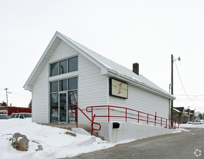
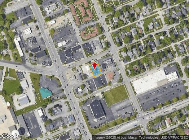
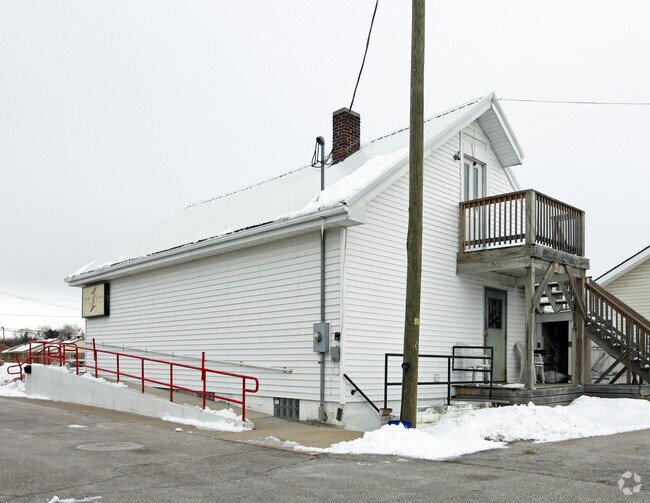
118 E Indiana Ave
Toledo, OH
Gibbs Addition
36-09925
GIBBS ADDITION LOT 19 & 1/2 VAC ALLEY ADJ... SWLY 73.30 FT
Officebuilding
Lucas
X
Ohio
39173C0009D
19,1
0
0.23 AC
2025
South/Southwest
007102
Toledo
2,413 SF
DEMOGRAPHICS near 118 E Indiana Ave
1 mile
3 mile
5 mile
2024 Total Population
4,781
54,536
118,834
2029 Population
4,628
53,955
117,880
Pop Growth 2024-2029
(3.20%)
(1.07%)
(0.80%)
Average Age
43
42
41
2024 Total Households
2,122
24,014
51,614
HH Growth 2024-2029
(3.30%)
(1.21%)
(0.90%)
Median Household Inc
$87,039
$72,126
$67,018
Avg Household Size
2.20
2.20
2.20
2024 Avg HH Vehicles
2.00
2.00
2.00
Median Home Value
$166,113
$194,722
$198,872
Median Year Built
1959
1974
1977
Nearby Places
Map Layers
Map Styles
 Street
 Aerial
Transit
 Traffic
 Biking
Places
Listings with unknown addresses are not visible on the map
- Restaurants
- Banks
- Shops
- Fitness
- Groceries
PUBLIC TRANSPORTATION
COMMUTER RAIL
Drive
Walk
Distance
12 min
8.2 mi
AIRPORT
Eugene F Kranz Toledo Express
Drive
Walk
Distance
Eugene F Kranz Toledo Express
22 min
10.3 mi
SALE & LEASE HISTORY
LISTING DATE
SALE/LEASE

Nov 30, 2021
For Sale
Nearby Properties
Address
Land Use
TOTAL SIZE
Lot Size
Zoning
Address
Land Use
TOTAL SIZE
Lot Size
Zoning
541,518 SF
21.30 AC
16-R1
Address
Land Use
TOTAL SIZE
Lot Size
Zoning
275,990 SF
49.65 AC
16-CM
Address
Land Use
TOTAL SIZE
Lot Size
Zoning
168,495 SF
12.36 AC
Address
Land Use
TOTAL SIZE
Lot Size
Zoning
131,721 SF
5.94 AC
Address
Land Use
TOTAL SIZE
Lot Size
Zoning
156,179 SF
15.67 AC
Address
Land Use
TOTAL SIZE
Lot Size
Zoning
35.94 AC
17-C3
Address
Land Use
TOTAL SIZE
Lot Size
Zoning
3.56 AC
Address
Land Use
TOTAL SIZE
Lot Size
Zoning
231,756 SF
31.37 AC
16-M1
Address
Land Use
TOTAL SIZE
Lot Size
Zoning
78,923 SF
10.12 AC
Address
Land Use
TOTAL SIZE
Lot Size
Zoning
173,528 SF
25.90 AC
Address
Land Use
TOTAL SIZE
Lot Size
Zoning
269,263 SF
55.93 AC
16-R2
Address
Land Use
TOTAL SIZE
Lot Size
Zoning
192,108 SF
33.10 AC
Address
Land Use
TOTAL SIZE
Lot Size
Zoning
231,670 SF
18.04 AC
Address
Land Use
TOTAL SIZE
Lot Size
Zoning
138,607 SF
21.30 AC
10-RS12
Address
Land Use
TOTAL SIZE
Lot Size
Zoning
606,883 SF
119.87 AC
16-M2
Address
Land Use
TOTAL SIZE
Lot Size
Zoning
352,382 SF
62.93 AC
16-M1
Address
Land Use
TOTAL SIZE
Lot Size
Zoning
337,990 SF
17.75 AC
16-M1
Address
Land Use
TOTAL SIZE
Lot Size
Zoning
8.57 AC
16-M1
Address
Land Use
TOTAL SIZE
Lot Size
Zoning
608,280 SF
48.86 AC
16-M2
Address
Land Use
TOTAL SIZE
Lot Size
Zoning
80,668 SF
9.67 AC
Address
Land Use
TOTAL SIZE
Lot Size
Zoning
212,672 SF
15.98 AC
17-R1
Address
Land Use
TOTAL SIZE
Lot Size
Zoning
350,408 SF
20.83 AC
17-M2
Address
Land Use
TOTAL SIZE
Lot Size
Zoning
148,107 SF
26.16 AC
Address
Land Use
TOTAL SIZE
Lot Size
Zoning
127,825 SF
10.99 AC
Address
Land Use
TOTAL SIZE
Lot Size
Zoning
214,986 SF
17.55 AC
19-R1
Address
Land Use
TOTAL SIZE
Lot Size
Zoning
119.87 AC
16-M2
Address
Land Use
TOTAL SIZE
Lot Size
Zoning
73,389 SF
1.78 AC
Address
Land Use
TOTAL SIZE
Lot Size
Zoning
78,166 SF
2.08 AC
16-CM
Address
Land Use
TOTAL SIZE
Lot Size
Zoning
104,314 SF
15.43 AC
16-M2
Address
Land Use
TOTAL SIZE
Lot Size
Zoning
32.75 AC
16-M2
The World's #1 Commercial Real Estate Marketplace
Connect with us
© 2026 CoStar Group
The information above has been obtained from sources believed reliable. While we do not doubt its accuracy we have not verified it and make no guarantee, warranty or representation about it. It is your responsibility to independently confirm its accuracy and completeness. Any projections, opinions, assumptions, or estimates used are for example only and do not represent the current or future performance of the property. The value of this transaction to you depends on tax and other factors which should be evaluated by your tax, financial, and legal advisors. You and your advisors should conduct a careful, independent investigation of the property to determine to your satisfaction the suitability of the property for your needs.