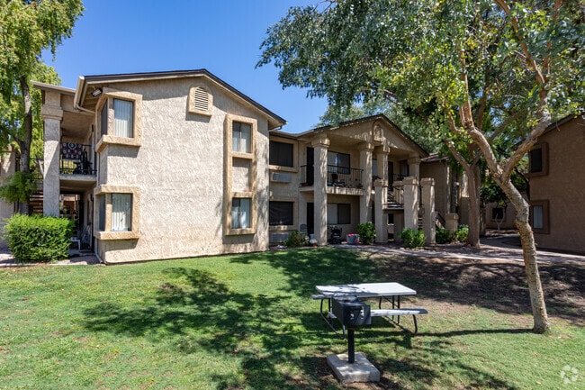
Property Record
108 N Greenfield Rd, Mesa, AZ 85205


Property Detail
108 N Greenfield Rd
140-19-008D
PT E2 SE4 NE4 DAF COM E4 COR SEC TH W 659.70F TH N 250F TO POB TH CONT N 936.15F TH E 618.73F TH S 935.80F TH W 619.50F TO POB EX RD P/D 83-502321
Apartment
Maricopa
M-H
Arizona
C and X Area of minimal flood hazard, usually depicted on FIRMs as above the 500-year flood level.
13.01 AC
2025
Central Mesa
2025
Phoenix
420708
Phoenix-Mesa-Chandler, AZ
343,128 SF
NEARBY LISTINGS FOR SALE OR LEASE
DEMOGRAPHICS near 108 N Greenfield Rd
1 mile
3 mile
5 mile
2025 Total Population
19,470
131,993
324,925
2030 Population
20,488
137,510
337,116
Pop Growth 2025-2030
+ 5.23%
+ 4.18%
+ 3.75%
Average Age
51
45
41
2025 Total Households
9,546
55,497
124,111
HH Growth 2025-2030
+ 6.05%
+ 4.68%
+ 4.17%
Median Household Inc
$57,540
$73,190
$81,946
Avg Household Size
2.00
2.30
2.50
2025 Avg HH Vehicles
1.00
2.00
2.00
Median Home Value
$197,185
$368,481
$416,366
Median Year Built
1987
1986
1987
Nearby Places
Map Layers
Map Styles
 Street
 Aerial
Layers
 Traffic
 Biking
Places
Listings with unknown addresses are not visible on the map
- Restaurants
- Banks
- Shops
- Fitness
- Groceries
PUBLIC TRANSPORTATION
AIRPORT
Phoenix-Mesa Gateway
Drive
Walk
Distance
Phoenix-Mesa Gateway
20 min
11.6 mi
Phoenix Sky Harbor International
Drive
Walk
Distance
Phoenix Sky Harbor International
30 min
18.7 mi
Freight Ports
Port of San Diego
Drive
Walk
Distance
Port of San Diego
417 min
379.6 mi
Nearby Properties
Address
Land Use
TOTAL SIZE
Lot Size
Zoning
Address
Land Use
TOTAL SIZE
Lot Size
Zoning
1,522,034 SF
32.67 AC
C-N
Address
Land Use
TOTAL SIZE
Lot Size
Zoning
125,356 SF
21.63 AC
R-9
Address
Land Use
TOTAL SIZE
Lot Size
Zoning
981,158 SF
43.42 AC
C-G
Address
Land Use
TOTAL SIZE
Lot Size
Zoning
53,910 SF
4.98 AC
C-G
Address
Land Use
TOTAL SIZE
Lot Size
Zoning
1,691,248 SF
528.80 AC
I-1
Address
Land Use
TOTAL SIZE
Lot Size
Zoning
400,798 SF
55.94 AC
PF
Address
Land Use
TOTAL SIZE
Lot Size
Zoning
441,928 SF
17.31 AC
RM3
Address
Land Use
TOTAL SIZE
Lot Size
Zoning
461,845 SF
21.62 AC
LI
Address
Land Use
TOTAL SIZE
Lot Size
Zoning
279,338 SF
39.90 AC
PF
Address
Land Use
TOTAL SIZE
Lot Size
Zoning
185,382 SF
23.37 AC
C-G
Address
Land Use
TOTAL SIZE
Lot Size
Zoning
160,296 SF
33.63 AC
PF
Address
Land Use
TOTAL SIZE
Lot Size
Zoning
269,763 SF
17.49 AC
M-H
Address
Land Use
TOTAL SIZE
Lot Size
Zoning
344,619 SF
13.85 AC
M-H
Address
Land Use
TOTAL SIZE
Lot Size
Zoning
100,580 SF
22.70 AC
C-G
Address
Land Use
TOTAL SIZE
Lot Size
Zoning
425,158 SF
23.71 AC
M-H
Address
Land Use
TOTAL SIZE
Lot Size
Zoning
98,852 SF
1.23 AC
C-G
Address
Land Use
TOTAL SIZE
Lot Size
Zoning
233,188 SF
7.34 AC
RM4
Address
Land Use
TOTAL SIZE
Lot Size
Zoning
307,545 SF
17.61 AC
M-H
Address
Land Use
TOTAL SIZE
Lot Size
Zoning
208,046 SF
23.54 AC
I-1
Address
Land Use
TOTAL SIZE
Lot Size
Zoning
219,041 SF
5.71 AC
I-1
Address
Land Use
TOTAL SIZE
Lot Size
Zoning
8.82 AC
Address
Land Use
TOTAL SIZE
Lot Size
Zoning
147,408 SF
34.58 AC
PF
Address
Land Use
TOTAL SIZE
Lot Size
Zoning
349,318 SF
18.47 AC
M-H
Address
Land Use
TOTAL SIZE
Lot Size
Zoning
359,204 SF
40.94 AC
LI
Address
Land Use
TOTAL SIZE
Lot Size
Zoning
212,942 SF
12.80 AC
M-H
Address
Land Use
TOTAL SIZE
Lot Size
Zoning
160,843 SF
22.07 AC
PF
Address
Land Use
TOTAL SIZE
Lot Size
Zoning
266,240 SF
9.75 AC
M-H
Address
Land Use
TOTAL SIZE
Lot Size
Zoning
203,722 SF
11.73 AC
C-G
Address
Land Use
TOTAL SIZE
Lot Size
Zoning
7.90 AC
Address
Land Use
TOTAL SIZE
Lot Size
Zoning
291,925 SF
17.70 AC
M-H
The World's #1 Commercial Real Estate Marketplace
Connect with us
© 2026 CoStar Group
The information above has been obtained from sources believed reliable. While we do not doubt its accuracy we have not verified it and make no guarantee, warranty or representation about it. It is your responsibility to independently confirm its accuracy and completeness. Any projections, opinions, assumptions, or estimates used are for example only and do not represent the current or future performance of the property. The value of this transaction to you depends on tax and other factors which should be evaluated by your tax, financial, and legal advisors. You and your advisors should conduct a careful, independent investigation of the property to determine to your satisfaction the suitability of the property for your needs.