Property Record
108 Roanoke Ave, Roanoke Rapids, NC 27870


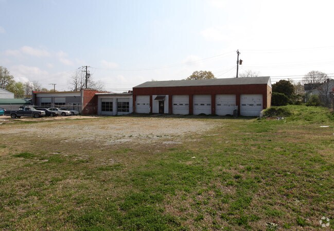
Property Detail
108 Roanoke Ave
09-01229
108-120 ROANOKE AVE
Servicestation
Halifax
RRB1
North Carolina
B and X Area of moderate flood hazard, usually the area between the limits of the 100-year and 500-year floods.
0.56 AC
2024
North Carolina Northeast Area
2025
Other Market Areas
930200
Roanoke Rapids, NC
5,000 SF
NEARBY LISTINGS FOR SALE OR LEASE
DEMOGRAPHICS near 108 Roanoke Ave
1 mile
3 mile
5 mile
2025 Total Population
4,216
17,881
25,547
2030 Population
4,057
17,183
24,690
Pop Growth 2025-2030
(3.77%)
(3.90%)
(3.35%)
Average Age
39
41
42
2025 Total Households
1,657
7,620
10,926
HH Growth 2025-2030
(3.86%)
(3.99%)
(3.44%)
Median Household Inc
$62,113
$52,457
$47,140
Avg Household Size
2.40
2.30
2.30
2025 Avg HH Vehicles
2.00
2.00
2.00
Median Home Value
$154,008
$141,001
$128,250
Median Year Built
1957
1973
1976
Nearby Places
Map Layers
Map Styles
 Street
 Aerial
Layers
 Traffic
 Biking
Places
Listings with unknown addresses are not visible on the map
- Restaurants
- Banks
- Shops
- Fitness
- Groceries
Nearby Properties
Address
Land Use
TOTAL SIZE
Lot Size
Zoning
Address
Land Use
TOTAL SIZE
Lot Size
Zoning
50,336 SF
113.40 AC
WELI1
Address
Land Use
TOTAL SIZE
Lot Size
Zoning
239,194 SF
48.24 AC
RRB5
Address
Land Use
TOTAL SIZE
Lot Size
Zoning
97,735 SF
21.37 AC
RRR8
Address
Land Use
TOTAL SIZE
Lot Size
Zoning
94,328 SF
26.40 AC
RRR8
Address
Land Use
TOTAL SIZE
Lot Size
Zoning
26,530 SF
196.49 AC
RRI2
Address
Land Use
TOTAL SIZE
Lot Size
Zoning
66,609 SF
2.60 AC
RRB4
Address
Land Use
TOTAL SIZE
Lot Size
Zoning
122,670 SF
56.57 AC
AR
Address
Land Use
TOTAL SIZE
Lot Size
Zoning
110,678 SF
11.34 AC
RRB4
Address
Land Use
TOTAL SIZE
Lot Size
Zoning
2.05 AC
WELCH
Address
Land Use
TOTAL SIZE
Lot Size
Zoning
13,794 SF
11.34 AC
RRR
Address
Land Use
TOTAL SIZE
Lot Size
Zoning
14,000 SF
13.66 AC
RRB4
Address
Land Use
TOTAL SIZE
Lot Size
Zoning
75,392 SF
4.22 AC
RRR
Address
Land Use
TOTAL SIZE
Lot Size
Zoning
60,043 SF
1.58 AC
RRR6
Address
Land Use
TOTAL SIZE
Lot Size
Zoning
69,793 SF
23.96 AC
Address
Land Use
TOTAL SIZE
Lot Size
Zoning
6,655 SF
10.02 AC
Address
Land Use
TOTAL SIZE
Lot Size
Zoning
38,176 SF
6.20 AC
RRR6
Address
Land Use
TOTAL SIZE
Lot Size
Zoning
75,353 SF
10 AC
RRR6
Address
Land Use
TOTAL SIZE
Lot Size
Zoning
14,400 SF
4.83 AC
RRI2
Address
Land Use
TOTAL SIZE
Lot Size
Zoning
87,165 SF
8.77 AC
RRB4
Address
Land Use
TOTAL SIZE
Lot Size
Zoning
46,948 SF
2.31 AC
RRB4
Address
Land Use
TOTAL SIZE
Lot Size
Zoning
28,316 SF
10.19 AC
RRB4
Address
Land Use
TOTAL SIZE
Lot Size
Zoning
10,114 SF
4.45 AC
RRR6
Address
Land Use
TOTAL SIZE
Lot Size
Zoning
132,851 SF
35.37 AC
Address
Land Use
TOTAL SIZE
Lot Size
Zoning
47,641 SF
2.15 AC
RRB4
Address
Land Use
TOTAL SIZE
Lot Size
Zoning
6,840 SF
1.82 AC
RRR20
Address
Land Use
TOTAL SIZE
Lot Size
Zoning
10,920 SF
1.92 AC
RRR8
Address
Land Use
TOTAL SIZE
Lot Size
Zoning
25,074 SF
0.32 AC
RRB2
Address
Land Use
TOTAL SIZE
Lot Size
Zoning
5,406 SF
15 AC
RRR
Address
Land Use
TOTAL SIZE
Lot Size
Zoning
6,324 SF
15.60 AC
AR
Address
Land Use
TOTAL SIZE
Lot Size
Zoning
30,762 SF
8.30 AC
RRB
The World's #1 Commercial Real Estate Marketplace
Connect with us
© 2026 CoStar Group
The information above has been obtained from sources believed reliable. While we do not doubt its accuracy we have not verified it and make no guarantee, warranty or representation about it. It is your responsibility to independently confirm its accuracy and completeness. Any projections, opinions, assumptions, or estimates used are for example only and do not represent the current or future performance of the property. The value of this transaction to you depends on tax and other factors which should be evaluated by your tax, financial, and legal advisors. You and your advisors should conduct a careful, independent investigation of the property to determine to your satisfaction the suitability of the property for your needs.