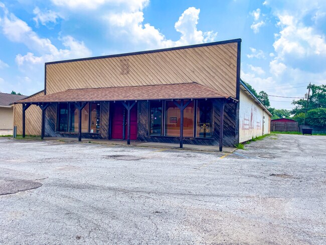
Property Record
1080 N Main St, Vidor, TX 77662
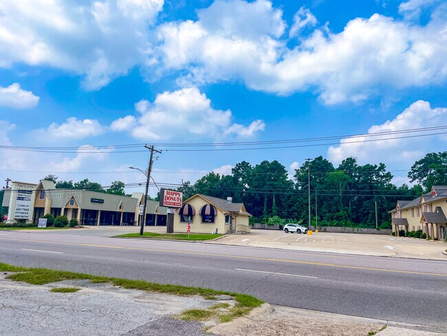
NEARBY LISTINGS FOR SALE OR LEASE
Property Detail
1080 N Main St
Beaumont-Port Arthur, TX
Miller-Vidor
008094-005120
LOT PART OF 18 BLK 5 MILLER-VIDOR
Commercialnec
Orange
X
Texas
48361C0020D
18
2025
0.59 AC
2025
Orange County
021504
Beaumont/Port Arthur
6,996 SF
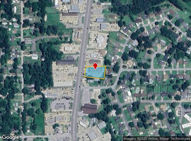
DEMOGRAPHICS near 1080 N Main St
1 Mile
3 Mile
5 Mile
2024 Total Population
3,725
15,561
22,514
2029 Population
3,829
15,739
22,723
Pop Growth 2024-2029
+ 2.79%
+ 1.14%
+ 0.93%
Average Age
39
40
40
2024 Total Households
1,386
5,976
8,604
HH Growth 2024-2029
+ 2.81%
+ 1.14%
+ 0.91%
Median Household Inc
$57,341
$64,105
$68,153
Avg Household Size
2.50
2.50
2.50
2024 Avg HH Vehicles
2.00
2.00
2.00
Median Home Value
$118,750
$124,748
$133,072
Median Year Built
1984
1983
1984
Nearby Places
Map Layers
Map Styles
 Street
 Aerial
- Restaurants
- Banks
- Shops
- Fitness
- Groceries
PUBLIC TRANSPORTATION
COMMUTER RAIL
Beaumont Amtrak (Sunset Limited - Amtrak)
DRIVE
WALK
Distance
Beaumont Amtrak (Sunset Limited - Amtrak)
13 min
9.6 mi
Freight Ports
Port Beaumont
DRIVE
WALK
Distance
Port Beaumont
9 min
7.3 mi
Nearby Properties
Address
Land Use
TOTAL SIZE
Lot Size
Zoning
Address
Land Use
TOTAL SIZE
Lot Size
Zoning
107,684 SF
43.41 AC
Address
Land Use
TOTAL SIZE
Lot Size
Zoning
Address
Land Use
TOTAL SIZE
Lot Size
Zoning
262,985 SF
18.80 AC
Address
Land Use
TOTAL SIZE
Lot Size
Zoning
187,028 SF
25.07 AC
Address
Land Use
TOTAL SIZE
Lot Size
Zoning
91,251 SF
14.74 AC
Address
Land Use
TOTAL SIZE
Lot Size
Zoning
21,950 SF
8.38 AC
Address
Land Use
TOTAL SIZE
Lot Size
Zoning
121,625 SF
20 AC
Address
Land Use
TOTAL SIZE
Lot Size
Zoning
27,344 SF
1.57 AC
Address
Land Use
TOTAL SIZE
Lot Size
Zoning
17,356 SF
2.01 AC
Address
Land Use
TOTAL SIZE
Lot Size
Zoning
46,375 SF
10.49 AC
Address
Land Use
TOTAL SIZE
Lot Size
Zoning
1,976 SF
13.56 AC
Address
Land Use
TOTAL SIZE
Lot Size
Zoning
16,000 SF
2.73 AC
Address
Land Use
TOTAL SIZE
Lot Size
Zoning
110,780 SF
9.32 AC
Address
Land Use
TOTAL SIZE
Lot Size
Zoning
62,892 SF
13.17 AC
Address
Land Use
TOTAL SIZE
Lot Size
Zoning
4,398 SF
0.97 AC
Address
Land Use
TOTAL SIZE
Lot Size
Zoning
8.12 AC
Address
Land Use
TOTAL SIZE
Lot Size
Zoning
35,320 SF
2.87 AC
Address
Land Use
TOTAL SIZE
Lot Size
Zoning
14,510 SF
1.61 AC
Address
Land Use
TOTAL SIZE
Lot Size
Zoning
23,700 SF
3.99 AC
Address
Land Use
TOTAL SIZE
Lot Size
Zoning
12,983 SF
7.11 AC
Address
Land Use
TOTAL SIZE
Lot Size
Zoning
28,344 SF
23.99 AC
Address
Land Use
TOTAL SIZE
Lot Size
Zoning
25,143 SF
1.41 AC
Address
Land Use
TOTAL SIZE
Lot Size
Zoning
414 SF
27.29 AC
Address
Land Use
TOTAL SIZE
Lot Size
Zoning
19,356 SF
10.03 AC
Address
Land Use
TOTAL SIZE
Lot Size
Zoning
5,675 SF
1.27 AC
Address
Land Use
TOTAL SIZE
Lot Size
Zoning
3.44 AC
Address
Land Use
TOTAL SIZE
Lot Size
Zoning
14,400 SF
1.09 AC
Address
Land Use
TOTAL SIZE
Lot Size
Zoning
1.70 AC
Address
Land Use
TOTAL SIZE
Lot Size
Zoning
20,000 SF
3.45 AC
Address
Land Use
TOTAL SIZE
Lot Size
Zoning
11,626 SF
1.39 AC
The World's #1 Commercial Real Estate Marketplace
Connect with us
© 2025 CoStar Group
The information above has been obtained from sources believed reliable. While we do not doubt its accuracy we have not verified it and make no guarantee, warranty or representation about it. It is your responsibility to independently confirm its accuracy and completeness. Any projections, opinions, assumptions, or estimates used are for example only and do not represent the current or future performance of the property. The value of this transaction to you depends on tax and other factors which should be evaluated by your tax, financial, and legal advisors. You and your advisors should conduct a careful, independent investigation of the property to determine to your satisfaction the suitability of the property for your needs.