Property Record
1080 S Milpitas Blvd, Milpitas, CA 95035


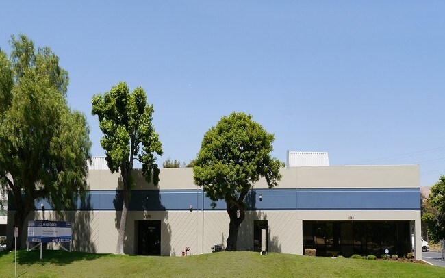

Property Detail
1080 S Milpitas Blvd
086-30-039
LOT 1 RECORDER'S BOOK 481 PAGE 12
Industrialgeneral
SANTA CLARA
M2
California
A Areas with a 1% annual chance of flooding and a 26% chance of flooding over the life of a 30-year mortgage.
1.15 AC
2024
Milpitas
2025
South Bay/San Jose
504509
San Jose-Sunnyvale-Santa Clara, CA
18,471 SF
NEARBY LISTINGS FOR SALE OR LEASE
DEMOGRAPHICS near 1080 S Milpitas Blvd
1 mile
3 mile
5 mile
2025 Total Population
30,059
164,554
319,025
2030 Population
31,499
168,269
325,224
Pop Growth 2025-2030
+ 4.79%
+ 2.26%
+ 1.94%
Average Age
36
39
39
2025 Total Households
10,214
53,386
104,071
HH Growth 2025-2030
+ 5.01%
+ 2.38%
+ 2.04%
Median Household Inc
$194,558
$185,124
$164,688
Avg Household Size
2.90
3.00
2.90
2025 Avg HH Vehicles
2.00
2.00
2.00
Median Home Value
$1,092,638
$1,093,359
$1,079,083
Median Year Built
2010
1987
1984
Nearby Places
Map Layers
Map Styles
 Street
 Aerial
Layers
 Traffic
 Biking
Places
Listings with unknown addresses are not visible on the map
- Restaurants
- Banks
- Shops
- Fitness
- Groceries
PUBLIC TRANSPORTATION
TRANSIT/SUBWAY
Montague Station (Alum Rock - Santa Teresa Line - Santa Clara VTA Light Rail)
Drive
Walk
Distance
Montague Station (Alum Rock - Santa Teresa Line - Santa Clara VTA Light Rail)
3 min
17 min
0.9 mi
COMMUTER RAIL
Great America (Altamont Corridor Express - Altamont Commuter Express (ACE))
Drive
Walk
Distance
Great America (Altamont Corridor Express - Altamont Commuter Express (ACE))
15 min
7.4 mi
Santa Clara (Caltrain - Caltrain (Caltrain))
Drive
Walk
Distance
Santa Clara (Caltrain - Caltrain (Caltrain))
14 min
9.2 mi
AIRPORT
Norman Y Mineta San Jose International
Drive
Walk
Distance
Norman Y Mineta San Jose International
13 min
7.1 mi
Metro Oakland International
Drive
Walk
Distance
Metro Oakland International
36 min
32.4 mi
SALE & LEASE HISTORY
LISTING DATE
SALE/LEASE

Sep 23, 2016
For Sale
May 14, 2018
For Lease
Jun 20, 2017
For Lease
Nearby Properties
Address
Land Use
TOTAL SIZE
Lot Size
Zoning
Address
Land Use
TOTAL SIZE
Lot Size
Zoning
7.49 AC
M2
Address
Land Use
TOTAL SIZE
Lot Size
Zoning
194,597 SF
20.10 AC
I
Address
Land Use
TOTAL SIZE
Lot Size
Zoning
74,528 SF
9.26 AC
TEC
Address
Land Use
TOTAL SIZE
Lot Size
Zoning
1,282,514 SF
99.02 AC
C2-S
Address
Land Use
TOTAL SIZE
Lot Size
Zoning
423,160 SF
6.24 AC
A(PD)
Address
Land Use
TOTAL SIZE
Lot Size
Zoning
556,649 SF
8.09 AC
IP
Address
Land Use
TOTAL SIZE
Lot Size
Zoning
104,960 SF
10.19 AC
IP
Address
Land Use
TOTAL SIZE
Lot Size
Zoning
503,840 SF
5.02 AC
MXD2
Address
Land Use
TOTAL SIZE
Lot Size
Zoning
350,507 SF
6.17 AC
APD
Address
Land Use
TOTAL SIZE
Lot Size
Zoning
328,189 SF
4.01 AC
R3
Address
Land Use
TOTAL SIZE
Lot Size
Zoning
3.72 AC
M2S
Address
Land Use
TOTAL SIZE
Lot Size
Zoning
5.21 AC
APD
Address
Land Use
TOTAL SIZE
Lot Size
Zoning
1,659,060 SF
6.42 AC
APD
Address
Land Use
TOTAL SIZE
Lot Size
Zoning
310,021 SF
5.45 AC
APD
Address
Land Use
TOTAL SIZE
Lot Size
Zoning
7.61 AC
A(PD)
Address
Land Use
TOTAL SIZE
Lot Size
Zoning
324,610 SF
3.27 AC
APD
Address
Land Use
TOTAL SIZE
Lot Size
Zoning
642,249 SF
6.89 AC
A(PD)
Address
Land Use
TOTAL SIZE
Lot Size
Zoning
270,200 SF
17.48 AC
IP
Address
Land Use
TOTAL SIZE
Lot Size
Zoning
339,693 SF
5.39 AC
APD
Address
Land Use
TOTAL SIZE
Lot Size
Zoning
362,780 SF
7.58 AC
APD
Address
Land Use
TOTAL SIZE
Lot Size
Zoning
316,904 SF
5.08 AC
APD
Address
Land Use
TOTAL SIZE
Lot Size
Zoning
4.56 AC
M2
Address
Land Use
TOTAL SIZE
Lot Size
Zoning
366,149 SF
2.98 AC
R3
Address
Land Use
TOTAL SIZE
Lot Size
Zoning
538,119 SF
7.04 AC
A(PD)
Address
Land Use
TOTAL SIZE
Lot Size
Zoning
66,350 SF
19.51 AC
IP
Address
Land Use
TOTAL SIZE
Lot Size
Zoning
143,242 SF
28.95 AC
C
Address
Land Use
TOTAL SIZE
Lot Size
Zoning
561,256 SF
36.49 AC
MP
Address
Land Use
TOTAL SIZE
Lot Size
Zoning
34.20 AC
MP
Address
Land Use
TOTAL SIZE
Lot Size
Zoning
2.55 AC
MXD2
Address
Land Use
TOTAL SIZE
Lot Size
Zoning
4.98 AC
IP
The World's #1 Commercial Real Estate Marketplace
Connect with us
© 2026 CoStar Group
The information above has been obtained from sources believed reliable. While we do not doubt its accuracy we have not verified it and make no guarantee, warranty or representation about it. It is your responsibility to independently confirm its accuracy and completeness. Any projections, opinions, assumptions, or estimates used are for example only and do not represent the current or future performance of the property. The value of this transaction to you depends on tax and other factors which should be evaluated by your tax, financial, and legal advisors. You and your advisors should conduct a careful, independent investigation of the property to determine to your satisfaction the suitability of the property for your needs.