Property Record
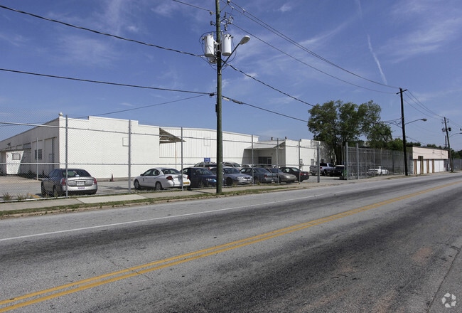
Murphy Ave Sw, Atlanta, GA 30310

NEARBY LISTINGS FOR SALE OR LEASE
Property Detail
Murphy Ave Sw
Atlanta-Sandy Springs-Roswell, GA
Tract 1 & 2
14-0106-LL-001-3
DEMO WORK ASSOC W/ATL BELTLINE
Governmentalpublicusegeneral
Fulton
X
Georgia
13121C0356F
16.15 AC
2023
Central Atlanta
2025
Atlanta
006200
DEMOGRAPHICS near Murphy Ave Sw
1 Mile
3 Mile
5 Mile
2024 Total Population
13,398
117,220
338,985
2029 Population
14,009
123,263
353,440
Pop Growth 2024-2029
+ 4.56%
+ 5.16%
+ 4.26%
Average Age
39
38
37
2024 Total Households
5,961
49,005
150,710
HH Growth 2024-2029
+ 4.45%
+ 5.49%
+ 4.49%
Median Household Inc
$46,781
$41,763
$63,246
Avg Household Size
2.20
2.10
2.00
2024 Avg HH Vehicles
1.00
1.00
1.00
Median Home Value
$293,193
$285,187
$330,798
Median Year Built
1953
1969
1984
Nearby Places
Map Layers
Map Styles
 Street
 Aerial
- Restaurants
- Banks
- Shops
- Fitness
- Groceries
PUBLIC TRANSPORTATION
TRANSIT/SUBWAY
West End (Gold Line - Metropolitan Atlanta Rapid Transit Authority (MARTA), Red Line - Metropolitan Atlanta Rapid Transit Authority (MARTA))
DRIVE
WALK
Distance
West End (Gold Line - Metropolitan Atlanta Rapid Transit Authority (MARTA), Red Line - Metropolitan Atlanta Rapid Transit Authority (MARTA))
3 min
19 min
1.0 mi
COMMUTER RAIL
DRIVE
WALK
Distance
14 min
6.8 mi
AIRPORT
Hartsfield - Jackson Atlanta International
DRIVE
WALK
Distance
Hartsfield - Jackson Atlanta International
16 min
7.9 mi
SALE & LEASE HISTORY
LISTING DATE
SALE/LEASE

Sep 24, 2016
For Lease
Nearby Properties
Address
Land Use
TOTAL SIZE
Lot Size
Zoning
Address
Land Use
TOTAL SIZE
Lot Size
Zoning
19.94 AC
SPI1
Address
Land Use
TOTAL SIZE
Lot Size
Zoning
11.74 AC
I1
Address
Land Use
TOTAL SIZE
Lot Size
Zoning
9.80 AC
C5
Address
Land Use
TOTAL SIZE
Lot Size
Zoning
3.16 AC
SPI1
Address
Land Use
TOTAL SIZE
Lot Size
Zoning
9 AC
C5
Address
Land Use
TOTAL SIZE
Lot Size
Zoning
10.27 AC
C5
Address
Land Use
TOTAL SIZE
Lot Size
Zoning
1,434,872 SF
1.89 AC
SPI1
Address
Land Use
TOTAL SIZE
Lot Size
Zoning
61.57 AC
C5
Address
Land Use
TOTAL SIZE
Lot Size
Zoning
1.55 AC
SPI1
Address
Land Use
TOTAL SIZE
Lot Size
Zoning
7 AC
C3
Address
Land Use
TOTAL SIZE
Lot Size
Zoning
1,589,465 SF
3.41 AC
SPI1
Address
Land Use
TOTAL SIZE
Lot Size
Zoning
3.62 AC
SPI1
Address
Land Use
TOTAL SIZE
Lot Size
Zoning
3,588,720 SF
1.32 AC
SPI1
Address
Land Use
TOTAL SIZE
Lot Size
Zoning
631,858 SF
1.33 AC
C5C
Address
Land Use
TOTAL SIZE
Lot Size
Zoning
510,561 SF
87 SF
SPI1
Address
Land Use
TOTAL SIZE
Lot Size
Zoning
34 AC
OI
Address
Land Use
TOTAL SIZE
Lot Size
Zoning
1,553,747 SF
2 AC
SPI1
Address
Land Use
TOTAL SIZE
Lot Size
Zoning
541,092 SF
0.53 AC
SPI1
Address
Land Use
TOTAL SIZE
Lot Size
Zoning
498,515 SF
3.41 AC
C1
Address
Land Use
TOTAL SIZE
Lot Size
Zoning
595,658 SF
4.09 AC
I1
Address
Land Use
TOTAL SIZE
Lot Size
Zoning
632,090 SF
1.01 AC
SPI1
Address
Land Use
TOTAL SIZE
Lot Size
Zoning
351,438 SF
0.44 AC
SPI1
Address
Land Use
TOTAL SIZE
Lot Size
Zoning
0.45 AC
SPI1
Address
Land Use
TOTAL SIZE
Lot Size
Zoning
979,670 SF
0.82 AC
SPI1
Address
Land Use
TOTAL SIZE
Lot Size
Zoning
529,576 SF
1.47 AC
SPI1
Address
Land Use
TOTAL SIZE
Lot Size
Zoning
94.93 AC
R5
Address
Land Use
TOTAL SIZE
Lot Size
Zoning
659,464 SF
0.74 AC
SPI1
Address
Land Use
TOTAL SIZE
Lot Size
Zoning
11,036 SF
0.62 AC
SPI1
Address
Land Use
TOTAL SIZE
Lot Size
Zoning
903,364 SF
1.08 AC
SPI1
Address
Land Use
TOTAL SIZE
Lot Size
Zoning
1,146,402 SF
4.74 AC
SPI1
The World's #1 Commercial Real Estate Marketplace
Connect with us
© 2025 CoStar Group
The information above has been obtained from sources believed reliable. While we do not doubt its accuracy we have not verified it and make no guarantee, warranty or representation about it. It is your responsibility to independently confirm its accuracy and completeness. Any projections, opinions, assumptions, or estimates used are for example only and do not represent the current or future performance of the property. The value of this transaction to you depends on tax and other factors which should be evaluated by your tax, financial, and legal advisors. You and your advisors should conduct a careful, independent investigation of the property to determine to your satisfaction the suitability of the property for your needs.