Property Record
10800 N Council Rd, Oklahoma City, OK 73162


NEARBY LISTINGS FOR SALE OR LEASE
Property Detail
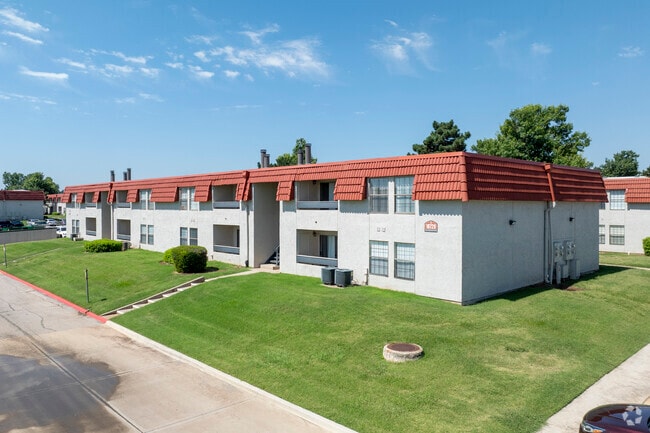
10800 N Council Rd
146601010
Unpltd Pt Sec 29 13N 4W
Multifamilydwelling
UNPLTD PT SEC 29 13N 4W 000 000 PT NW4 SEC 29 13N 4W BEG NW/C E659.36FT S990FT W660FT N990FT TO BEG EX A TR 208.7FT N&S BY 208.7FT E&W IN NW/C
AE
Oklahoma
40109C0135H
Oklahoma
2023
14 AC
2024
Northhaven
108515
Oklahoma City
202,744 SF
Oklahoma City, OK
DEMOGRAPHICS near 10800 N Council Rd
1 Mile
3 Mile
5 Mile
2024 Total Population
14,083
73,768
139,875
2029 Population
14,305
77,400
149,141
Pop Growth 2024-2029
+ 1.58%
+ 4.92%
+ 6.62%
Average Age
42
39
39
2024 Total Households
5,968
30,295
56,288
HH Growth 2024-2029
+ 1.64%
+ 4.51%
+ 6.09%
Median Household Inc
$73,910
$73,169
$74,379
Avg Household Size
2.30
2.40
2.40
2024 Avg HH Vehicles
2.00
2.00
2.00
Median Home Value
$189,143
$222,099
$225,960
Median Year Built
1985
1987
1985
Nearby Places
Map Layers
Map Styles
 Street
 Aerial
- Restaurants
- Banks
- Shops
- Fitness
- Groceries
PUBLIC TRANSPORTATION
AIRPORT
Will Rogers World
DRIVE
WALK
Distance
Will Rogers World
30 min
17.0 mi
Freight Ports
Tulsa Port Of Catoosa
DRIVE
WALK
Distance
Tulsa Port Of Catoosa
138 min
126.6 mi
Nearby Properties
Address
Land Use
TOTAL SIZE
Lot Size
Zoning
Address
Land Use
TOTAL SIZE
Lot Size
Zoning
60,267 SF
0.88 AC
C-3
Address
Land Use
TOTAL SIZE
Lot Size
Zoning
823,638 SF
94.89 AC
PUD
Address
Land Use
TOTAL SIZE
Lot Size
Zoning
7,500 SF
55.85 AC
Address
Land Use
TOTAL SIZE
Lot Size
Zoning
414,006 SF
22.80 AC
PUD
Address
Land Use
TOTAL SIZE
Lot Size
Zoning
37,400 SF
4.23 AC
PUD
Address
Land Use
TOTAL SIZE
Lot Size
Zoning
333,436 SF
22.82 AC
PUD
Address
Land Use
TOTAL SIZE
Lot Size
Zoning
10,635 SF
1.49 AC
PUD
Address
Land Use
TOTAL SIZE
Lot Size
Zoning
356,798 SF
31.11 AC
C-3
Address
Land Use
TOTAL SIZE
Lot Size
Zoning
224,984 SF
12.72 AC
PUD
Address
Land Use
TOTAL SIZE
Lot Size
Zoning
229,927 SF
25.01 AC
PUD
Address
Land Use
TOTAL SIZE
Lot Size
Zoning
175,991 SF
18.07 AC
SPUD
Address
Land Use
TOTAL SIZE
Lot Size
Zoning
286,485 SF
14.86 AC
R-4
Address
Land Use
TOTAL SIZE
Lot Size
Zoning
363,374 SF
15.85 AC
R-4
Address
Land Use
TOTAL SIZE
Lot Size
Zoning
211,560 SF
8.32 AC
R-4
Address
Land Use
TOTAL SIZE
Lot Size
Zoning
226,800 SF
30.07 AC
R-2
Address
Land Use
TOTAL SIZE
Lot Size
Zoning
263,560 SF
13.10 AC
R-4
Address
Land Use
TOTAL SIZE
Lot Size
Zoning
0.19 AC
LCR320U*
Address
Land Use
TOTAL SIZE
Lot Size
Zoning
157,279 SF
15.07 AC
PUD
Address
Land Use
TOTAL SIZE
Lot Size
Zoning
110,006 SF
6.15 AC
C-3
Address
Land Use
TOTAL SIZE
Lot Size
Zoning
10,400 SF
5.19 AC
Address
Land Use
TOTAL SIZE
Lot Size
Zoning
153,065 SF
13.87 AC
C-3
Address
Land Use
TOTAL SIZE
Lot Size
Zoning
342,342 SF
27.20 AC
R-4
Address
Land Use
TOTAL SIZE
Lot Size
Zoning
220,304 SF
19.54 AC
PUD
Address
Land Use
TOTAL SIZE
Lot Size
Zoning
199,832 SF
9.72 AC
PUD
Address
Land Use
TOTAL SIZE
Lot Size
Zoning
52,214 SF
6.91 AC
PUD
Address
Land Use
TOTAL SIZE
Lot Size
Zoning
243,906 SF
9.56 AC
C-3
Address
Land Use
TOTAL SIZE
Lot Size
Zoning
175,635 SF
17.14 AC
I-2
Address
Land Use
TOTAL SIZE
Lot Size
Zoning
6,400 SF
3.40 AC
Address
Land Use
TOTAL SIZE
Lot Size
Zoning
172,368 SF
10.72 AC
R-4
Address
Land Use
TOTAL SIZE
Lot Size
Zoning
69,410 SF
9 AC
PUD
The World's #1 Commercial Real Estate Marketplace
Connect with us
© 2026 CoStar Group
The information above has been obtained from sources believed reliable. While we do not doubt its accuracy we have not verified it and make no guarantee, warranty or representation about it. It is your responsibility to independently confirm its accuracy and completeness. Any projections, opinions, assumptions, or estimates used are for example only and do not represent the current or future performance of the property. The value of this transaction to you depends on tax and other factors which should be evaluated by your tax, financial, and legal advisors. You and your advisors should conduct a careful, independent investigation of the property to determine to your satisfaction the suitability of the property for your needs.