Property Record
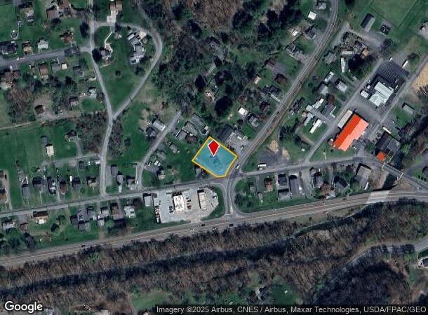
10801 Kreighbaum Rd Nw, Cumberland, MD 21502
NEARBY LISTINGS FOR SALE OR LEASE
-
-
View all Cumberland listings for sale on LoopNet.com
Property Detail
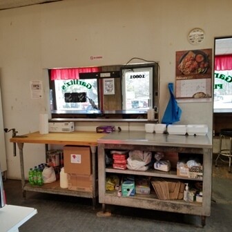
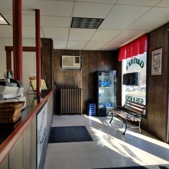
10801 Kreighbaum Rd Nw
Cumberland, MD-WV
ELLERSLIE & MT SAVAGE RDS 108X146 108X139
20-008326
Allegany
Warehouse
Maryland
2025
0.35 AC
2025
Maryland West/Hagerstown
001502
Other Market Areas
1,440 SF
DEMOGRAPHICS near 10801 Kreighbaum Rd Nw
1 Mile
3 Mile
5 Mile
2024 Total Population
646
10,274
34,320
2029 Population
587
10,040
33,881
Pop Growth 2024-2029
(9.13%)
(2.28%)
(1.28%)
Average Age
45
43
43
2024 Total Households
269
4,444
14,548
HH Growth 2024-2029
(9.29%)
(2.57%)
(1.50%)
Median Household Inc
$56,249
$58,652
$49,479
Avg Household Size
2.30
2.20
2.20
2024 Avg HH Vehicles
2.00
2.00
2.00
Median Home Value
$147,286
$149,169
$137,630
Median Year Built
1965
1953
1953
Nearby Places
Map Layers
Map Styles
 Street
 Aerial
- Restaurants
- Banks
- Shops
- Fitness
- Groceries
PUBLIC TRANSPORTATION
COMMUTER RAIL
Cumberland Amtrak Station (Capitol Limited - Amtrak)
DRIVE
WALK
Distance
Cumberland Amtrak Station (Capitol Limited - Amtrak)
8 min
4.6 mi
Freight Ports
Port of Baltimore
DRIVE
WALK
Distance
Port of Baltimore
165 min
143.0 mi
SALE & LEASE HISTORY
LISTING DATE
SALE/LEASE

Feb 21, 2017
For Sale
Feb 21, 2017
For Lease
Nearby Properties
Address
Land Use
TOTAL SIZE
Lot Size
Zoning
Address
Land Use
TOTAL SIZE
Lot Size
Zoning
40,845 SF
26.24 AC
R-O
Address
Land Use
TOTAL SIZE
Lot Size
Zoning
46,785 SF
6.60 AC
Address
Land Use
TOTAL SIZE
Lot Size
Zoning
63,412 SF
5.45 AC
R-PUD
Address
Land Use
TOTAL SIZE
Lot Size
Zoning
46,845 SF
38.24 AC
R-R
Address
Land Use
TOTAL SIZE
Lot Size
Zoning
13,014 SF
83.55 AC
R
Address
Land Use
TOTAL SIZE
Lot Size
Zoning
59,849 SF
25 AC
R-PUD
Address
Land Use
TOTAL SIZE
Lot Size
Zoning
109,875 SF
39.52 AC
R-S
Address
Land Use
TOTAL SIZE
Lot Size
Zoning
41,464 SF
4.29 AC
B-2
Address
Land Use
TOTAL SIZE
Lot Size
Zoning
29.43 AC
R-A
Address
Land Use
TOTAL SIZE
Lot Size
Zoning
2,310 SF
11.35 AC
R-PUD
Address
Land Use
TOTAL SIZE
Lot Size
Zoning
31,581 SF
45.50 AC
R
Address
Land Use
TOTAL SIZE
Lot Size
Zoning
3,592 SF
1.81 AC
Address
Land Use
TOTAL SIZE
Lot Size
Zoning
10,815 SF
2.28 AC
R-L
Address
Land Use
TOTAL SIZE
Lot Size
Zoning
23,394 SF
3 AC
B-2
Address
Land Use
TOTAL SIZE
Lot Size
Zoning
12,250 SF
2.93 AC
B-2
Address
Land Use
TOTAL SIZE
Lot Size
Zoning
16,840 SF
1.44 AC
B-2
Address
Land Use
TOTAL SIZE
Lot Size
Zoning
1,308 SF
6.25 AC
G
Address
Land Use
TOTAL SIZE
Lot Size
Zoning
12,200 SF
2.13 AC
B
Address
Land Use
TOTAL SIZE
Lot Size
Zoning
4,504 SF
2.31 AC
B
Address
Land Use
TOTAL SIZE
Lot Size
Zoning
9,301 SF
1.14 AC
Address
Land Use
TOTAL SIZE
Lot Size
Zoning
11,366 SF
2.20 AC
B-2
Address
Land Use
TOTAL SIZE
Lot Size
Zoning
13,112 SF
3.26 AC
R-A
Address
Land Use
TOTAL SIZE
Lot Size
Zoning
Address
Land Use
TOTAL SIZE
Lot Size
Zoning
24,360 SF
3.58 AC
B-2
Address
Land Use
TOTAL SIZE
Lot Size
Zoning
11,000 SF
3.02 AC
R-O
Address
Land Use
TOTAL SIZE
Lot Size
Zoning
9,634 SF
0.30 AC
B-CBD
Address
Land Use
TOTAL SIZE
Lot Size
Zoning
20,080 SF
0.77 AC
R-O
Address
Land Use
TOTAL SIZE
Lot Size
Zoning
21,960 SF
0.81 AC
R-O
Address
Land Use
TOTAL SIZE
Lot Size
Zoning
31,902 SF
0.64 AC
R-O
Address
Land Use
TOTAL SIZE
Lot Size
Zoning
14,136 SF
0.57 AC
R-O
The World's #1 Commercial Real Estate Marketplace
Connect with us
© 2025 CoStar Group
The information above has been obtained from sources believed reliable. While we do not doubt its accuracy we have not verified it and make no guarantee, warranty or representation about it. It is your responsibility to independently confirm its accuracy and completeness. Any projections, opinions, assumptions, or estimates used are for example only and do not represent the current or future performance of the property. The value of this transaction to you depends on tax and other factors which should be evaluated by your tax, financial, and legal advisors. You and your advisors should conduct a careful, independent investigation of the property to determine to your satisfaction the suitability of the property for your needs.