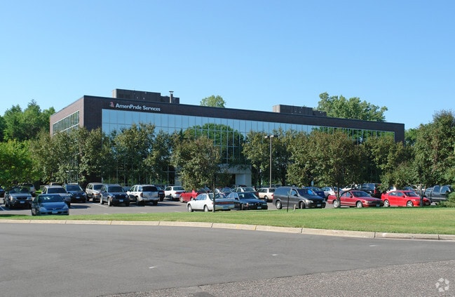
Property Record
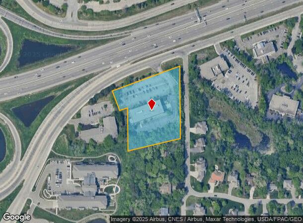
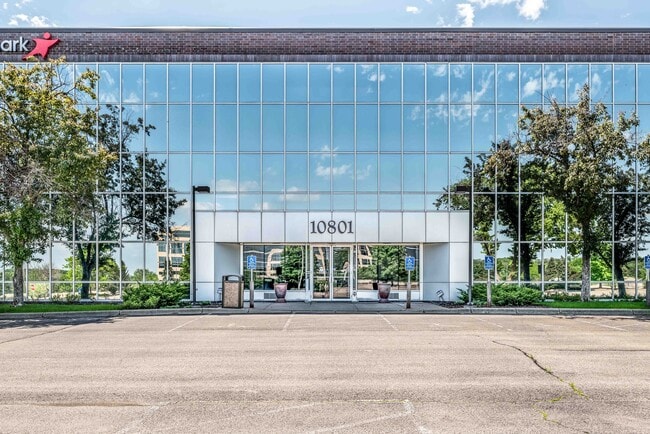
10801 Wayzata Blvd, Hopkins, MN 55305
NEARBY LISTINGS FOR SALE OR LEASE
Property Detail
10801 Wayzata Blvd
Minneapolis-St. Paul-Bloomington, MN-WI
Chatham Fields
01-117-22-32-0053
LOT 013 BLOCK 001 B CHATHAM FIELDS LOT 13 AND N 100 FT FRONT AND REAR OF LOT 14 ALSO LOTS 1 2 9 10 11 AND 12 EXCEPT HWY IRREGULAR
Commercialnec
Hennepin
X
Minnesota
27053C0331F
13
2024
2.78 AC
2024
I-394 Corridor
026405
Minneapolis/St Paul
13,622 SF
DEMOGRAPHICS near 10801 Wayzata Blvd
1 Mile
3 Mile
5 Mile
2024 Total Population
8,172
71,493
206,204
2029 Population
8,147
70,554
202,930
Pop Growth 2024-2029
(0.31%)
(1.31%)
(1.59%)
Average Age
42
42
42
2024 Total Households
4,020
31,822
92,940
HH Growth 2024-2029
(0.37%)
(1.44%)
(1.64%)
Median Household Inc
$95,426
$94,020
$93,213
Avg Household Size
2.00
2.10
2.10
2024 Avg HH Vehicles
2.00
2.00
2.00
Median Home Value
$366,393
$364,889
$371,300
Median Year Built
1982
1973
1973
Nearby Places
Map Layers
Map Styles
 Street
 Aerial
- Restaurants
- Banks
- Shops
- Fitness
- Groceries
PUBLIC TRANSPORTATION
COMMUTER RAIL
Target Field Station (Northstar Corridor - Northstar Commuter Rail)
DRIVE
WALK
Distance
Target Field Station (Northstar Corridor - Northstar Commuter Rail)
13 min
8.4 mi
AIRPORT
Minneapolis-St Paul International/Wold-Chamberlain
DRIVE
WALK
Distance
Minneapolis-St Paul International/Wold-Chamberlain
30 min
19.6 mi
SALE & LEASE HISTORY
LISTING DATE
SALE/LEASE

May 16, 2024
For Sale
Nearby Properties
Address
Land Use
TOTAL SIZE
Lot Size
Zoning
Address
Land Use
TOTAL SIZE
Lot Size
Zoning
324,564 SF
32.54 AC
PID
Address
Land Use
TOTAL SIZE
Lot Size
Zoning
18.27 AC
Address
Land Use
TOTAL SIZE
Lot Size
Zoning
20,710 SF
7.69 AC
PID
Address
Land Use
TOTAL SIZE
Lot Size
Zoning
20,710 SF
7.69 AC
PID
Address
Land Use
TOTAL SIZE
Lot Size
Zoning
6.47 AC
Address
Land Use
TOTAL SIZE
Lot Size
Zoning
19.75 AC
Address
Land Use
TOTAL SIZE
Lot Size
Zoning
224,581 SF
13.72 AC
PUD
Address
Land Use
TOTAL SIZE
Lot Size
Zoning
19.46 AC
PUD
Address
Land Use
TOTAL SIZE
Lot Size
Zoning
202,718 SF
14.37 AC
PID
Address
Land Use
TOTAL SIZE
Lot Size
Zoning
Address
Land Use
TOTAL SIZE
Lot Size
Zoning
196,498 SF
13.13 AC
PID
Address
Land Use
TOTAL SIZE
Lot Size
Zoning
11.93 AC
PID
Address
Land Use
TOTAL SIZE
Lot Size
Zoning
2.58 AC
Address
Land Use
TOTAL SIZE
Lot Size
Zoning
2.38 AC
Address
Land Use
TOTAL SIZE
Lot Size
Zoning
Address
Land Use
TOTAL SIZE
Lot Size
Zoning
40.17 AC
Address
Land Use
TOTAL SIZE
Lot Size
Zoning
Address
Land Use
TOTAL SIZE
Lot Size
Zoning
13.80 AC
Address
Land Use
TOTAL SIZE
Lot Size
Zoning
4.34 AC
Address
Land Use
TOTAL SIZE
Lot Size
Zoning
94,155 SF
2.06 AC
PUD
Address
Land Use
TOTAL SIZE
Lot Size
Zoning
10.57 AC
PID
Address
Land Use
TOTAL SIZE
Lot Size
Zoning
12.06 AC
PID
Address
Land Use
TOTAL SIZE
Lot Size
Zoning
2.69 AC
Address
Land Use
TOTAL SIZE
Lot Size
Zoning
255,931 SF
3.79 AC
Address
Land Use
TOTAL SIZE
Lot Size
Zoning
14.36 AC
PID
Address
Land Use
TOTAL SIZE
Lot Size
Zoning
237,757 SF
7.12 AC
Address
Land Use
TOTAL SIZE
Lot Size
Zoning
198,528 SF
6.05 AC
Address
Land Use
TOTAL SIZE
Lot Size
Zoning
43,180 SF
10.28 AC
PID
Address
Land Use
TOTAL SIZE
Lot Size
Zoning
43,180 SF
10.94 AC
PID
Address
Land Use
TOTAL SIZE
Lot Size
Zoning
127,028 SF
9.04 AC
R4
The World's #1 Commercial Real Estate Marketplace
Connect with us
© 2025 CoStar Group
The information above has been obtained from sources believed reliable. While we do not doubt its accuracy we have not verified it and make no guarantee, warranty or representation about it. It is your responsibility to independently confirm its accuracy and completeness. Any projections, opinions, assumptions, or estimates used are for example only and do not represent the current or future performance of the property. The value of this transaction to you depends on tax and other factors which should be evaluated by your tax, financial, and legal advisors. You and your advisors should conduct a careful, independent investigation of the property to determine to your satisfaction the suitability of the property for your needs.