Property Record
10808 Fort St, Omaha, NE 68164


NEARBY LISTINGS FOR SALE OR LEASE
Property Detail
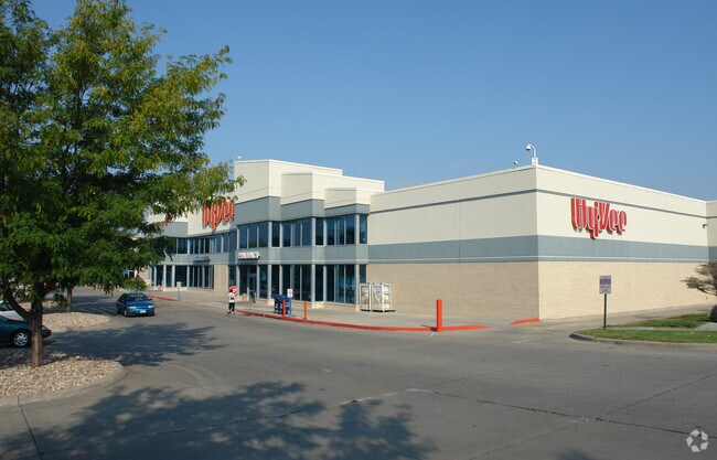
10808 Fort St
Omaha-Council Bluffs, NE-IA
Rambleridge
4839-4413-20
RAMBLERIDGE LOT 639 BLOCK 0 -EX S 9.68 FT & E 2.5 FT- IRREG LT 3 IN TIMBER RIDGE & -EX E 2.5 FT & S 9.68 W 31.59 FT- IRREG S 455 E 300 FT LOT 636 & -EX E 2.5 FT & IRREG SESTLY 15 FT TRIA & PT TAKEN FOR ADDL WIDENING- LOT 639
Supermarket
Douglas
X
Nebraska
31055C0212H
639,3
2024
8.06 AC
2025
Northwest Omaha
007310
Omaha/Council Bluffs
70,434 SF
DEMOGRAPHICS near 10808 Fort St
1 Mile
3 Mile
5 Mile
2024 Total Population
13,389
77,438
194,473
2029 Population
13,500
78,343
197,278
Pop Growth 2024-2029
+ 0.83%
+ 1.17%
+ 1.44%
Average Age
36
38
39
2024 Total Households
5,272
32,480
79,038
HH Growth 2024-2029
+ 0.93%
+ 1.19%
+ 1.44%
Median Household Inc
$70,595
$72,766
$77,421
Avg Household Size
2.50
2.30
2.40
2024 Avg HH Vehicles
2.00
2.00
2.00
Median Home Value
$199,479
$205,712
$236,578
Median Year Built
1978
1985
1981
Nearby Places
Map Layers
Map Styles
 Street
 Aerial
- Restaurants
- Banks
- Shops
- Fitness
- Groceries
PUBLIC TRANSPORTATION
AIRPORT
Eppley Airfield
DRIVE
WALK
Distance
Eppley Airfield
24 min
12.1 mi
SALE & LEASE HISTORY
LISTING DATE
SALE/LEASE

Dec 16, 2016
For Sale
Nearby Properties
Address
Land Use
TOTAL SIZE
Lot Size
Zoning
Address
Land Use
TOTAL SIZE
Lot Size
Zoning
564,031 SF
119.20 AC
Address
Land Use
TOTAL SIZE
Lot Size
Zoning
856,187 SF
36.41 AC
Address
Land Use
TOTAL SIZE
Lot Size
Zoning
549,971 SF
42.84 AC
R6
Address
Land Use
TOTAL SIZE
Lot Size
Zoning
584,213 SF
36.38 AC
R7
Address
Land Use
TOTAL SIZE
Lot Size
Zoning
548,510 SF
36.78 AC
Address
Land Use
TOTAL SIZE
Lot Size
Zoning
301,341 SF
15.04 AC
R6
Address
Land Use
TOTAL SIZE
Lot Size
Zoning
428,342 SF
18.62 AC
Address
Land Use
TOTAL SIZE
Lot Size
Zoning
329,565 SF
7.72 AC
Address
Land Use
TOTAL SIZE
Lot Size
Zoning
460,264 SF
20.87 AC
Address
Land Use
TOTAL SIZE
Lot Size
Zoning
255,483 SF
14.25 AC
Address
Land Use
TOTAL SIZE
Lot Size
Zoning
420,264 SF
23.97 AC
R6
Address
Land Use
TOTAL SIZE
Lot Size
Zoning
243,750 SF
15.46 AC
Address
Land Use
TOTAL SIZE
Lot Size
Zoning
288,432 SF
12.98 AC
Address
Land Use
TOTAL SIZE
Lot Size
Zoning
251,394 SF
14.71 AC
Address
Land Use
TOTAL SIZE
Lot Size
Zoning
255,205 SF
9.41 AC
R6
Address
Land Use
TOTAL SIZE
Lot Size
Zoning
248,169 SF
10.39 AC
Address
Land Use
TOTAL SIZE
Lot Size
Zoning
253,742 SF
3.24 AC
LI
Address
Land Use
TOTAL SIZE
Lot Size
Zoning
230,952 SF
8.56 AC
Address
Land Use
TOTAL SIZE
Lot Size
Zoning
264,371 SF
20.18 AC
Address
Land Use
TOTAL SIZE
Lot Size
Zoning
216,823 SF
13.05 AC
Address
Land Use
TOTAL SIZE
Lot Size
Zoning
218,620 SF
12.10 AC
R6
Address
Land Use
TOTAL SIZE
Lot Size
Zoning
229,992 SF
7.17 AC
Address
Land Use
TOTAL SIZE
Lot Size
Zoning
135,576 SF
6.44 AC
R7
Address
Land Use
TOTAL SIZE
Lot Size
Zoning
159,506 SF
5.62 AC
GO
Address
Land Use
TOTAL SIZE
Lot Size
Zoning
143,575 SF
7.58 AC
Address
Land Use
TOTAL SIZE
Lot Size
Zoning
156,276 SF
7.70 AC
R6
Address
Land Use
TOTAL SIZE
Lot Size
Zoning
186,710 SF
12.63 AC
R6
Address
Land Use
TOTAL SIZE
Lot Size
Zoning
136,149 SF
17.78 AC
Address
Land Use
TOTAL SIZE
Lot Size
Zoning
208,262 SF
5 AC
LO
Address
Land Use
TOTAL SIZE
Lot Size
Zoning
175,582 SF
8.40 AC
The World's #1 Commercial Real Estate Marketplace
Connect with us
© 2025 CoStar Group
The information above has been obtained from sources believed reliable. While we do not doubt its accuracy we have not verified it and make no guarantee, warranty or representation about it. It is your responsibility to independently confirm its accuracy and completeness. Any projections, opinions, assumptions, or estimates used are for example only and do not represent the current or future performance of the property. The value of this transaction to you depends on tax and other factors which should be evaluated by your tax, financial, and legal advisors. You and your advisors should conduct a careful, independent investigation of the property to determine to your satisfaction the suitability of the property for your needs.