Property Record
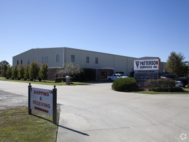
1081 Aillet Rd, Broussard, LA 70518


Property Detail
1081 Aillet Rd
1960001428
41.20 AC AILLET ROAD, HWY. 90, COUNTRY SQUIRE ESTATES, ROGUETCOB 695-709-165324 718-520-170807 1421-180-376033 1440-768-38779
Commercialacreage
Saint Martin
B and X Area of moderate flood hazard, usually the area between the limits of the 100-year and 500-year floods.
Louisiana
2025
41.20 AC
2025
St Martin Parish
020601
Lafayette
47,630 SF
Lafayette, LA
NEARBY LISTINGS FOR SALE OR LEASE
DEMOGRAPHICS near 1081 Aillet Rd
1 mile
3 mile
5 mile
2025 Total Population
1,426
15,376
39,222
2030 Population
1,462
15,831
40,605
Pop Growth 2025-2030
+ 2.52%
+ 2.96%
+ 3.53%
Average Age
40
36
37
2025 Total Households
528
5,377
14,217
HH Growth 2025-2030
+ 2.46%
+ 2.85%
+ 3.62%
Median Household Inc
$90,624
$67,924
$78,102
Avg Household Size
2.60
2.80
2.70
2025 Avg HH Vehicles
2.00
2.00
2.00
Median Home Value
$275,184
$254,635
$268,525
Median Year Built
2003
2008
2008
Nearby Places
Map Layers
Map Styles
 Street
 Aerial
Transit
 Traffic
 Biking
Places
Listings with unknown addresses are not visible on the map
- Restaurants
- Banks
- Shops
- Fitness
- Groceries
PUBLIC TRANSPORTATION
AIRPORT
Lafayette Regional/Paul Fournet Field
Drive
Walk
Distance
Lafayette Regional/Paul Fournet Field
16 min
12.2 mi
Freight Ports
Port of Iberia
Drive
Walk
Distance
Port of Iberia
16 min
11.9 mi
Nearby Properties
Address
Land Use
TOTAL SIZE
Lot Size
Zoning
Address
Land Use
TOTAL SIZE
Lot Size
Zoning
274.26 AC
Address
Land Use
TOTAL SIZE
Lot Size
Zoning
426,080 SF
35.76 AC
Address
Land Use
TOTAL SIZE
Lot Size
Zoning
77,290 SF
79.35 AC
Address
Land Use
TOTAL SIZE
Lot Size
Zoning
126,400 SF
25.50 AC
Address
Land Use
TOTAL SIZE
Lot Size
Zoning
70,500 SF
9 AC
Address
Land Use
TOTAL SIZE
Lot Size
Zoning
67,278 SF
13 AC
Address
Land Use
TOTAL SIZE
Lot Size
Zoning
Address
Land Use
TOTAL SIZE
Lot Size
Zoning
Address
Land Use
TOTAL SIZE
Lot Size
Zoning
37,840 SF
7 AC
Address
Land Use
TOTAL SIZE
Lot Size
Zoning
Address
Land Use
TOTAL SIZE
Lot Size
Zoning
15,240 SF
17.04 AC
Address
Land Use
TOTAL SIZE
Lot Size
Zoning
100,500 SF
16.69 AC
Address
Land Use
TOTAL SIZE
Lot Size
Zoning
35,225 SF
19.06 AC
Address
Land Use
TOTAL SIZE
Lot Size
Zoning
50,700 SF
5 AC
Address
Land Use
TOTAL SIZE
Lot Size
Zoning
20,000 SF
10.27 AC
Address
Land Use
TOTAL SIZE
Lot Size
Zoning
24,500 SF
27 AC
Address
Land Use
TOTAL SIZE
Lot Size
Zoning
Address
Land Use
TOTAL SIZE
Lot Size
Zoning
31,475 SF
7.58 AC
Address
Land Use
TOTAL SIZE
Lot Size
Zoning
Address
Land Use
TOTAL SIZE
Lot Size
Zoning
20,000 SF
41.48 AC
Address
Land Use
TOTAL SIZE
Lot Size
Zoning
33.60 AC
Address
Land Use
TOTAL SIZE
Lot Size
Zoning
14.66 AC
Address
Land Use
TOTAL SIZE
Lot Size
Zoning
16,031 SF
3.65 AC
Address
Land Use
TOTAL SIZE
Lot Size
Zoning
64,000 SF
10.94 AC
Address
Land Use
TOTAL SIZE
Lot Size
Zoning
20,800 SF
7.10 AC
Address
Land Use
TOTAL SIZE
Lot Size
Zoning
75,393 SF
20.03 AC
Address
Land Use
TOTAL SIZE
Lot Size
Zoning
90,030 SF
16.63 AC
Address
Land Use
TOTAL SIZE
Lot Size
Zoning
14,539 SF
8.91 AC
Address
Land Use
TOTAL SIZE
Lot Size
Zoning
Address
Land Use
TOTAL SIZE
Lot Size
Zoning
14,567 SF
0.92 AC
The World's #1 Commercial Real Estate Marketplace
Connect with us
© 2026 CoStar Group
The information above has been obtained from sources believed reliable. While we do not doubt its accuracy we have not verified it and make no guarantee, warranty or representation about it. It is your responsibility to independently confirm its accuracy and completeness. Any projections, opinions, assumptions, or estimates used are for example only and do not represent the current or future performance of the property. The value of this transaction to you depends on tax and other factors which should be evaluated by your tax, financial, and legal advisors. You and your advisors should conduct a careful, independent investigation of the property to determine to your satisfaction the suitability of the property for your needs.