Property Record
10810 Columbia Pike, Silver Spring, MD 20901


Property Detail
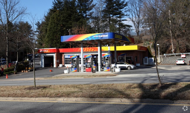
10810 Columbia Pike
05-00308932
BURNT MILLS MANOR SE C 2
Servicestation
Montgomery
CRT22
Maryland
B and X Area of moderate flood hazard, usually the area between the limits of the 100-year and 500-year floods.
17
2025
0.42 AC
2025
North Silver Spring/Rt 29
701506
Washington, DC
1,953 SF
Washington-Arlington-Alexandria, DC-VA-MD-WV
NEARBY LISTINGS FOR SALE OR LEASE
DEMOGRAPHICS near 10810 Columbia Pike
1 mile
3 mile
5 mile
2025 Total Population
16,402
174,359
467,417
2030 Population
16,864
178,563
479,171
Pop Growth 2025-2030
+ 2.82%
+ 2.41%
+ 2.51%
Average Age
40
39
39
2025 Total Households
5,517
60,880
162,603
HH Growth 2025-2030
+ 2.83%
+ 2.51%
+ 2.76%
Median Household Inc
$121,857
$102,110
$104,297
Avg Household Size
2.90
2.70
2.70
2025 Avg HH Vehicles
2.00
2.00
2.00
Median Home Value
$641,167
$619,366
$586,863
Median Year Built
1961
1964
1965
Nearby Places
Map Layers
Map Styles
 Street
 Aerial
Layers
 Traffic
 Biking
Places
Listings with unknown addresses are not visible on the map
- Restaurants
- Banks
- Shops
- Fitness
- Groceries
PUBLIC TRANSPORTATION
COMMUTER RAIL
Drive
Walk
Distance
10 min
3.8 mi
Drive
Walk
Distance
13 min
6.9 mi
AIRPORT
Ronald Reagan Washington Ntl
Drive
Walk
Distance
Ronald Reagan Washington Ntl
34 min
16.2 mi
Baltimore/Washington International Thurgood Marshall
Drive
Walk
Distance
Baltimore/Washington International Thurgood Marshall
38 min
27.5 mi
Washington Dulles International
Drive
Walk
Distance
Washington Dulles International
47 min
31.1 mi
Freight Ports
Port of Baltimore
Drive
Walk
Distance
Port of Baltimore
41 min
30.1 mi
Nearby Properties
Address
Land Use
TOTAL SIZE
Lot Size
Zoning
Address
Land Use
TOTAL SIZE
Lot Size
Zoning
456,429 SF
35.07 AC
I3
Address
Land Use
TOTAL SIZE
Lot Size
Zoning
610.61 AC
RE2
Address
Land Use
TOTAL SIZE
Lot Size
Zoning
775,490 SF
14.21 AC
R60
Address
Land Use
TOTAL SIZE
Lot Size
Zoning
1,775,186 SF
75.19 AC
GR1.5
Address
Land Use
TOTAL SIZE
Lot Size
Zoning
919,016 SF
3.25 AC
CR5.0
Address
Land Use
TOTAL SIZE
Lot Size
Zoning
917,092 SF
17.19 AC
R10
Address
Land Use
TOTAL SIZE
Lot Size
Zoning
487,112 SF
3.19 AC
CR3.0
Address
Land Use
TOTAL SIZE
Lot Size
Zoning
364,000 SF
CR6.0
Address
Land Use
TOTAL SIZE
Lot Size
Zoning
1,146,407 SF
60.25 AC
AG
Address
Land Use
TOTAL SIZE
Lot Size
Zoning
66,150 SF
6.79 AC
CRF
Address
Land Use
TOTAL SIZE
Lot Size
Zoning
305,000 SF
1.62 AC
CR5.0
Address
Land Use
TOTAL SIZE
Lot Size
Zoning
386,567 SF
29.70 AC
R60
Address
Land Use
TOTAL SIZE
Lot Size
Zoning
480,733 SF
2.10 AC
CR8.0
Address
Land Use
TOTAL SIZE
Lot Size
Zoning
460,492 SF
3.56 AC
CR4.0
Address
Land Use
TOTAL SIZE
Lot Size
Zoning
458,546 SF
8.56 AC
R10
Address
Land Use
TOTAL SIZE
Lot Size
Zoning
385,000 SF
16.42 AC
RH
Address
Land Use
TOTAL SIZE
Lot Size
Zoning
164,307 SF
16.45 AC
R90
Address
Land Use
TOTAL SIZE
Lot Size
Zoning
335,922 SF
1.22 AC
CR8.0
Address
Land Use
TOTAL SIZE
Lot Size
Zoning
540,807 SF
8.73 AC
RH
Address
Land Use
TOTAL SIZE
Lot Size
Zoning
330,040 SF
0.98 AC
CR
Address
Land Use
TOTAL SIZE
Lot Size
Zoning
187,691 SF
3.03 AC
R90
Address
Land Use
TOTAL SIZE
Lot Size
Zoning
371,939 SF
21.54 AC
EOF1.
Address
Land Use
TOTAL SIZE
Lot Size
Zoning
427,500 SF
25.70 AC
R30
Address
Land Use
TOTAL SIZE
Lot Size
Zoning
352,334 SF
1.66 AC
CR4.0
Address
Land Use
TOTAL SIZE
Lot Size
Zoning
15.11 AC
RMF20
Address
Land Use
TOTAL SIZE
Lot Size
Zoning
296,100 SF
12.08 AC
R20
Address
Land Use
TOTAL SIZE
Lot Size
Zoning
545,420 SF
3.49 AC
CR5.0
Address
Land Use
TOTAL SIZE
Lot Size
Zoning
158,545 SF
14.72 AC
R60
Address
Land Use
TOTAL SIZE
Lot Size
Zoning
170,619 SF
11.49 AC
R20
Address
Land Use
TOTAL SIZE
Lot Size
Zoning
124,896 SF
0.37 AC
CR6.0
The World's #1 Commercial Real Estate Marketplace
Connect with us
© 2026 CoStar Group
The information above has been obtained from sources believed reliable. While we do not doubt its accuracy we have not verified it and make no guarantee, warranty or representation about it. It is your responsibility to independently confirm its accuracy and completeness. Any projections, opinions, assumptions, or estimates used are for example only and do not represent the current or future performance of the property. The value of this transaction to you depends on tax and other factors which should be evaluated by your tax, financial, and legal advisors. You and your advisors should conduct a careful, independent investigation of the property to determine to your satisfaction the suitability of the property for your needs.