Property Record
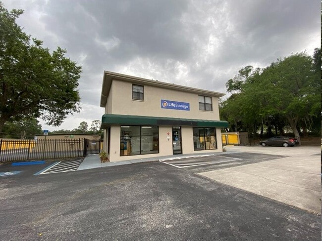
10813 Boyette Rd, Riverview, FL 33569


Property Detail
10813 Boyette Rd
U-20-30-20-ZZZ-000003-02020.0
E 388 FT OF N 1/2 OF NW 1/4 OF SE 1/4 LESS R/W FOR GIBSONTON DR EXTN
Publicstorage
HILLSBOROUGH
PD
Florida
B and X Area of moderate flood hazard, usually the area between the limits of the 100-year and 500-year floods.
2020
2024
4.97 AC
2025
Eastern Outlying
013925
Tampa/St Petersburg
51,065 SF
Tampa-St. Petersburg-Clearwater, FL
NEARBY LISTINGS FOR SALE OR LEASE
DEMOGRAPHICS near 10813 Boyette Rd
1 mile
3 mile
5 mile
2025 Total Population
9,667
84,019
224,358
2030 Population
10,609
91,036
242,346
Pop Growth 2025-2030
+ 9.74%
+ 8.35%
+ 8.02%
Average Age
42
39
38
2025 Total Households
3,805
30,655
81,718
HH Growth 2025-2030
+ 9.96%
+ 8.52%
+ 8.16%
Median Household Inc
$75,647
$89,330
$90,122
Avg Household Size
2.50
2.70
2.70
2025 Avg HH Vehicles
2.00
2.00
2.00
Median Home Value
$337,995
$376,111
$377,425
Median Year Built
2004
2004
2003
Nearby Places
Map Layers
Map Styles
 Street
 Aerial
Transit
 Traffic
 Biking
Places
Listings with unknown addresses are not visible on the map
- Restaurants
- Banks
- Shops
- Fitness
- Groceries
PUBLIC TRANSPORTATION
AIRPORT
Tampa International
Drive
Walk
Distance
Tampa International
35 min
21.4 mi
St Pete-Clearwater International
Drive
Walk
Distance
St Pete-Clearwater International
52 min
31.4 mi
Sarasota/Bradenton International
Drive
Walk
Distance
Sarasota/Bradenton International
57 min
40.6 mi
Nearby Properties
Address
Land Use
TOTAL SIZE
Lot Size
Zoning
Address
Land Use
TOTAL SIZE
Lot Size
Zoning
378,117 SF
22.88 AC
PD
Address
Land Use
TOTAL SIZE
Lot Size
Zoning
382,521 SF
24.27 AC
PD
Address
Land Use
TOTAL SIZE
Lot Size
Zoning
399,150 SF
26.32 AC
PD
Address
Land Use
TOTAL SIZE
Lot Size
Zoning
423,284 SF
20.91 AC
PD
Address
Land Use
TOTAL SIZE
Lot Size
Zoning
339,482 SF
19.15 AC
PD
Address
Land Use
TOTAL SIZE
Lot Size
Zoning
248,749 SF
14.83 AC
PD
Address
Land Use
TOTAL SIZE
Lot Size
Zoning
370,924 SF
73.35 AC
PD
Address
Land Use
TOTAL SIZE
Lot Size
Zoning
257,382 SF
52.57 AC
PD
Address
Land Use
TOTAL SIZE
Lot Size
Zoning
284,185 SF
15.31 AC
PD
Address
Land Use
TOTAL SIZE
Lot Size
Zoning
289,109 SF
75.56 AC
AR
Address
Land Use
TOTAL SIZE
Lot Size
Zoning
178,972 SF
16.28 AC
PD
Address
Land Use
TOTAL SIZE
Lot Size
Zoning
92,133 SF
13.05 AC
IPD-1
Address
Land Use
TOTAL SIZE
Lot Size
Zoning
124,865 SF
20.14 AC
PD
Address
Land Use
TOTAL SIZE
Lot Size
Zoning
125,136 SF
13.58 AC
PD
Address
Land Use
TOTAL SIZE
Lot Size
Zoning
222,320 SF
18.94 AC
PD
Address
Land Use
TOTAL SIZE
Lot Size
Zoning
163,701 SF
87.66 AC
PD
Address
Land Use
TOTAL SIZE
Lot Size
Zoning
97,039 SF
35.42 AC
PD
Address
Land Use
TOTAL SIZE
Lot Size
Zoning
209,218 SF
14.63 AC
PD
Address
Land Use
TOTAL SIZE
Lot Size
Zoning
215,929 SF
26.74 AC
PD
Address
Land Use
TOTAL SIZE
Lot Size
Zoning
104,130 SF
19.71 AC
PD
Address
Land Use
TOTAL SIZE
Lot Size
Zoning
71,836 SF
42.82 AC
ASC-1
Address
Land Use
TOTAL SIZE
Lot Size
Zoning
175,903 SF
14.97 AC
PD
Address
Land Use
TOTAL SIZE
Lot Size
Zoning
101,809 SF
15.02 AC
PD
Address
Land Use
TOTAL SIZE
Lot Size
Zoning
133,325 SF
20.75 AC
PD
Address
Land Use
TOTAL SIZE
Lot Size
Zoning
75,304 SF
4.27 AC
PD
Address
Land Use
TOTAL SIZE
Lot Size
Zoning
50,203 SF
2.39 AC
PD
Address
Land Use
TOTAL SIZE
Lot Size
Zoning
51,872 SF
4.50 AC
PD
Address
Land Use
TOTAL SIZE
Lot Size
Zoning
89,725 SF
23.64 AC
PD
Address
Land Use
TOTAL SIZE
Lot Size
Zoning
87,925 SF
4.38 AC
PD
Address
Land Use
TOTAL SIZE
Lot Size
Zoning
126,368 SF
9.37 AC
PD
The World's #1 Commercial Real Estate Marketplace
Connect with us
© 2026 CoStar Group
The information above has been obtained from sources believed reliable. While we do not doubt its accuracy we have not verified it and make no guarantee, warranty or representation about it. It is your responsibility to independently confirm its accuracy and completeness. Any projections, opinions, assumptions, or estimates used are for example only and do not represent the current or future performance of the property. The value of this transaction to you depends on tax and other factors which should be evaluated by your tax, financial, and legal advisors. You and your advisors should conduct a careful, independent investigation of the property to determine to your satisfaction the suitability of the property for your needs.