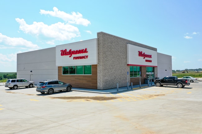
Property Record
10819 S 192Nd Ave, Gretna, NE 68028
NEARBY LISTINGS FOR SALE OR LEASE
Property Detail
10819 S 192Nd Ave
Omaha/Council Bluffs
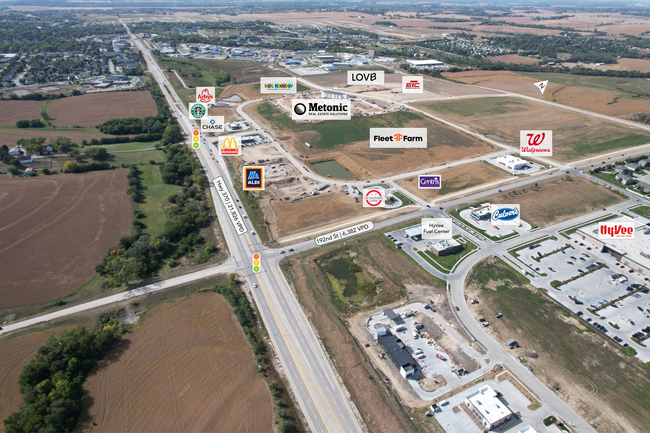
Gretna Landing
Omaha-Council Bluffs, NE-IA
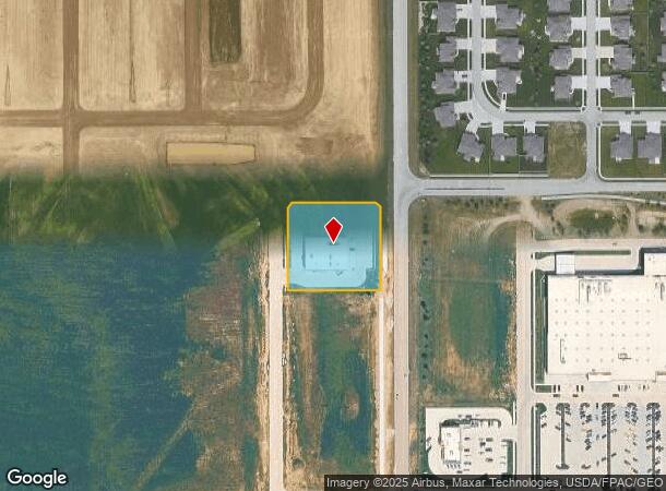
LOT 1 GRETNA LANDING (1.359 AC)
011615580
Sarpy
Commercialnec
Nebraska
2024
1
2025
1.36 AC
010630
Southwest Omaha
DEMOGRAPHICS near 10819 S 192Nd Ave
1 Mile
3 Mile
5 Mile
2024 Total Population
3,596
36,535
85,352
2029 Population
4,041
40,076
90,108
Pop Growth 2024-2029
+ 12.37%
+ 9.69%
+ 5.57%
Average Age
35
35
36
2024 Total Households
1,226
12,074
29,147
HH Growth 2024-2029
+ 12.48%
+ 9.80%
+ 5.68%
Median Household Inc
$156,003
$130,516
$119,562
Avg Household Size
2.90
3.00
2.90
2024 Avg HH Vehicles
2.00
2.00
2.00
Median Home Value
$404,601
$327,227
$293,617
Median Year Built
2011
2009
2003
Nearby Places
- Restaurants
- Banks
- Shops
- Fitness
- Groceries
PUBLIC TRANSPORTATION
AIRPORT
Eppley Airfield
DRIVE
WALK
Distance
Eppley Airfield
34 min
23.9 mi
Freight Ports
Tulsa Port Of Catoosa
DRIVE
WALK
Distance
Tulsa Port Of Catoosa
473 min
424.7 mi
SALE & LEASE HISTORY
LISTING DATE
SALE/LEASE

Mar 25, 2024
For Sale
Feb 14, 2025
For Sale
Aug 06, 2024
For Sale
Nearby Properties
Address
Land Use
TOTAL SIZE
Lot Size
Zoning
Address
Land Use
TOTAL SIZE
Lot Size
Zoning
72.91 AC
Address
Land Use
TOTAL SIZE
Lot Size
Zoning
2,295 SF
11.77 AC
Address
Land Use
TOTAL SIZE
Lot Size
Zoning
27,027 SF
11.15 AC
Address
Land Use
TOTAL SIZE
Lot Size
Zoning
12.60 AC
Address
Land Use
TOTAL SIZE
Lot Size
Zoning
12,720 SF
3.44 AC
IL
Address
Land Use
TOTAL SIZE
Lot Size
Zoning
13,312 SF
9.27 AC
Address
Land Use
TOTAL SIZE
Lot Size
Zoning
193,490 SF
9.35 AC
Address
Land Use
TOTAL SIZE
Lot Size
Zoning
147,076 SF
7.81 AC
Address
Land Use
TOTAL SIZE
Lot Size
Zoning
155,635 SF
22.14 AC
BG
Address
Land Use
TOTAL SIZE
Lot Size
Zoning
28,444 SF
0.85 AC
Address
Land Use
TOTAL SIZE
Lot Size
Zoning
38,154 SF
10.65 AC
Address
Land Use
TOTAL SIZE
Lot Size
Zoning
1,288 SF
157.59 AC
AG
Address
Land Use
TOTAL SIZE
Lot Size
Zoning
36,145 SF
2 AC
Address
Land Use
TOTAL SIZE
Lot Size
Zoning
13.44 AC
Address
Land Use
TOTAL SIZE
Lot Size
Zoning
6,404 SF
4.61 AC
Address
Land Use
TOTAL SIZE
Lot Size
Zoning
42,147 SF
2.59 AC
BG
Address
Land Use
TOTAL SIZE
Lot Size
Zoning
39,264 SF
1.67 AC
RG35
Address
Land Use
TOTAL SIZE
Lot Size
Zoning
9,083 SF
2.56 AC
Address
Land Use
TOTAL SIZE
Lot Size
Zoning
7,384 SF
153.55 AC
AG
Address
Land Use
TOTAL SIZE
Lot Size
Zoning
8,800 SF
0.34 AC
AG
Address
Land Use
TOTAL SIZE
Lot Size
Zoning
67,737 SF
4.01 AC
Address
Land Use
TOTAL SIZE
Lot Size
Zoning
11,666 SF
4.15 AC
Address
Land Use
TOTAL SIZE
Lot Size
Zoning
63,241 SF
3.13 AC
Address
Land Use
TOTAL SIZE
Lot Size
Zoning
1,344 SF
10.41 AC
Address
Land Use
TOTAL SIZE
Lot Size
Zoning
9,560 SF
2.99 AC
Address
Land Use
TOTAL SIZE
Lot Size
Zoning
17,800 SF
0.78 AC
Address
Land Use
TOTAL SIZE
Lot Size
Zoning
12,539 SF
5.98 AC
BG
Address
Land Use
TOTAL SIZE
Lot Size
Zoning
62,960 SF
3.62 AC
Address
Land Use
TOTAL SIZE
Lot Size
Zoning
44,001 SF
3.93 AC
Address
Land Use
TOTAL SIZE
Lot Size
Zoning
32,763 SF
3 AC
The World's #1 Commercial Real Estate Marketplace
Connect with us
© 2025 CoStar Group
The information above has been obtained from sources believed reliable. While we do not doubt its accuracy we have not verified it and make no guarantee, warranty or representation about it. It is your responsibility to independently confirm its accuracy and completeness. Any projections, opinions, assumptions, or estimates used are for example only and do not represent the current or future performance of the property. The value of this transaction to you depends on tax and other factors which should be evaluated by your tax, financial, and legal advisors. You and your advisors should conduct a careful, independent investigation of the property to determine to your satisfaction the suitability of the property for your needs.