Property Record
10820 S Us Highway 41 Hwy, Gibsonton, FL 33534


NEARBY LISTINGS FOR SALE OR LEASE
Property Detail
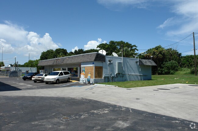
10820 S Us Highway 41 Hwy
Tampa-St. Petersburg-Clearwater, FL
Florida Garden Lands Revised Map Of
U-26-30-19-1RR-000000-00053.N
FLORIDA GARDEN LANDS REVISED MAP OF N 210 FT OF LOT 53 W OF ACL R/W AND S 22 FT OF LOT 52 LYING E OF E R/W LINE OF S US HWY 41 AND W OF W R/W LINE OF ATLANTIC COASTLINE RR
Servicestationmarket
Hillsborough
AE
Florida
12057C0482J
53
2024
1.25 AC
2024
Southeast Hillsborough
013804
Tampa/St Petersburg
3,220 SF
DEMOGRAPHICS near 10820 S Us Highway 41 Hwy
1 Mile
3 Mile
5 Mile
2024 Total Population
4,703
31,771
119,473
2029 Population
5,173
35,104
131,722
Pop Growth 2024-2029
+ 9.99%
+ 10.49%
+ 10.25%
Average Age
36
35
37
2024 Total Households
1,557
10,963
43,238
HH Growth 2024-2029
+ 10.21%
+ 10.71%
+ 10.48%
Median Household Inc
$60,420
$76,179
$76,615
Avg Household Size
2.90
2.80
2.70
2024 Avg HH Vehicles
2.00
2.00
2.00
Median Home Value
$252,202
$260,047
$267,074
Median Year Built
1992
2006
2006
Nearby Places
Map Layers
Map Styles
 Street
 Aerial
- Restaurants
- Banks
- Shops
- Fitness
- Groceries
PUBLIC TRANSPORTATION
AIRPORT
Tampa International
DRIVE
WALK
Distance
Tampa International
32 min
19.2 mi
St Pete-Clearwater International
DRIVE
WALK
Distance
St Pete-Clearwater International
49 min
29.2 mi
Sarasota/Bradenton International
DRIVE
WALK
Distance
Sarasota/Bradenton International
57 min
39.6 mi
Nearby Properties
Address
Land Use
TOTAL SIZE
Lot Size
Zoning
Address
Land Use
TOTAL SIZE
Lot Size
Zoning
399,150 SF
26.32 AC
PD
Address
Land Use
TOTAL SIZE
Lot Size
Zoning
476,371 SF
41.23 AC
PD
Address
Land Use
TOTAL SIZE
Lot Size
Zoning
370,924 SF
73.35 AC
PD
Address
Land Use
TOTAL SIZE
Lot Size
Zoning
628,730 SF
952.72 AC
M
Address
Land Use
TOTAL SIZE
Lot Size
Zoning
347,147 SF
258.94 AC
PD
Address
Land Use
TOTAL SIZE
Lot Size
Zoning
124,865 SF
20.14 AC
PD
Address
Land Use
TOTAL SIZE
Lot Size
Zoning
146,440 SF
18.56 AC
PD
Address
Land Use
TOTAL SIZE
Lot Size
Zoning
48,968 SF
10 AC
PD
Address
Land Use
TOTAL SIZE
Lot Size
Zoning
520,366 SF
122.24 AC
PD
Address
Land Use
TOTAL SIZE
Lot Size
Zoning
222,320 SF
18.94 AC
PD
Address
Land Use
TOTAL SIZE
Lot Size
Zoning
215,929 SF
26.74 AC
PD
Address
Land Use
TOTAL SIZE
Lot Size
Zoning
126,368 SF
9.37 AC
PD
Address
Land Use
TOTAL SIZE
Lot Size
Zoning
83,325 SF
13.11 AC
PD
Address
Land Use
TOTAL SIZE
Lot Size
Zoning
130,308 SF
7.85 AC
PD
Address
Land Use
TOTAL SIZE
Lot Size
Zoning
47,290 SF
9.99 AC
PD
Address
Land Use
TOTAL SIZE
Lot Size
Zoning
924 SF
563.45 AC
AR
Address
Land Use
TOTAL SIZE
Lot Size
Zoning
101,880 SF
6.53 AC
PD
Address
Land Use
TOTAL SIZE
Lot Size
Zoning
72,298 SF
9.58 AC
PD
Address
Land Use
TOTAL SIZE
Lot Size
Zoning
85,303 SF
10.40 AC
PD
Address
Land Use
TOTAL SIZE
Lot Size
Zoning
87,068 SF
24.86 AC
PD
Address
Land Use
TOTAL SIZE
Lot Size
Zoning
72,729 SF
6.89 AC
PD
Address
Land Use
TOTAL SIZE
Lot Size
Zoning
54,892 SF
2.57 AC
PD
Address
Land Use
TOTAL SIZE
Lot Size
Zoning
327.61 AC
AR
Address
Land Use
TOTAL SIZE
Lot Size
Zoning
290.36 AC
AI
Address
Land Use
TOTAL SIZE
Lot Size
Zoning
21,780 SF
2.39 AC
PD
Address
Land Use
TOTAL SIZE
Lot Size
Zoning
83,301 SF
9.99 AC
PD
Address
Land Use
TOTAL SIZE
Lot Size
Zoning
79.33 AC
RMC-6
Address
Land Use
TOTAL SIZE
Lot Size
Zoning
94,078 SF
10.68 AC
AR
Address
Land Use
TOTAL SIZE
Lot Size
Zoning
2,267 SF
72.57 AC
AR
Address
Land Use
TOTAL SIZE
Lot Size
Zoning
70,162 SF
5.39 AC
CG
The World's #1 Commercial Real Estate Marketplace
Connect with us
© 2025 CoStar Group
The information above has been obtained from sources believed reliable. While we do not doubt its accuracy we have not verified it and make no guarantee, warranty or representation about it. It is your responsibility to independently confirm its accuracy and completeness. Any projections, opinions, assumptions, or estimates used are for example only and do not represent the current or future performance of the property. The value of this transaction to you depends on tax and other factors which should be evaluated by your tax, financial, and legal advisors. You and your advisors should conduct a careful, independent investigation of the property to determine to your satisfaction the suitability of the property for your needs.