Property Record
10825 Us Highway 441, Leesburg, FL 34788


NEARBY LISTINGS FOR SALE OR LEASE
Property Detail
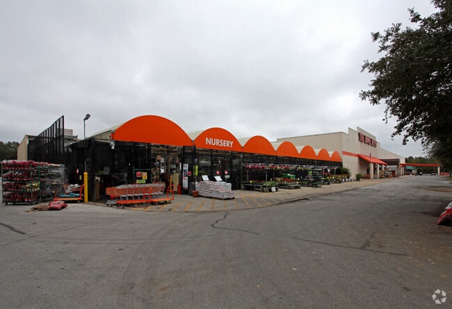
10825 Us Highway 441
23-19-25-0004-000-04600
BEG 276.86 FT W OF NE COR OF SE 1/4 RUN S 651.15 FT W 250 FT N 120 FT W 240.57 FT S TO R/W HWY 441 NWLY ALONG R/W TO PT 1174.14 FT W OF E LINE OF SEC N TO N LINE OF GOV LOT 1 E TO POB--LESS THAT PART OF LAND LYING WITHIN FOLLOWING DESCRIBED LAND: FRO
Warehouse
Lake
X
Florida
12069C0334E
46
0
11.83 AC
2026
Lake County
030308
Orlando
109,792 SF
Orlando-Kissimmee-Sanford, FL
DEMOGRAPHICS near 10825 Us Highway 441
1 Mile
3 Mile
5 Mile
2024 Total Population
4,197
23,345
54,278
2029 Population
4,894
27,424
63,852
Pop Growth 2024-2029
+ 16.61%
+ 17.47%
+ 17.64%
Average Age
49
47
47
2024 Total Households
1,915
10,183
23,919
HH Growth 2024-2029
+ 16.45%
+ 17.40%
+ 17.57%
Median Household Inc
$52,928
$53,672
$53,461
Avg Household Size
2.20
2.20
2.20
2024 Avg HH Vehicles
2.00
2.00
2.00
Median Home Value
$93,386
$182,006
$189,044
Median Year Built
1988
1988
1988
Nearby Places
Map Layers
Map Styles
 Street
 Aerial
- Restaurants
- Banks
- Shops
- Fitness
- Groceries
Nearby Properties
Address
Land Use
TOTAL SIZE
Lot Size
Zoning
Address
Land Use
TOTAL SIZE
Lot Size
Zoning
137,651 SF
17.35 AC
RMRP
Address
Land Use
TOTAL SIZE
Lot Size
Zoning
131,655 SF
9.98 AC
RP
Address
Land Use
TOTAL SIZE
Lot Size
Zoning
5,760 SF
110.52 AC
R1
Address
Land Use
TOTAL SIZE
Lot Size
Zoning
546,456 SF
56.22 AC
RP
Address
Land Use
TOTAL SIZE
Lot Size
Zoning
183,700 SF
11.66 AC
R2
Address
Land Use
TOTAL SIZE
Lot Size
Zoning
60,700 SF
784.12 AC
P
Address
Land Use
TOTAL SIZE
Lot Size
Zoning
137,622 SF
18.33 AC
C3
Address
Land Use
TOTAL SIZE
Lot Size
Zoning
45,310 SF
2.93 AC
PFD
Address
Land Use
TOTAL SIZE
Lot Size
Zoning
39,164 SF
7.25 AC
Address
Land Use
TOTAL SIZE
Lot Size
Zoning
121,815 SF
33.48 AC
PD
Address
Land Use
TOTAL SIZE
Lot Size
Zoning
2,000 SF
19.74 AC
PFD
Address
Land Use
TOTAL SIZE
Lot Size
Zoning
81,821 SF
12.30 AC
Address
Land Use
TOTAL SIZE
Lot Size
Zoning
40,776 SF
2.28 AC
C1
Address
Land Use
TOTAL SIZE
Lot Size
Zoning
48,478 SF
1.61 AC
CIP
Address
Land Use
TOTAL SIZE
Lot Size
Zoning
77,075 SF
4.66 AC
CP
Address
Land Use
TOTAL SIZE
Lot Size
Zoning
37,310 SF
4.39 AC
Address
Land Use
TOTAL SIZE
Lot Size
Zoning
37,983 SF
5.54 AC
C3
Address
Land Use
TOTAL SIZE
Lot Size
Zoning
86.22 AC
PD
Address
Land Use
TOTAL SIZE
Lot Size
Zoning
32,704 SF
6.12 AC
R1
Address
Land Use
TOTAL SIZE
Lot Size
Zoning
44,225 SF
15.63 AC
A
Address
Land Use
TOTAL SIZE
Lot Size
Zoning
20,559 SF
5.21 AC
Address
Land Use
TOTAL SIZE
Lot Size
Zoning
47,748 SF
5.81 AC
PD
Address
Land Use
TOTAL SIZE
Lot Size
Zoning
33,675 SF
2.74 AC
Address
Land Use
TOTAL SIZE
Lot Size
Zoning
17,069 SF
7.26 AC
Address
Land Use
TOTAL SIZE
Lot Size
Zoning
53,312 SF
3.86 AC
RP
Address
Land Use
TOTAL SIZE
Lot Size
Zoning
20,099 SF
1.80 AC
PD
Address
Land Use
TOTAL SIZE
Lot Size
Zoning
32,823 SF
1.93 AC
C3
Address
Land Use
TOTAL SIZE
Lot Size
Zoning
55.05 AC
R1
Address
Land Use
TOTAL SIZE
Lot Size
Zoning
17,948 SF
3.10 AC
C3
The World's #1 Commercial Real Estate Marketplace
Connect with us
© 2026 CoStar Group
The information above has been obtained from sources believed reliable. While we do not doubt its accuracy we have not verified it and make no guarantee, warranty or representation about it. It is your responsibility to independently confirm its accuracy and completeness. Any projections, opinions, assumptions, or estimates used are for example only and do not represent the current or future performance of the property. The value of this transaction to you depends on tax and other factors which should be evaluated by your tax, financial, and legal advisors. You and your advisors should conduct a careful, independent investigation of the property to determine to your satisfaction the suitability of the property for your needs.