Property Record
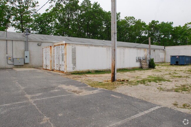
1083 Brook Rd, Lakewood, NJ 08701


NEARBY LISTINGS FOR SALE OR LEASE
Property Detail
1083 Brook Rd
New York-Jersey City-White Plains, NY-NJ
Lakewood
15-00174-01-00047
2.29 AC 0100045021 SCHOOL
Publicschool
Ocean
X
New Jersey
34025C0435F
47
0
2.29 AC
2025
Ocean County
715201
Northern New Jersey
9,840 SF
DEMOGRAPHICS near 1083 Brook Rd
1 Mile
3 Mile
5 Mile
2024 Total Population
6,319
88,334
202,207
2029 Population
6,404
90,461
208,646
Pop Growth 2024-2029
+ 1.35%
+ 2.41%
+ 3.18%
Average Age
24
27
31
2024 Total Households
1,158
20,731
55,403
HH Growth 2024-2029
(0.78%)
+ 1.35%
+ 2.48%
Median Household Inc
$59,740
$65,931
$73,558
Avg Household Size
4.60
3.80
3.30
2024 Avg HH Vehicles
2.00
2.00
2.00
Median Home Value
$517,572
$399,347
$364,101
Median Year Built
2000
1985
1982
Nearby Places
Map Layers
Map Styles
 Street
 Aerial
- Restaurants
- Banks
- Shops
- Fitness
- Groceries
Nearby Properties
Address
Land Use
TOTAL SIZE
Lot Size
Zoning
Address
Land Use
TOTAL SIZE
Lot Size
Zoning
113.02 AC
R12
Address
Land Use
TOTAL SIZE
Lot Size
Zoning
338.52 AC
OSP
Address
Land Use
TOTAL SIZE
Lot Size
Zoning
105.04 AC
SED
Address
Land Use
TOTAL SIZE
Lot Size
Zoning
2,382 SF
341 AC
OSP
Address
Land Use
TOTAL SIZE
Lot Size
Zoning
161,340 SF
35.35 AC
HD-1
Address
Land Use
TOTAL SIZE
Lot Size
Zoning
56.58 AC
DA-1
Address
Land Use
TOTAL SIZE
Lot Size
Zoning
21,876 SF
22.26 AC
B3
Address
Land Use
TOTAL SIZE
Lot Size
Zoning
272,500 SF
17.88 AC
M1
Address
Land Use
TOTAL SIZE
Lot Size
Zoning
36.25 AC
R12
Address
Land Use
TOTAL SIZE
Lot Size
Zoning
49.57 AC
RR1
Address
Land Use
TOTAL SIZE
Lot Size
Zoning
50,125 SF
19.18 AC
M1
Address
Land Use
TOTAL SIZE
Lot Size
Zoning
5,826 SF
15.35 AC
RM
Address
Land Use
TOTAL SIZE
Lot Size
Zoning
30 AC
RR1
Address
Land Use
TOTAL SIZE
Lot Size
Zoning
94,380 SF
8.71 AC
B4
Address
Land Use
TOTAL SIZE
Lot Size
Zoning
14.73 AC
R-5
Address
Land Use
TOTAL SIZE
Lot Size
Zoning
39,777 SF
3.50 AC
M1
Address
Land Use
TOTAL SIZE
Lot Size
Zoning
37,202 SF
14.79 AC
B3
Address
Land Use
TOTAL SIZE
Lot Size
Zoning
162,000 SF
34.35 AC
ARE2
Address
Land Use
TOTAL SIZE
Lot Size
Zoning
8,784 SF
16.16 AC
R-LM
Address
Land Use
TOTAL SIZE
Lot Size
Zoning
17.08 AC
R15
Address
Land Use
TOTAL SIZE
Lot Size
Zoning
38,920 SF
9.70 AC
M1
Address
Land Use
TOTAL SIZE
Lot Size
Zoning
1,270 SF
3.65 AC
R12
Address
Land Use
TOTAL SIZE
Lot Size
Zoning
360,400 SF
35.98 AC
SED
Address
Land Use
TOTAL SIZE
Lot Size
Zoning
152.17 AC
ABC
Address
Land Use
TOTAL SIZE
Lot Size
Zoning
2,736 SF
18.04 AC
R15
Address
Land Use
TOTAL SIZE
Lot Size
Zoning
127,932 SF
2.41 AC
R-OP
Address
Land Use
TOTAL SIZE
Lot Size
Zoning
3.64 AC
R10
Address
Land Use
TOTAL SIZE
Lot Size
Zoning
96,503 SF
2.26 AC
R-OP
Address
Land Use
TOTAL SIZE
Lot Size
Zoning
26,473 SF
0.72 AC
R-OP
Address
Land Use
TOTAL SIZE
Lot Size
Zoning
40.02 AC
DA-1
The World's #1 Commercial Real Estate Marketplace
Connect with us
© 2025 CoStar Group
The information above has been obtained from sources believed reliable. While we do not doubt its accuracy we have not verified it and make no guarantee, warranty or representation about it. It is your responsibility to independently confirm its accuracy and completeness. Any projections, opinions, assumptions, or estimates used are for example only and do not represent the current or future performance of the property. The value of this transaction to you depends on tax and other factors which should be evaluated by your tax, financial, and legal advisors. You and your advisors should conduct a careful, independent investigation of the property to determine to your satisfaction the suitability of the property for your needs.