Property Record
1083 New Dehaven St, Conshohocken, PA 19428

NEARBY LISTINGS FOR SALE OR LEASE
Property Detail
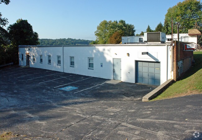
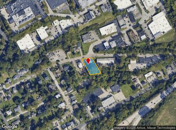
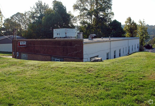
1083 New Dehaven St
24-00-02192-007
ASSESSOR BLOCK-UNIT NUMBER 6-61
Commercialnec
Montgomery
X
Pennsylvania
42029C0120G
61
2024
0.36 AC
2025
East Montgomery Cty
204200
Philadelphia
5,680 SF
Philadelphia-Camden-Wilmington, PA-NJ-DE-MD
DEMOGRAPHICS near 1083 New Dehaven St
1 Mile
3 Mile
5 Mile
2024 Total Population
5,078
62,428
221,505
2029 Population
5,144
63,459
225,482
Pop Growth 2024-2029
+ 1.30%
+ 1.65%
+ 1.80%
Average Age
40
38
39
2024 Total Households
2,322
24,086
86,309
HH Growth 2024-2029
+ 1.08%
+ 1.81%
+ 1.96%
Median Household Inc
$127,195
$119,062
$104,739
Avg Household Size
2.10
2.30
2.40
2024 Avg HH Vehicles
2.00
2.00
2.00
Median Home Value
$474,125
$502,290
$445,695
Median Year Built
1971
1963
1965
Nearby Places
Map Layers
Map Styles
 Street
 Aerial
- Restaurants
- Banks
- Shops
- Fitness
- Groceries
PUBLIC TRANSPORTATION
COMMUTER RAIL
Conshohocken (R6 - Southeastern Pennsylvania Transportation Authority Regional Rail (SEPTA Regional Rail))
DRIVE
WALK
Distance
Conshohocken (R6 - Southeastern Pennsylvania Transportation Authority Regional Rail (SEPTA Regional Rail))
4 min
1.4 mi
DRIVE
WALK
Distance
4 min
1.5 mi
AIRPORT
Philadelphia International
DRIVE
WALK
Distance
Philadelphia International
35 min
22.4 mi
Trenton Mercer
DRIVE
WALK
Distance
Trenton Mercer
53 min
39.1 mi
Freight Ports
South Jersey Port
DRIVE
WALK
Distance
South Jersey Port
30 min
18.3 mi
Nearby Properties
Address
Land Use
TOTAL SIZE
Lot Size
Zoning
Address
Land Use
TOTAL SIZE
Lot Size
Zoning
703,572 SF
159 AC
Address
Land Use
TOTAL SIZE
Lot Size
Zoning
10.50 AC
Address
Land Use
TOTAL SIZE
Lot Size
Zoning
222,980 SF
57.68 AC
Address
Land Use
TOTAL SIZE
Lot Size
Zoning
48,900 SF
20 AC
Address
Land Use
TOTAL SIZE
Lot Size
Zoning
398,844 SF
21.89 AC
Address
Land Use
TOTAL SIZE
Lot Size
Zoning
45,871 SF
112 AC
Address
Land Use
TOTAL SIZE
Lot Size
Zoning
1,037,806 SF
73.69 AC
R2
Address
Land Use
TOTAL SIZE
Lot Size
Zoning
350,807 SF
50 AC
R1
Address
Land Use
TOTAL SIZE
Lot Size
Zoning
520,066 SF
1.02 AC
HB
Address
Land Use
TOTAL SIZE
Lot Size
Zoning
702,393 SF
61.81 AC
RA
Address
Land Use
TOTAL SIZE
Lot Size
Zoning
723,623 SF
6.69 AC
HVY
Address
Land Use
TOTAL SIZE
Lot Size
Zoning
527,618 SF
7.89 AC
SP2
Address
Land Use
TOTAL SIZE
Lot Size
Zoning
254,781 SF
14.62 AC
Address
Land Use
TOTAL SIZE
Lot Size
Zoning
137,282 SF
14.33 AC
Address
Land Use
TOTAL SIZE
Lot Size
Zoning
622,736 SF
2.06 AC
O
Address
Land Use
TOTAL SIZE
Lot Size
Zoning
676,867 SF
2.98 AC
SP2
Address
Land Use
TOTAL SIZE
Lot Size
Zoning
470,032 SF
2.98 AC
SP2
Address
Land Use
TOTAL SIZE
Lot Size
Zoning
434,229 SF
3.24 AC
HI
Address
Land Use
TOTAL SIZE
Lot Size
Zoning
92,337 SF
7.30 AC
Address
Land Use
TOTAL SIZE
Lot Size
Zoning
872,232 SF
51.99 AC
G
Address
Land Use
TOTAL SIZE
Lot Size
Zoning
561,359 SF
48.06 AC
R1
Address
Land Use
TOTAL SIZE
Lot Size
Zoning
426,711 SF
6.04 AC
HI
Address
Land Use
TOTAL SIZE
Lot Size
Zoning
843,567 SF
50.79 AC
HI
Address
Land Use
TOTAL SIZE
Lot Size
Zoning
214,714 SF
22.23 AC
R1
Address
Land Use
TOTAL SIZE
Lot Size
Zoning
531,656 SF
19.51 AC
HVY
Address
Land Use
TOTAL SIZE
Lot Size
Zoning
660,582 SF
5.43 AC
O
Address
Land Use
TOTAL SIZE
Lot Size
Zoning
443,289 SF
41.78 AC
R2
Address
Land Use
TOTAL SIZE
Lot Size
Zoning
804,184 SF
26.72 AC
HR
Address
Land Use
TOTAL SIZE
Lot Size
Zoning
322,236 SF
50.80 AC
Address
Land Use
TOTAL SIZE
Lot Size
Zoning
370,404 SF
15.55 AC
SM1
The World's #1 Commercial Real Estate Marketplace
Connect with us
© 2025 CoStar Group
The information above has been obtained from sources believed reliable. While we do not doubt its accuracy we have not verified it and make no guarantee, warranty or representation about it. It is your responsibility to independently confirm its accuracy and completeness. Any projections, opinions, assumptions, or estimates used are for example only and do not represent the current or future performance of the property. The value of this transaction to you depends on tax and other factors which should be evaluated by your tax, financial, and legal advisors. You and your advisors should conduct a careful, independent investigation of the property to determine to your satisfaction the suitability of the property for your needs.