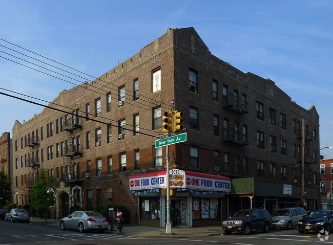
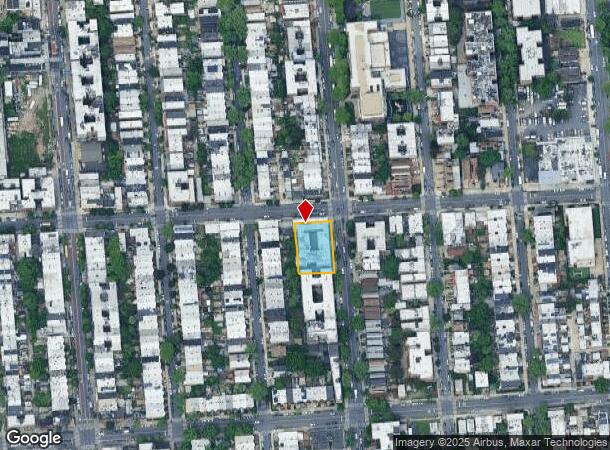
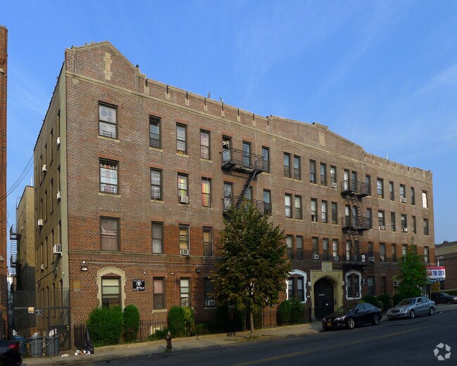
Property Record
1084 New York Ave, Brooklyn, NY 11203

NEARBY LISTINGS FOR SALE OR LEASE
Property Detail
1084 New York Ave
04917-0006
Kings
Apartment
New York
X
6
3604970214F
0.36 AC
2024
East Flatbush
2025
Long Island (New York)
082600
New York-Jersey City-White Plains, NY-NJ
47,680 SF
DEMOGRAPHICS near 1084 New York Ave
1 Mile
3 Mile
5 Mile
2024 Total Population
181,343
1,205,513
2,511,705
2029 Population
172,116
1,128,781
2,345,872
Pop Growth 2024-2029
(5.09%)
(6.37%)
(6.60%)
Average Age
41
39
39
2024 Total Households
66,277
434,381
915,638
HH Growth 2024-2029
(5.45%)
(6.73%)
(6.90%)
Median Household Inc
$66,688
$69,990
$68,646
Avg Household Size
2.60
2.60
2.60
2024 Avg HH Vehicles
.00
1.00
1.00
Median Home Value
$684,161
$828,829
$830,277
Median Year Built
1947
1947
1948
Nearby Places
- Restaurants
- Banks
- Shops
- Fitness
- Groceries
PUBLIC TRANSPORTATION
TRANSIT/SUBWAY
Beverly Road (2,5 Line) (2 - New York MTA Subway (The Subway), 5 - New York MTA Subway (The Subway))
DRIVE
WALK
Distance
Beverly Road (2,5 Line) (2 - New York MTA Subway (The Subway), 5 - New York MTA Subway (The Subway))
1 min
5 min
0.2 mi
Church Avenue (2,5 line) (2 - New York MTA Subway (The Subway), 5 - New York MTA Subway (The Subway))
DRIVE
WALK
Distance
Church Avenue (2,5 line) (2 - New York MTA Subway (The Subway), 5 - New York MTA Subway (The Subway))
2 min
8 min
0.4 mi
Newkirk Avenue (2,5 Line) (2 - New York MTA Subway (The Subway), 5 - New York MTA Subway (The Subway))
DRIVE
WALK
Distance
Newkirk Avenue (2,5 Line) (2 - New York MTA Subway (The Subway), 5 - New York MTA Subway (The Subway))
2 min
11 min
0.6 mi
Winthrop Street (2 - New York MTA Subway (The Subway), 5 - New York MTA Subway (The Subway))
DRIVE
WALK
Distance
Winthrop Street (2 - New York MTA Subway (The Subway), 5 - New York MTA Subway (The Subway))
4 min
16 min
0.8 mi
Beverley Road (Q Line) (Q - New York MTA Subway (The Subway))
DRIVE
WALK
Distance
Beverley Road (Q Line) (Q - New York MTA Subway (The Subway))
4 min
20 min
1.0 mi
COMMUTER RAIL
Nostrand Avenue Station (Far Rockaway Branch - Long Island Rail Road, Hempstead Branch - Long Island Rail Road, Long Beach Branch - Long Island Rail Road, West Hempstead Branch - Long Island Rail Road)
DRIVE
WALK
Distance
Nostrand Avenue Station (Far Rockaway Branch - Long Island Rail Road, Hempstead Branch - Long Island Rail Road, Long Beach Branch - Long Island Rail Road, West Hempstead Branch - Long Island Rail Road)
10 min
2.7 mi
DRIVE
WALK
Distance
10 min
3.5 mi
AIRPORT
John F Kennedy International
DRIVE
WALK
Distance
John F Kennedy International
20 min
11.1 mi
LaGuardia
DRIVE
WALK
Distance
LaGuardia
27 min
12.6 mi
Newark Liberty International
DRIVE
WALK
Distance
Newark Liberty International
35 min
19.8 mi
Freight Ports
NY - Red Hook Container Terminal
DRIVE
WALK
Distance
NY - Red Hook Container Terminal
11 min
5.2 mi
Nearby Properties
Address
Land Use
TOTAL SIZE
Lot Size
Zoning
Address
Land Use
TOTAL SIZE
Lot Size
Zoning
869,038 SF
1.53 AC
M1-1
Address
Land Use
TOTAL SIZE
Lot Size
Zoning
92,440 SF
466.23 AC
R5
Address
Land Use
TOTAL SIZE
Lot Size
Zoning
1,281,577 SF
20.78 AC
M3-1
Address
Land Use
TOTAL SIZE
Lot Size
Zoning
1,503,150 SF
20.47 AC
R5
Address
Land Use
TOTAL SIZE
Lot Size
Zoning
393.54 AC
PARK
Address
Land Use
TOTAL SIZE
Lot Size
Zoning
577,381 SF
3.19 AC
R6
Address
Land Use
TOTAL SIZE
Lot Size
Zoning
965,600 SF
6.65 AC
R5
Address
Land Use
TOTAL SIZE
Lot Size
Zoning
1,061,228 SF
8.86 AC
R5
Address
Land Use
TOTAL SIZE
Lot Size
Zoning
1,073,920 SF
16.53 AC
R6
Address
Land Use
TOTAL SIZE
Lot Size
Zoning
561,945 SF
11.58 AC
R6
Address
Land Use
TOTAL SIZE
Lot Size
Zoning
61.60 AC
PARK
Address
Land Use
TOTAL SIZE
Lot Size
Zoning
335,800 SF
1.51 AC
R6
Address
Land Use
TOTAL SIZE
Lot Size
Zoning
785,450 SF
14.22 AC
R6
Address
Land Use
TOTAL SIZE
Lot Size
Zoning
296,915 SF
0.31 AC
C5-3
Address
Land Use
TOTAL SIZE
Lot Size
Zoning
566,000 SF
12.33 AC
R6
Address
Land Use
TOTAL SIZE
Lot Size
Zoning
489,344 SF
3.78 AC
C6-4
Address
Land Use
TOTAL SIZE
Lot Size
Zoning
710,746 SF
1.88 AC
C63A
Address
Land Use
TOTAL SIZE
Lot Size
Zoning
6,000 SF
110.42 AC
PARK
Address
Land Use
TOTAL SIZE
Lot Size
Zoning
427,208 SF
1.30 AC
R6
Address
Land Use
TOTAL SIZE
Lot Size
Zoning
511,776 SF
2.33 AC
R6
Address
Land Use
TOTAL SIZE
Lot Size
Zoning
393,092 SF
1.07 AC
R8A
Address
Land Use
TOTAL SIZE
Lot Size
Zoning
371,139 SF
3.22 AC
R5
Address
Land Use
TOTAL SIZE
Lot Size
Zoning
240,382 SF
0.24 AC
R9
Address
Land Use
TOTAL SIZE
Lot Size
Zoning
229,456 SF
4.15 AC
M1-1
Address
Land Use
TOTAL SIZE
Lot Size
Zoning
635,994 SF
17.90 AC
R5
Address
Land Use
TOTAL SIZE
Lot Size
Zoning
241,735 SF
1.99 AC
C8-4
Address
Land Use
TOTAL SIZE
Lot Size
Zoning
308,757 SF
0.74 AC
R7-1
Address
Land Use
TOTAL SIZE
Lot Size
Zoning
540,672 SF
10.65 AC
R6
Address
Land Use
TOTAL SIZE
Lot Size
Zoning
75,340 SF
3.02 AC
PARK
Address
Land Use
TOTAL SIZE
Lot Size
Zoning
206,640 SF
3.21 AC
R6
The World's #1 Commercial Real Estate Marketplace
Connect with us
© 2025 CoStar Group
The information above has been obtained from sources believed reliable. While we do not doubt its accuracy we have not verified it and make no guarantee, warranty or representation about it. It is your responsibility to independently confirm its accuracy and completeness. Any projections, opinions, assumptions, or estimates used are for example only and do not represent the current or future performance of the property. The value of this transaction to you depends on tax and other factors which should be evaluated by your tax, financial, and legal advisors. You and your advisors should conduct a careful, independent investigation of the property to determine to your satisfaction the suitability of the property for your needs.