Property Record
1085 Eaton Dr, Ft Wright, KY 41017
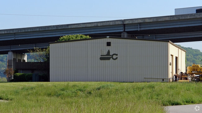


Property Detail
1085 Eaton Dr
043-00-00-020.00
7.1113 ACS SEC MADISON PK & I-275
Utilities
Kenton
AE The base floodplain where base flood elevations are provided. AE Zones are now used on new format FIRMs instead of A1-A30 Zones.
Kentucky
0
7.11 AC
2025
Covington
065300
Cincinnati/Dayton
7,200 SF
Cincinnati, OH-KY-IN
NEARBY LISTINGS FOR SALE OR LEASE
DEMOGRAPHICS near 1085 Eaton Dr
1 mile
3 mile
5 mile
2025 Total Population
1,469
55,257
174,088
2030 Population
1,523
57,008
179,782
Pop Growth 2025-2030
+ 3.68%
+ 3.17%
+ 3.27%
Average Age
42
40
40
2025 Total Households
563
23,193
72,996
HH Growth 2025-2030
+ 3.73%
+ 3.18%
+ 3.32%
Median Household Inc
$136,046
$79,154
$76,988
Avg Household Size
2.60
2.30
2.30
2025 Avg HH Vehicles
2.00
2.00
2.00
Median Home Value
$402,941
$271,245
$247,495
Median Year Built
1976
1969
1971
Nearby Places
Map Layers
Map Styles
 Street
 Aerial
Transit
 Traffic
 Biking
Places
Listings with unknown addresses are not visible on the map
- Restaurants
- Banks
- Shops
- Fitness
- Groceries
PUBLIC TRANSPORTATION
COMMUTER RAIL
Cincinnati Union Terminal (Cardinal - Amtrak)
Drive
Walk
Distance
Cincinnati Union Terminal (Cardinal - Amtrak)
15 min
7.5 mi
AIRPORT
Cincinnati/Northern Kentucky International
Drive
Walk
Distance
Cincinnati/Northern Kentucky International
21 min
9.4 mi
Freight Ports
Port of Toledo
Drive
Walk
Distance
Port of Toledo
251 min
212.1 mi
Nearby Properties
Address
Land Use
TOTAL SIZE
Lot Size
Zoning
Address
Land Use
TOTAL SIZE
Lot Size
Zoning
Address
Land Use
TOTAL SIZE
Lot Size
Zoning
19.43 AC
Address
Land Use
TOTAL SIZE
Lot Size
Zoning
360,000 SF
Address
Land Use
TOTAL SIZE
Lot Size
Zoning
25.08 AC
Address
Land Use
TOTAL SIZE
Lot Size
Zoning
475,250 SF
37.16 AC
Address
Land Use
TOTAL SIZE
Lot Size
Zoning
441,907 SF
Address
Land Use
TOTAL SIZE
Lot Size
Zoning
21.55 AC
Address
Land Use
TOTAL SIZE
Lot Size
Zoning
12.13 AC
Address
Land Use
TOTAL SIZE
Lot Size
Zoning
Address
Land Use
TOTAL SIZE
Lot Size
Zoning
30.11 AC
Address
Land Use
TOTAL SIZE
Lot Size
Zoning
20.49 AC
Address
Land Use
TOTAL SIZE
Lot Size
Zoning
15.05 AC
Address
Land Use
TOTAL SIZE
Lot Size
Zoning
57,030 SF
7 AC
Address
Land Use
TOTAL SIZE
Lot Size
Zoning
12.60 AC
Address
Land Use
TOTAL SIZE
Lot Size
Zoning
Address
Land Use
TOTAL SIZE
Lot Size
Zoning
85,726 SF
15.07 AC
Address
Land Use
TOTAL SIZE
Lot Size
Zoning
7.82 AC
Address
Land Use
TOTAL SIZE
Lot Size
Zoning
Address
Land Use
TOTAL SIZE
Lot Size
Zoning
Address
Land Use
TOTAL SIZE
Lot Size
Zoning
Address
Land Use
TOTAL SIZE
Lot Size
Zoning
61,013 SF
6.73 AC
Address
Land Use
TOTAL SIZE
Lot Size
Zoning
25.96 AC
Address
Land Use
TOTAL SIZE
Lot Size
Zoning
179,770 SF
Address
Land Use
TOTAL SIZE
Lot Size
Zoning
126,326 SF
8.87 AC
Address
Land Use
TOTAL SIZE
Lot Size
Zoning
Address
Land Use
TOTAL SIZE
Lot Size
Zoning
180,972 SF
Address
Land Use
TOTAL SIZE
Lot Size
Zoning
20.27 AC
Address
Land Use
TOTAL SIZE
Lot Size
Zoning
183,917 SF
24.93 AC
Address
Land Use
TOTAL SIZE
Lot Size
Zoning
72.43 AC
Address
Land Use
TOTAL SIZE
Lot Size
Zoning
64,039 SF
3.69 AC
The World's #1 Commercial Real Estate Marketplace
Connect with us
© 2026 CoStar Group
The information above has been obtained from sources believed reliable. While we do not doubt its accuracy we have not verified it and make no guarantee, warranty or representation about it. It is your responsibility to independently confirm its accuracy and completeness. Any projections, opinions, assumptions, or estimates used are for example only and do not represent the current or future performance of the property. The value of this transaction to you depends on tax and other factors which should be evaluated by your tax, financial, and legal advisors. You and your advisors should conduct a careful, independent investigation of the property to determine to your satisfaction the suitability of the property for your needs.