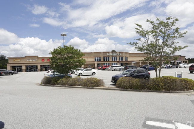
Property Record
1085 Old Clemson Hwy, Seneca, SC 29672


NEARBY LISTINGS FOR SALE OR LEASE
Property Detail
1085 Old Clemson Hwy
226-00-02-006
Subdivision Plat For Edwards Land Manage
Regionalshoppingcenterormallwithanchorstore
OLD CLEMSON HWY (6.02AC)
X
Oconee
45073C0335D
South Carolina
2025
6.02 AC
2025
South Carolina Rural Areas
030602
Other Market Areas
47,195 SF
Seneca, SC
DEMOGRAPHICS near 1085 Old Clemson Hwy
1 Mile
3 Mile
5 Mile
2024 Total Population
1,651
13,609
39,923
2029 Population
1,700
14,008
41,245
Pop Growth 2024-2029
+ 2.97%
+ 2.93%
+ 3.31%
Average Age
40
35
36
2024 Total Households
735
5,373
15,227
HH Growth 2024-2029
+ 3.13%
+ 2.96%
+ 3.59%
Median Household Inc
$45,417
$37,349
$42,487
Avg Household Size
2.20
2.30
2.30
2024 Avg HH Vehicles
2.00
2.00
2.00
Median Home Value
$256,578
$231,952
$221,155
Median Year Built
1990
1988
1987
Nearby Places
Map Layers
Map Styles
 Street
 Aerial
- Restaurants
- Banks
- Shops
- Fitness
- Groceries
PUBLIC TRANSPORTATION
COMMUTER RAIL
Clemson Amtrak Station (Crescent - Amtrak)
DRIVE
WALK
Distance
Clemson Amtrak Station (Crescent - Amtrak)
6 min
3.0 mi
Freight Ports
Georgia Ports - Savannah
DRIVE
WALK
Distance
Georgia Ports - Savannah
323 min
256.3 mi
SALE & LEASE HISTORY
LISTING DATE
SALE/LEASE

Sep 24, 2016
For Sale
Jul 07, 2022
For Lease
Feb 22, 2025
For Lease
Feb 14, 2024
For Lease
Feb 11, 2019
For Sale
Nearby Properties
Address
Land Use
TOTAL SIZE
Lot Size
Zoning
Address
Land Use
TOTAL SIZE
Lot Size
Zoning
3,224.70 AC
NOT ZONED
Address
Land Use
TOTAL SIZE
Lot Size
Zoning
21,573 SF
4.91 AC
CP 2 COMMU
Address
Land Use
TOTAL SIZE
Lot Size
Zoning
3,985 SF
56.58 AC
Address
Land Use
TOTAL SIZE
Lot Size
Zoning
119,175 SF
2.11 AC
RM 3 MULTI
Address
Land Use
TOTAL SIZE
Lot Size
Zoning
259,277 SF
3.39 AC
PD17
Address
Land Use
TOTAL SIZE
Lot Size
Zoning
24,882 SF
12.94 AC
PD
Address
Land Use
TOTAL SIZE
Lot Size
Zoning
15,783 SF
1.43 AC
RM 4 MULTI
Address
Land Use
TOTAL SIZE
Lot Size
Zoning
26,864 SF
0.98 AC
GC
Address
Land Use
TOTAL SIZE
Lot Size
Zoning
185,383 SF
2.52 AC
GENERAL CO
Address
Land Use
TOTAL SIZE
Lot Size
Zoning
267,298 SF
1.68 AC
GC
Address
Land Use
TOTAL SIZE
Lot Size
Zoning
3,538 SF
7.12 AC
Address
Land Use
TOTAL SIZE
Lot Size
Zoning
6,574 SF
0.50 AC
RLC
Address
Land Use
TOTAL SIZE
Lot Size
Zoning
84,530 SF
5.10 AC
CP 2 COMMU
Address
Land Use
TOTAL SIZE
Lot Size
Zoning
43,916 SF
0.25 AC
C
Address
Land Use
TOTAL SIZE
Lot Size
Zoning
0.78 AC
GENERAL CO
Address
Land Use
TOTAL SIZE
Lot Size
Zoning
0.40 AC
GC
Address
Land Use
TOTAL SIZE
Lot Size
Zoning
0.54 AC
RLC
Address
Land Use
TOTAL SIZE
Lot Size
Zoning
21,378 SF
0.95 AC
RLC RES LI
Address
Land Use
TOTAL SIZE
Lot Size
Zoning
0.52 AC
C
Address
Land Use
TOTAL SIZE
Lot Size
Zoning
0.48 AC
GC
Address
Land Use
TOTAL SIZE
Lot Size
Zoning
53,460 SF
17.15 AC
Address
Land Use
TOTAL SIZE
Lot Size
Zoning
30,104 SF
0.27 AC
CP 1 NEIGH
Address
Land Use
TOTAL SIZE
Lot Size
Zoning
0.34 AC
GC
Address
Land Use
TOTAL SIZE
Lot Size
Zoning
1,990 SF
2.86 AC
RM 4 MULTI
Address
Land Use
TOTAL SIZE
Lot Size
Zoning
10,266 SF
5.71 AC
PD
Address
Land Use
TOTAL SIZE
Lot Size
Zoning
13,012 SF
10.48 AC
Address
Land Use
TOTAL SIZE
Lot Size
Zoning
469.50 AC
The World's #1 Commercial Real Estate Marketplace
Connect with us
© 2025 CoStar Group
The information above has been obtained from sources believed reliable. While we do not doubt its accuracy we have not verified it and make no guarantee, warranty or representation about it. It is your responsibility to independently confirm its accuracy and completeness. Any projections, opinions, assumptions, or estimates used are for example only and do not represent the current or future performance of the property. The value of this transaction to you depends on tax and other factors which should be evaluated by your tax, financial, and legal advisors. You and your advisors should conduct a careful, independent investigation of the property to determine to your satisfaction the suitability of the property for your needs.