Property Record
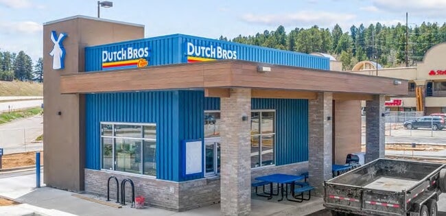
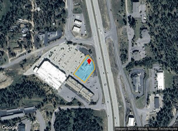
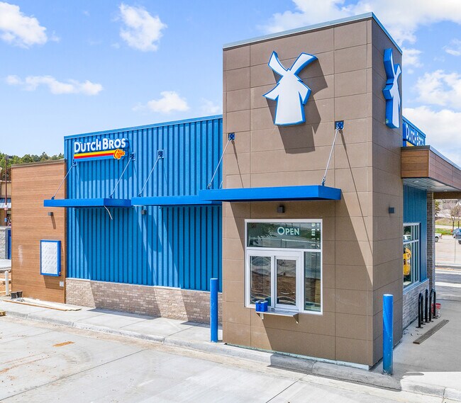
10855 Us Highway 285, Conifer, CO 80433
NEARBY LISTINGS FOR SALE OR LEASE
Property Detail
10855 Us Highway 285
Denver-Aurora-Centennial, CO
Conifer Centre Ex Sur No 3 Adj 1
61-231-02-006
SECTION 23 TOWNSHIP 06 RANGE 71 QTR NE SUBDIVISIONCD 160410 SUBDIVISIONNAME CONIFER CENTRE EX SUR NO 3 ADJ 1 BLOCK LOT 0002 SIZE: 31799 TRACT VALUE: .730
Commercialnec
Jefferson
X
Colorado
08059C0370F
2
2023
0.73 AC
2024
Southwest Outlying
012037
Denver
890 SF
DEMOGRAPHICS near 10855 Us Highway 285
1 mile
3 mile
5 mile
2024 Total Population
326
5,474
12,553
2029 Population
319
5,396
12,409
Pop Growth 2024-2029
(2.15%)
(1.42%)
(1.15%)
Average Age
45
46
46
2024 Total Households
133
2,201
5,068
HH Growth 2024-2029
(2.26%)
(1.59%)
(1.26%)
Median Household Inc
$127,083
$122,499
$122,816
Avg Household Size
2.40
2.40
2.40
2024 Avg HH Vehicles
3.00
3.00
3.00
Median Home Value
$767,857
$708,686
$713,666
Median Year Built
1982
1979
1979
Nearby Places
Map Layers
Map Styles
 Street
 Aerial
Transit
 Traffic
 Biking
Places
Listings with unknown addresses are not visible on the map
- Restaurants
- Banks
- Shops
- Fitness
- Groceries
SALE & LEASE HISTORY
LISTING DATE
SALE/LEASE

May 22, 2020
For Sale
Nearby Properties
Address
Land Use
TOTAL SIZE
Lot Size
Zoning
Address
Land Use
TOTAL SIZE
Lot Size
Zoning
483.04 AC
A2
Address
Land Use
TOTAL SIZE
Lot Size
Zoning
159,469 SF
104.55 AC
A2
Address
Land Use
TOTAL SIZE
Lot Size
Zoning
205.11 AC
A2
Address
Land Use
TOTAL SIZE
Lot Size
Zoning
87,394 SF
7.32 AC
Address
Land Use
TOTAL SIZE
Lot Size
Zoning
173.19 AC
CO
Address
Land Use
TOTAL SIZE
Lot Size
Zoning
99,925 SF
40 AC
A2
Address
Land Use
TOTAL SIZE
Lot Size
Zoning
62,164 SF
6.07 AC
Address
Land Use
TOTAL SIZE
Lot Size
Zoning
65,199 SF
1.78 AC
Address
Land Use
TOTAL SIZE
Lot Size
Zoning
55,436 SF
5.10 AC
PD
Address
Land Use
TOTAL SIZE
Lot Size
Zoning
68,855 SF
6.65 AC
PD
Address
Land Use
TOTAL SIZE
Lot Size
Zoning
55,831 SF
3.35 AC
C1
Address
Land Use
TOTAL SIZE
Lot Size
Zoning
12,076 SF
499.18 AC
A2
Address
Land Use
TOTAL SIZE
Lot Size
Zoning
2,728 SF
80 AC
A2
Address
Land Use
TOTAL SIZE
Lot Size
Zoning
35,890 SF
3.04 AC
Address
Land Use
TOTAL SIZE
Lot Size
Zoning
50,801 SF
19.26 AC
R1
Address
Land Use
TOTAL SIZE
Lot Size
Zoning
19,979 SF
15.09 AC
PD
Address
Land Use
TOTAL SIZE
Lot Size
Zoning
389.03 AC
A2
Address
Land Use
TOTAL SIZE
Lot Size
Zoning
17,509 SF
0.59 AC
Address
Land Use
TOTAL SIZE
Lot Size
Zoning
26,752 SF
1.67 AC
Address
Land Use
TOTAL SIZE
Lot Size
Zoning
14,932 SF
0.36 AC
Address
Land Use
TOTAL SIZE
Lot Size
Zoning
54,394 SF
2.27 AC
PD
Address
Land Use
TOTAL SIZE
Lot Size
Zoning
9,364 SF
9.44 AC
A1
Address
Land Use
TOTAL SIZE
Lot Size
Zoning
120 AC
CO
Address
Land Use
TOTAL SIZE
Lot Size
Zoning
5,597 SF
1.61 AC
PD
Address
Land Use
TOTAL SIZE
Lot Size
Zoning
9,554 SF
1.50 AC
RC
Address
Land Use
TOTAL SIZE
Lot Size
Zoning
4,345 SF
0.76 AC
PD
Address
Land Use
TOTAL SIZE
Lot Size
Zoning
7,200 SF
1.28 AC
C1
Address
Land Use
TOTAL SIZE
Lot Size
Zoning
9,832 SF
1.61 AC
PD
Address
Land Use
TOTAL SIZE
Lot Size
Zoning
3,232 SF
1.05 AC
PD
Address
Land Use
TOTAL SIZE
Lot Size
Zoning
14,822 SF
2.99 AC
PD
The World's #1 Commercial Real Estate Marketplace
Connect with us
© 2026 CoStar Group
The information above has been obtained from sources believed reliable. While we do not doubt its accuracy we have not verified it and make no guarantee, warranty or representation about it. It is your responsibility to independently confirm its accuracy and completeness. Any projections, opinions, assumptions, or estimates used are for example only and do not represent the current or future performance of the property. The value of this transaction to you depends on tax and other factors which should be evaluated by your tax, financial, and legal advisors. You and your advisors should conduct a careful, independent investigation of the property to determine to your satisfaction the suitability of the property for your needs.