Property Record
10863 E County Road 300 N, Indianapolis, IN 46234


NEARBY LISTINGS FOR SALE OR LEASE
Property Detail
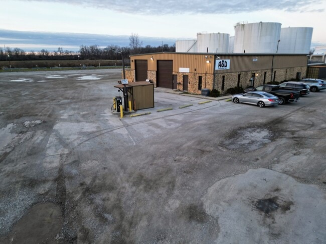
10863 E County Road 300 N
Indianapolis-Carmel-Anderson, IN
Lincoln Township
32-08-29-225-007.000-016
MINOR PLAT #423 PT LOT 7 2.48AC DBA: R & D TRANSPORT
Autorepair
Hendricks
X
Indiana
18097C0112F
7
2024
2.48 AC
2024
West Hendricks Cty
210109
Indianapolis
7,100 SF
DEMOGRAPHICS near 10863 E County Road 300 N
1 Mile
3 Mile
5 Mile
2024 Total Population
5,882
65,046
187,324
2029 Population
6,099
67,901
194,028
Pop Growth 2024-2029
+ 3.69%
+ 4.39%
+ 3.58%
Average Age
38
37
37
2024 Total Households
2,187
25,424
72,523
HH Growth 2024-2029
+ 3.29%
+ 3.89%
+ 3.23%
Median Household Inc
$76,791
$68,578
$65,446
Avg Household Size
2.70
2.50
2.50
2024 Avg HH Vehicles
2.00
2.00
2.00
Median Home Value
$167,687
$190,411
$186,255
Median Year Built
1995
1992
1987
Nearby Places
Map Layers
Map Styles
 Street
 Aerial
- Restaurants
- Banks
- Shops
- Fitness
- Groceries
PUBLIC TRANSPORTATION
AIRPORT
Indianapolis International
DRIVE
WALK
Distance
Indianapolis International
23 min
11.2 mi
Freight Ports
Port of Toledo
DRIVE
WALK
Distance
Port of Toledo
282 min
232.1 mi
SALE & LEASE HISTORY
LISTING DATE
SALE/LEASE

Jan 03, 2024
For Lease
Nearby Properties
Address
Land Use
TOTAL SIZE
Lot Size
Zoning
Address
Land Use
TOTAL SIZE
Lot Size
Zoning
56.57 AC
Address
Land Use
TOTAL SIZE
Lot Size
Zoning
315,254 SF
48.71 AC
Address
Land Use
TOTAL SIZE
Lot Size
Zoning
6,486 SF
17.63 AC
Address
Land Use
TOTAL SIZE
Lot Size
Zoning
4,632 SF
17.77 AC
Address
Land Use
TOTAL SIZE
Lot Size
Zoning
4,515 SF
23.95 AC
ZO01
Address
Land Use
TOTAL SIZE
Lot Size
Zoning
Address
Land Use
TOTAL SIZE
Lot Size
Zoning
32.50 AC
Address
Land Use
TOTAL SIZE
Lot Size
Zoning
5,189 SF
19.05 AC
Address
Land Use
TOTAL SIZE
Lot Size
Zoning
145,816 SF
1.07 AC
Address
Land Use
TOTAL SIZE
Lot Size
Zoning
21.15 AC
Address
Land Use
TOTAL SIZE
Lot Size
Zoning
3,518 SF
16.76 AC
Address
Land Use
TOTAL SIZE
Lot Size
Zoning
3,827 SF
24.15 AC
ZO01
Address
Land Use
TOTAL SIZE
Lot Size
Zoning
3,348 SF
32.01 AC
ZO01
Address
Land Use
TOTAL SIZE
Lot Size
Zoning
456 SF
50.27 AC
Address
Land Use
TOTAL SIZE
Lot Size
Zoning
27,327 SF
15 AC
Address
Land Use
TOTAL SIZE
Lot Size
Zoning
1,904 SF
47.31 AC
ZO01
Address
Land Use
TOTAL SIZE
Lot Size
Zoning
29.46 AC
Address
Land Use
TOTAL SIZE
Lot Size
Zoning
24.15 AC
Address
Land Use
TOTAL SIZE
Lot Size
Zoning
86,706 SF
19.47 AC
Address
Land Use
TOTAL SIZE
Lot Size
Zoning
2,737 SF
9.65 AC
Address
Land Use
TOTAL SIZE
Lot Size
Zoning
7,364 SF
9.20 AC
Address
Land Use
TOTAL SIZE
Lot Size
Zoning
Address
Land Use
TOTAL SIZE
Lot Size
Zoning
4,734 SF
30.98 AC
ZO01
Address
Land Use
TOTAL SIZE
Lot Size
Zoning
3,802 SF
12.25 AC
Address
Land Use
TOTAL SIZE
Lot Size
Zoning
18.29 AC
Address
Land Use
TOTAL SIZE
Lot Size
Zoning
Address
Land Use
TOTAL SIZE
Lot Size
Zoning
2,664 SF
5.64 AC
Address
Land Use
TOTAL SIZE
Lot Size
Zoning
57,100 SF
18.13 AC
Address
Land Use
TOTAL SIZE
Lot Size
Zoning
777 SF
7.48 AC
Address
Land Use
TOTAL SIZE
Lot Size
Zoning
5,184 SF
23.31 AC
ZO01
The World's #1 Commercial Real Estate Marketplace
Connect with us
© 2026 CoStar Group
The information above has been obtained from sources believed reliable. While we do not doubt its accuracy we have not verified it and make no guarantee, warranty or representation about it. It is your responsibility to independently confirm its accuracy and completeness. Any projections, opinions, assumptions, or estimates used are for example only and do not represent the current or future performance of the property. The value of this transaction to you depends on tax and other factors which should be evaluated by your tax, financial, and legal advisors. You and your advisors should conduct a careful, independent investigation of the property to determine to your satisfaction the suitability of the property for your needs.