Property Record
1088 E Main St, Meriden, CT 06450


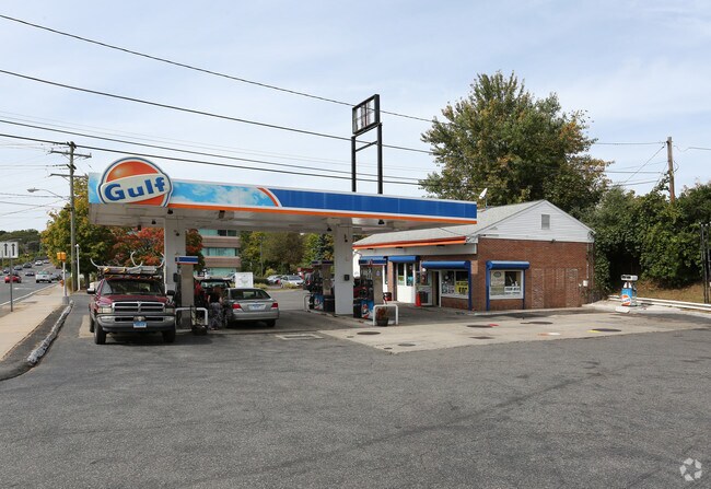
Property Detail
1088 E Main St
MERI-001007-000333H-000004A-000004B
NEW HAVEN
Commercialbuilding
Connecticut
C-3
4a-4b
B and X Area of moderate flood hazard, usually the area between the limits of the 100-year and 500-year floods.
0.43 AC
2024
Meriden
2025
Westchester/So Connecticut
171300
New Haven, CT
1,368 SF
NEARBY LISTINGS FOR SALE OR LEASE
DEMOGRAPHICS near 1088 E Main St
1 mile
3 mile
5 mile
2025 Total Population
7,932
54,860
92,407
2030 Population
8,064
55,256
93,123
Pop Growth 2025-2030
+ 1.66%
+ 0.72%
+ 0.77%
Average Age
43
40
41
2025 Total Households
3,194
21,953
36,587
HH Growth 2025-2030
+ 1.57%
+ 0.69%
+ 0.72%
Median Household Inc
$83,575
$67,585
$81,039
Avg Household Size
2.30
2.40
2.40
2025 Avg HH Vehicles
2.00
2.00
2.00
Median Home Value
$246,264
$245,032
$284,343
Median Year Built
1964
1958
1965
Nearby Places
Map Layers
Map Styles
 Street
 Aerial
Layers
 Traffic
 Biking
Places
Listings with unknown addresses are not visible on the map
- Restaurants
- Banks
- Shops
- Fitness
- Groceries
PUBLIC TRANSPORTATION
COMMUTER RAIL
Drive
Walk
Distance
4 min
2.2 mi
Drive
Walk
Distance
11 min
5.9 mi
AIRPORT
Tweed/New Haven
Drive
Walk
Distance
Tweed/New Haven
34 min
21.7 mi
Bradley International
Drive
Walk
Distance
Bradley International
48 min
34.1 mi
Freight Ports
Port of New Haven
Drive
Walk
Distance
Port of New Haven
29 min
20.6 mi
Nearby Properties
Address
Land Use
TOTAL SIZE
Lot Size
Zoning
Address
Land Use
TOTAL SIZE
Lot Size
Zoning
267,249 SF
27.55 AC
R-1
Address
Land Use
TOTAL SIZE
Lot Size
Zoning
34.10 AC
C-3
Address
Land Use
TOTAL SIZE
Lot Size
Zoning
10.38 AC
M-1
Address
Land Use
TOTAL SIZE
Lot Size
Zoning
329,296 SF
35.55 AC
IX
Address
Land Use
TOTAL SIZE
Lot Size
Zoning
339,844 SF
52.43 AC
M-4
Address
Land Use
TOTAL SIZE
Lot Size
Zoning
159,085 SF
21.79 AC
C-3
Address
Land Use
TOTAL SIZE
Lot Size
Zoning
11.02 AC
S-R
Address
Land Use
TOTAL SIZE
Lot Size
Zoning
3,952 SF
21.76 AC
R-1
Address
Land Use
TOTAL SIZE
Lot Size
Zoning
26.45 AC
RF40
Address
Land Use
TOTAL SIZE
Lot Size
Zoning
153,180 SF
3.07 AC
TODH
Address
Land Use
TOTAL SIZE
Lot Size
Zoning
187,914 SF
16.13 AC
IX
Address
Land Use
TOTAL SIZE
Lot Size
Zoning
1.67 AC
TODP
Address
Land Use
TOTAL SIZE
Lot Size
Zoning
203,692 SF
21.22 AC
IX
Address
Land Use
TOTAL SIZE
Lot Size
Zoning
166,724 SF
21.79 AC
M-2
Address
Land Use
TOTAL SIZE
Lot Size
Zoning
598.20 AC
R-R
Address
Land Use
TOTAL SIZE
Lot Size
Zoning
16.24 AC
C-3
Address
Land Use
TOTAL SIZE
Lot Size
Zoning
880 SF
22.58 AC
C-1
Address
Land Use
TOTAL SIZE
Lot Size
Zoning
84,919 SF
7.53 AC
C-1
Address
Land Use
TOTAL SIZE
Lot Size
Zoning
228,233 SF
1.97 AC
TODH
Address
Land Use
TOTAL SIZE
Lot Size
Zoning
19.47 AC
RF40
Address
Land Use
TOTAL SIZE
Lot Size
Zoning
115,951 SF
14.77 AC
M-1
Address
Land Use
TOTAL SIZE
Lot Size
Zoning
171,057 SF
25.06 AC
M-4
Address
Land Use
TOTAL SIZE
Lot Size
Zoning
98,894 SF
44.82 AC
WI
Address
Land Use
TOTAL SIZE
Lot Size
Zoning
100,512 SF
6 AC
C-2
Address
Land Use
TOTAL SIZE
Lot Size
Zoning
18.61 AC
C-2
Address
Land Use
TOTAL SIZE
Lot Size
Zoning
173,063 SF
22.38 AC
IX
Address
Land Use
TOTAL SIZE
Lot Size
Zoning
143,412 SF
2.05 AC
R-3
Address
Land Use
TOTAL SIZE
Lot Size
Zoning
125,420 SF
6.79 AC
R-1
Address
Land Use
TOTAL SIZE
Lot Size
Zoning
172,508 SF
3.98 AC
C-1
Address
Land Use
TOTAL SIZE
Lot Size
Zoning
3.60 AC
M-1
The World's #1 Commercial Real Estate Marketplace
Connect with us
© 2026 CoStar Group
The information above has been obtained from sources believed reliable. While we do not doubt its accuracy we have not verified it and make no guarantee, warranty or representation about it. It is your responsibility to independently confirm its accuracy and completeness. Any projections, opinions, assumptions, or estimates used are for example only and do not represent the current or future performance of the property. The value of this transaction to you depends on tax and other factors which should be evaluated by your tax, financial, and legal advisors. You and your advisors should conduct a careful, independent investigation of the property to determine to your satisfaction the suitability of the property for your needs.