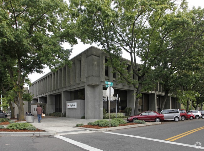
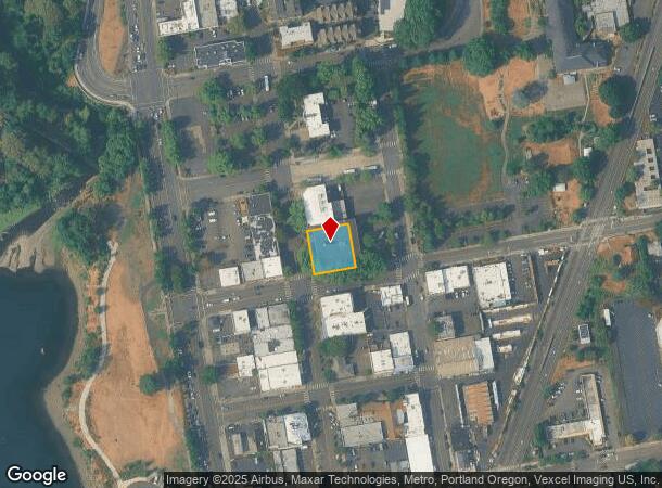
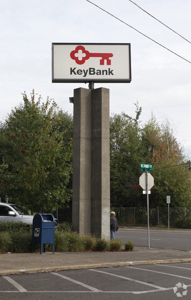
Property Record
10888 Se Main St, Milwaukie, OR 97222
Current Lease Availabilities
NEARBY LISTINGS FOR SALE OR LEASE
Property Detail
10888 Se Main St
Portland-Vancouver-Hillsboro, OR-WA
Milwaukie
00026894
5 MILWAUKIE LTS 7&8 PT LT 6 BLK 16
Commercialbuilding
Clackamas
X
Oregon
41067C0575E
7,8,6
2025
0.27 AC
2025
Clackamas/Milwaukie
020800
Portland
996 SF
DEMOGRAPHICS near 10888 Se Main St
1 Mile
3 Mile
5 Mile
2024 Total Population
9,973
111,409
351,407
2029 Population
10,224
112,274
351,588
Pop Growth 2024-2029
+ 2.52%
+ 0.78%
+ 0.05%
Average Age
42
42
42
2024 Total Households
4,541
45,635
148,274
HH Growth 2024-2029
+ 2.64%
+ 0.71%
(0.07%)
Median Household Inc
$64,543
$90,087
$91,668
Avg Household Size
2.10
2.30
2.30
2024 Avg HH Vehicles
2.00
2.00
2.00
Median Home Value
$471,765
$537,346
$582,323
Median Year Built
1968
1967
1972
Nearby Places
Map Layers
Map Styles
 Street
 Aerial
- Restaurants
- Banks
- Shops
- Fitness
- Groceries
PUBLIC TRANSPORTATION
TRANSIT/SUBWAY
Milwaukie/Main St Max Station (MAX Orange Line - TriMet)
DRIVE
WALK
Distance
Milwaukie/Main St Max Station (MAX Orange Line - TriMet)
0 min
5 min
0.2 mi
COMMUTER RAIL
Oregon City Amtrak (Amtrak Cascades - Amtrak)
DRIVE
WALK
Distance
Oregon City Amtrak (Amtrak Cascades - Amtrak)
13 min
6.8 mi
Portland (Amtrak Cascades - Amtrak, Coast Starlight - Amtrak, Empire Builder - Amtrak)
DRIVE
WALK
Distance
Portland (Amtrak Cascades - Amtrak, Coast Starlight - Amtrak, Empire Builder - Amtrak)
16 min
6.9 mi
AIRPORT
Portland International
DRIVE
WALK
Distance
Portland International
27 min
15.7 mi
Freight Ports
Port of Portland
DRIVE
WALK
Distance
Port of Portland
18 min
9.6 mi
Nearby Properties
Address
Land Use
TOTAL SIZE
Lot Size
Zoning
Address
Land Use
TOTAL SIZE
Lot Size
Zoning
931,749 SF
85.50 AC
CI1
Address
Land Use
TOTAL SIZE
Lot Size
Zoning
822,867 SF
103.39 AC
CI1
Address
Land Use
TOTAL SIZE
Lot Size
Zoning
138,295 SF
29.79 AC
CI1
Address
Land Use
TOTAL SIZE
Lot Size
Zoning
28.30 AC
EC/R-0
Address
Land Use
TOTAL SIZE
Lot Size
Zoning
Address
Land Use
TOTAL SIZE
Lot Size
Zoning
Address
Land Use
TOTAL SIZE
Lot Size
Zoning
6.48 AC
R-3
Address
Land Use
TOTAL SIZE
Lot Size
Zoning
1 SF
1 AC
PF
Address
Land Use
TOTAL SIZE
Lot Size
Zoning
3,550 SF
3.99 AC
DMU
Address
Land Use
TOTAL SIZE
Lot Size
Zoning
Address
Land Use
TOTAL SIZE
Lot Size
Zoning
222,120 SF
6.87 AC
RM2
Address
Land Use
TOTAL SIZE
Lot Size
Zoning
57,300 SF
4.38 AC
R5
Address
Land Use
TOTAL SIZE
Lot Size
Zoning
Address
Land Use
TOTAL SIZE
Lot Size
Zoning
1 SF
0.14 AC
EC
Address
Land Use
TOTAL SIZE
Lot Size
Zoning
10.35 AC
PF
Address
Land Use
TOTAL SIZE
Lot Size
Zoning
0.26 AC
C3
Address
Land Use
TOTAL SIZE
Lot Size
Zoning
21.39 AC
CI
Address
Land Use
TOTAL SIZE
Lot Size
Zoning
176,428 SF
1.31 AC
CM2
Address
Land Use
TOTAL SIZE
Lot Size
Zoning
11.35 AC
C3
Address
Land Use
TOTAL SIZE
Lot Size
Zoning
62,048 SF
8.58 AC
R20
Address
Land Use
TOTAL SIZE
Lot Size
Zoning
143,116 SF
0.92 AC
CM2
Address
Land Use
TOTAL SIZE
Lot Size
Zoning
11.10 AC
HDR
Address
Land Use
TOTAL SIZE
Lot Size
Zoning
5.69 AC
IG2
Address
Land Use
TOTAL SIZE
Lot Size
Zoning
1.61 AC
DMU
Address
Land Use
TOTAL SIZE
Lot Size
Zoning
Address
Land Use
TOTAL SIZE
Lot Size
Zoning
434,405 SF
4.14 AC
R5
Address
Land Use
TOTAL SIZE
Lot Size
Zoning
7 AC
NME
Address
Land Use
TOTAL SIZE
Lot Size
Zoning
22.01 AC
BI
Address
Land Use
TOTAL SIZE
Lot Size
Zoning
7.26 AC
RTL
Address
Land Use
TOTAL SIZE
Lot Size
Zoning
70,920 SF
9.09 AC
R5
The World's #1 Commercial Real Estate Marketplace
Connect with us
© 2025 CoStar Group
The information above has been obtained from sources believed reliable. While we do not doubt its accuracy we have not verified it and make no guarantee, warranty or representation about it. It is your responsibility to independently confirm its accuracy and completeness. Any projections, opinions, assumptions, or estimates used are for example only and do not represent the current or future performance of the property. The value of this transaction to you depends on tax and other factors which should be evaluated by your tax, financial, and legal advisors. You and your advisors should conduct a careful, independent investigation of the property to determine to your satisfaction the suitability of the property for your needs.