Property Record
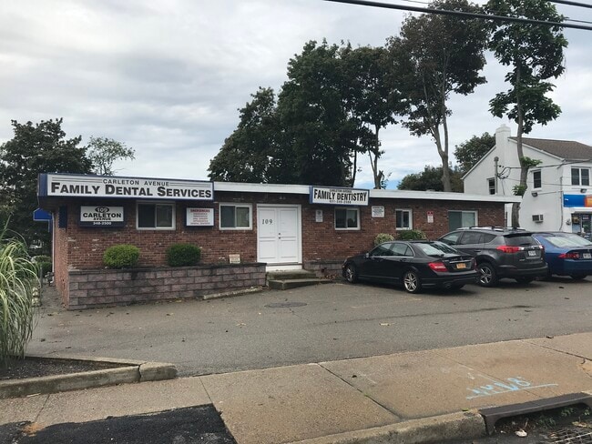
109 Carleton Ave, Central Islip, NY 11722


Property Detail
109 Carleton Ave
Nassau County-Suffolk County, NY
EDZ X2221190Y204581 N024N00000000
0500-120-00-05-00-083-000
Suffolk
Commercialbuilding
New York
BUS1
500
B and X Area of moderate flood hazard, usually the area between the limits of the 100-year and 500-year floods.
0.43 AC
0
Western Suffolk
2025
Long Island (New York)
146203
NEARBY LISTINGS FOR SALE OR LEASE
DEMOGRAPHICS near 109 Carleton Ave
1 mile
3 mile
5 mile
2025 Total Population
20,275
104,346
246,803
2030 Population
19,783
101,818
242,031
Pop Growth 2025-2030
(2.43%)
(2.42%)
(1.93%)
Average Age
38
38
40
2025 Total Households
5,248
27,297
72,844
HH Growth 2025-2030
(2.48%)
(2.52%)
(1.91%)
Median Household Inc
$106,060
$113,645
$120,580
Avg Household Size
3.50
3.50
3.20
2025 Avg HH Vehicles
2.00
2.00
2.00
Median Home Value
$434,368
$450,074
$541,072
Median Year Built
1972
1967
1967
Nearby Places
Map Layers
Map Styles
 Street
 Aerial
Layers
 Traffic
 Biking
Places
Listings with unknown addresses are not visible on the map
- Restaurants
- Banks
- Shops
- Fitness
- Groceries
PUBLIC TRANSPORTATION
TRANSIT/SUBWAY
Central Islip Station (Ronkonkoma Branch - Long Island Rail Road)
Drive
Walk
Distance
Central Islip Station (Ronkonkoma Branch - Long Island Rail Road)
3 min
17 min
0.9 mi
COMMUTER RAIL
Central Islip Station (Ronkonkoma Branch - Long Island Rail Road)
Drive
Walk
Distance
Central Islip Station (Ronkonkoma Branch - Long Island Rail Road)
2 min
16 min
0.8 mi
Brentwood Station (Ronkonkoma Branch - Long Island Rail Road)
Drive
Walk
Distance
Brentwood Station (Ronkonkoma Branch - Long Island Rail Road)
8 min
3.3 mi
AIRPORT
Long Island MacArthur
Drive
Walk
Distance
Long Island MacArthur
13 min
6.7 mi
John F Kennedy International
Drive
Walk
Distance
John F Kennedy International
52 min
38.5 mi
Freight Ports
NY - Red Hook Container Terminal
Drive
Walk
Distance
NY - Red Hook Container Terminal
71 min
48.4 mi
SALE & LEASE HISTORY
LISTING DATE
SALE/LEASE

Oct 05, 2023
For Sale
Nearby Properties
Address
Land Use
TOTAL SIZE
Lot Size
Zoning
Address
Land Use
TOTAL SIZE
Lot Size
Zoning
301 SF
3.70 AC
Address
Land Use
TOTAL SIZE
Lot Size
Zoning
97.50 AC
AAA
Address
Land Use
TOTAL SIZE
Lot Size
Zoning
194.82 AC
AAA
Address
Land Use
TOTAL SIZE
Lot Size
Zoning
57.30 AC
AAA
Address
Land Use
TOTAL SIZE
Lot Size
Zoning
22.22 AC
AA
Address
Land Use
TOTAL SIZE
Lot Size
Zoning
17.70 AC
A
Address
Land Use
TOTAL SIZE
Lot Size
Zoning
8.18 AC
NULL
Address
Land Use
TOTAL SIZE
Lot Size
Zoning
38.74 AC
Address
Land Use
TOTAL SIZE
Lot Size
Zoning
52.73 AC
AAA
Address
Land Use
TOTAL SIZE
Lot Size
Zoning
465.70 AC
AAA
Address
Land Use
TOTAL SIZE
Lot Size
Zoning
170.87 AC
AAA
Address
Land Use
TOTAL SIZE
Lot Size
Zoning
24.10 AC
A
Address
Land Use
TOTAL SIZE
Lot Size
Zoning
27.38 AC
Address
Land Use
TOTAL SIZE
Lot Size
Zoning
2.79 AC
Address
Land Use
TOTAL SIZE
Lot Size
Zoning
36.66 AC
NULL
Address
Land Use
TOTAL SIZE
Lot Size
Zoning
24.96 AC
Address
Land Use
TOTAL SIZE
Lot Size
Zoning
5.32 AC
BUS3
Address
Land Use
TOTAL SIZE
Lot Size
Zoning
33.30 AC
A
Address
Land Use
TOTAL SIZE
Lot Size
Zoning
24.70 AC
AAA
Address
Land Use
TOTAL SIZE
Lot Size
Zoning
360.60 AC
AAA
Address
Land Use
TOTAL SIZE
Lot Size
Zoning
339.70 AC
AAA
Address
Land Use
TOTAL SIZE
Lot Size
Zoning
13.06 AC
BUS3
Address
Land Use
TOTAL SIZE
Lot Size
Zoning
15.46 AC
PDDEC
Address
Land Use
TOTAL SIZE
Lot Size
Zoning
5,140 SF
23.39 AC
CA
Address
Land Use
TOTAL SIZE
Lot Size
Zoning
97.24 AC
AAA
Address
Land Use
TOTAL SIZE
Lot Size
Zoning
21.20 AC
AA
Address
Land Use
TOTAL SIZE
Lot Size
Zoning
15 AC
AA
Address
Land Use
TOTAL SIZE
Lot Size
Zoning
45.56 AC
Address
Land Use
TOTAL SIZE
Lot Size
Zoning
12.84 AC
NULL
Address
Land Use
TOTAL SIZE
Lot Size
Zoning
19.86 AC
C
The World's #1 Commercial Real Estate Marketplace
Connect with us
© 2026 CoStar Group
The information above has been obtained from sources believed reliable. While we do not doubt its accuracy we have not verified it and make no guarantee, warranty or representation about it. It is your responsibility to independently confirm its accuracy and completeness. Any projections, opinions, assumptions, or estimates used are for example only and do not represent the current or future performance of the property. The value of this transaction to you depends on tax and other factors which should be evaluated by your tax, financial, and legal advisors. You and your advisors should conduct a careful, independent investigation of the property to determine to your satisfaction the suitability of the property for your needs.