Property Record
109 Elm St, Millbury, MA 01527

NEARBY LISTINGS FOR SALE OR LEASE
Property Detail
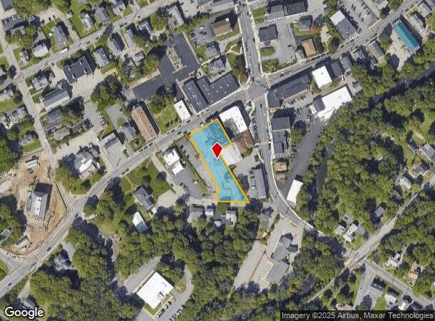
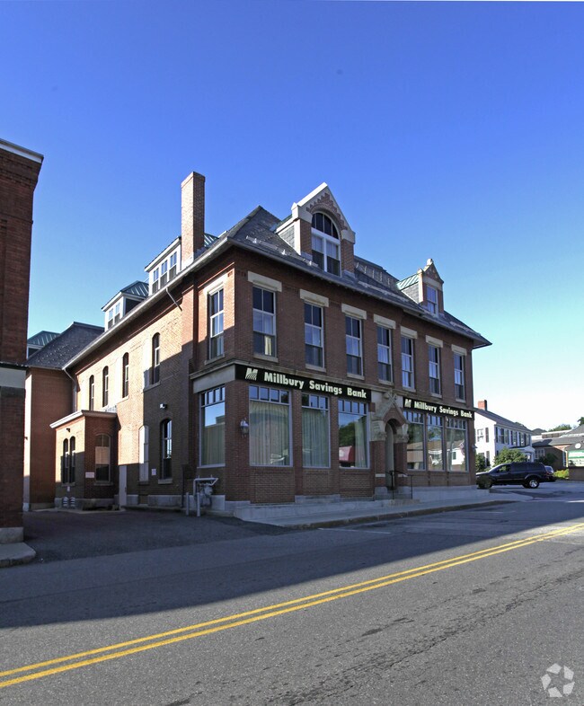
109 Elm St
Financialbuilding
Worcester
X
Massachusetts
25027C0809E
0.73 AC
2025
Outlying Worcester
2025
Boston
737200
Worcester, MA
20,941 SF
MILB-000053-000000-000208
DEMOGRAPHICS near 109 Elm St
1 Mile
3 Mile
5 Mile
2024 Total Population
5,185
23,621
114,069
2029 Population
5,146
23,593
113,096
Pop Growth 2024-2029
(0.75%)
(0.12%)
(0.85%)
Average Age
43
43
40
2024 Total Households
2,258
9,634
43,808
HH Growth 2024-2029
(0.84%)
(0.12%)
(0.83%)
Median Household Inc
$91,957
$100,690
$80,475
Avg Household Size
2.20
2.40
2.50
2024 Avg HH Vehicles
2.00
2.00
2.00
Median Home Value
$346,880
$385,061
$359,984
Median Year Built
1954
1971
1959
Nearby Places
Map Layers
Map Styles
 Street
 Aerial
- Restaurants
- Banks
- Shops
- Fitness
- Groceries
PUBLIC TRANSPORTATION
COMMUTER RAIL
Worcester Union Station (Lake Shore Limited - Amtrak)
DRIVE
WALK
Distance
Worcester Union Station (Lake Shore Limited - Amtrak)
10 min
6.4 mi
Worcester (Framingham/Worcester Line - Massachusetts Bay Transportation Authority Commuter Rail (Purple Line))
DRIVE
WALK
Distance
Worcester (Framingham/Worcester Line - Massachusetts Bay Transportation Authority Commuter Rail (Purple Line))
10 min
6.5 mi
AIRPORT
Worcester Regional
DRIVE
WALK
Distance
Worcester Regional
20 min
11.2 mi
Freight Ports
Port of Boston
DRIVE
WALK
Distance
Port of Boston
61 min
45.7 mi
Nearby Properties
Address
Land Use
TOTAL SIZE
Lot Size
Zoning
Address
Land Use
TOTAL SIZE
Lot Size
Zoning
25,000 SF
99.10 AC
MG-.5
Address
Land Use
TOTAL SIZE
Lot Size
Zoning
423,649 SF
33.23 AC
B2
Address
Land Use
TOTAL SIZE
Lot Size
Zoning
591,515 SF
33.04 AC
MG-1
Address
Land Use
TOTAL SIZE
Lot Size
Zoning
Address
Land Use
TOTAL SIZE
Lot Size
Zoning
55.79 AC
R4
Address
Land Use
TOTAL SIZE
Lot Size
Zoning
8.77 AC
BL-1
Address
Land Use
TOTAL SIZE
Lot Size
Zoning
151.20 AC
Address
Land Use
TOTAL SIZE
Lot Size
Zoning
18.10 AC
I1
Address
Land Use
TOTAL SIZE
Lot Size
Zoning
Address
Land Use
TOTAL SIZE
Lot Size
Zoning
13,417 SF
28.90 AC
MG-.5
Address
Land Use
TOTAL SIZE
Lot Size
Zoning
169,822 SF
18.80 AC
RL-7
Address
Land Use
TOTAL SIZE
Lot Size
Zoning
47.94 AC
RL-7
Address
Land Use
TOTAL SIZE
Lot Size
Zoning
10.19 AC
B2
Address
Land Use
TOTAL SIZE
Lot Size
Zoning
1,628 SF
7.06 AC
Address
Land Use
TOTAL SIZE
Lot Size
Zoning
71,622 SF
33.28 AC
Address
Land Use
TOTAL SIZE
Lot Size
Zoning
199,424 SF
12.97 AC
ML-.5
Address
Land Use
TOTAL SIZE
Lot Size
Zoning
96,000 SF
Address
Land Use
TOTAL SIZE
Lot Size
Zoning
103,460 SF
8.41 AC
I2
Address
Land Use
TOTAL SIZE
Lot Size
Zoning
8.19 AC
MG-.5
Address
Land Use
TOTAL SIZE
Lot Size
Zoning
2.62 AC
RG-5
Address
Land Use
TOTAL SIZE
Lot Size
Zoning
336,046 SF
36.36 AC
Address
Land Use
TOTAL SIZE
Lot Size
Zoning
109,500 SF
7.40 AC
V
Address
Land Use
TOTAL SIZE
Lot Size
Zoning
136,816 SF
9.09 AC
MG-2
Address
Land Use
TOTAL SIZE
Lot Size
Zoning
6,868 SF
4.57 AC
MG-.5
Address
Land Use
TOTAL SIZE
Lot Size
Zoning
64,260 SF
7.30 AC
Address
Land Use
TOTAL SIZE
Lot Size
Zoning
54,498 SF
6 AC
Address
Land Use
TOTAL SIZE
Lot Size
Zoning
61,295 SF
4.71 AC
ML-.5
Address
Land Use
TOTAL SIZE
Lot Size
Zoning
115,521 SF
7.71 AC
ML-.5
Address
Land Use
TOTAL SIZE
Lot Size
Zoning
64,848 SF
1.76 AC
I1
Address
Land Use
TOTAL SIZE
Lot Size
Zoning
16.64 AC
RL-7
The World's #1 Commercial Real Estate Marketplace
Connect with us
© 2026 CoStar Group
The information above has been obtained from sources believed reliable. While we do not doubt its accuracy we have not verified it and make no guarantee, warranty or representation about it. It is your responsibility to independently confirm its accuracy and completeness. Any projections, opinions, assumptions, or estimates used are for example only and do not represent the current or future performance of the property. The value of this transaction to you depends on tax and other factors which should be evaluated by your tax, financial, and legal advisors. You and your advisors should conduct a careful, independent investigation of the property to determine to your satisfaction the suitability of the property for your needs.