Property Record
109 Missy Elliott Blvd, Portsmouth, VA 23701

NEARBY LISTINGS FOR SALE OR LEASE
Property Detail
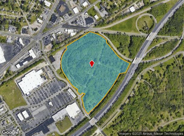
109 Missy Elliott Blvd
Hampton Roads
New Port
Virginia Beach-Norfolk-Newport News, VA-NC
Portsmouth
0523-0010
Virginia
Residentialnec
30.49 AC
X
Portsmouth
5155290078D
DEMOGRAPHICS near 109 Missy Elliott Blvd
1 Mile
3 Mile
5 Mile
2024 Total Population
9,818
87,277
187,018
2029 Population
9,828
87,541
188,849
Pop Growth 2024-2029
+ 0.10%
+ 0.30%
+ 0.98%
Average Age
37
38
38
2024 Total Households
3,927
34,284
75,216
HH Growth 2024-2029
+ 0.05%
+ 0.24%
+ 0.73%
Median Household Inc
$49,778
$54,140
$63,843
Avg Household Size
2.40
2.40
2.40
2024 Avg HH Vehicles
2.00
2.00
2.00
Median Home Value
$172,527
$192,076
$238,946
Median Year Built
1960
1964
1971
Nearby Places
- Restaurants
- Banks
- Shops
- Fitness
- Groceries
PUBLIC TRANSPORTATION
COMMUTER RAIL
Norfolk (Northeast Regional - Amtrak)
DRIVE
WALK
Distance
Norfolk (Northeast Regional - Amtrak)
11 min
5.8 mi
AIRPORT
Norfolk International
DRIVE
WALK
Distance
Norfolk International
23 min
12.2 mi
Newport News/Williamsburg International
DRIVE
WALK
Distance
Newport News/Williamsburg International
46 min
31.2 mi
Freight Ports
Virginia Port Authority - Portsmouth
DRIVE
WALK
Distance
Virginia Port Authority - Portsmouth
11 min
4.8 mi
Nearby Properties
Address
Land Use
TOTAL SIZE
Lot Size
Zoning
Address
Land Use
TOTAL SIZE
Lot Size
Zoning
250,000 SF
38 AC
MUH
Address
Land Use
TOTAL SIZE
Lot Size
Zoning
300,829 SF
38.40 AC
IL
Address
Land Use
TOTAL SIZE
Lot Size
Zoning
250,766 SF
31.14 AC
NMU
Address
Land Use
TOTAL SIZE
Lot Size
Zoning
406,344 SF
8.45 AC
GMU
Address
Land Use
TOTAL SIZE
Lot Size
Zoning
1,684 SF
23.36 AC
RMF1: MULT
Address
Land Use
TOTAL SIZE
Lot Size
Zoning
120,471 SF
10.32 AC
M1: LIGHT
Address
Land Use
TOTAL SIZE
Lot Size
Zoning
295,000 SF
27.89 AC
M1: LIGHT
Address
Land Use
TOTAL SIZE
Lot Size
Zoning
133,380 SF
6.20 AC
NMU
Address
Land Use
TOTAL SIZE
Lot Size
Zoning
241,397 SF
50.65 AC
M1: LIGHT
Address
Land Use
TOTAL SIZE
Lot Size
Zoning
28,253 SF
32.34 AC
M3: WATERF
Address
Land Use
TOTAL SIZE
Lot Size
Zoning
121,200 SF
9.81 AC
PUD: PLANN
Address
Land Use
TOTAL SIZE
Lot Size
Zoning
181,723 SF
41.87 AC
M1: LIGHT
Address
Land Use
TOTAL SIZE
Lot Size
Zoning
274,700 SF
24.69 AC
UR
Address
Land Use
TOTAL SIZE
Lot Size
Zoning
3.61 AC
GMU
Address
Land Use
TOTAL SIZE
Lot Size
Zoning
143,220 SF
44.78 AC
M1: LIGHT
Address
Land Use
TOTAL SIZE
Lot Size
Zoning
79,259 SF
18.87 AC
UR
Address
Land Use
TOTAL SIZE
Lot Size
Zoning
201,989 SF
20.08 AC
GMU
Address
Land Use
TOTAL SIZE
Lot Size
Zoning
85,266 SF
10.10 AC
M1: LIGHT
Address
Land Use
TOTAL SIZE
Lot Size
Zoning
81,165 SF
23.07 AC
UR
Address
Land Use
TOTAL SIZE
Lot Size
Zoning
291,454 SF
24.68 AC
URM
Address
Land Use
TOTAL SIZE
Lot Size
Zoning
205,470 SF
12.39 AC
URM
Address
Land Use
TOTAL SIZE
Lot Size
Zoning
58,680 SF
8.84 AC
UR
Address
Land Use
TOTAL SIZE
Lot Size
Zoning
387,092 SF
55.92 AC
URM
Address
Land Use
TOTAL SIZE
Lot Size
Zoning
193,534 SF
17.99 AC
M1: LIGHT
Address
Land Use
TOTAL SIZE
Lot Size
Zoning
212,100 SF
10.14 AC
SD
Address
Land Use
TOTAL SIZE
Lot Size
Zoning
110,707 SF
17.95 AC
URM
Address
Land Use
TOTAL SIZE
Lot Size
Zoning
197,533 SF
15 AC
M1: LIGHT
Address
Land Use
TOTAL SIZE
Lot Size
Zoning
98,715 SF
20.64 AC
UR
Address
Land Use
TOTAL SIZE
Lot Size
Zoning
155,750 SF
12.01 AC
URM
Address
Land Use
TOTAL SIZE
Lot Size
Zoning
97,012 SF
5.40 AC
URM
The World's #1 Commercial Real Estate Marketplace
Connect with us
© 2025 CoStar Group
The information above has been obtained from sources believed reliable. While we do not doubt its accuracy we have not verified it and make no guarantee, warranty or representation about it. It is your responsibility to independently confirm its accuracy and completeness. Any projections, opinions, assumptions, or estimates used are for example only and do not represent the current or future performance of the property. The value of this transaction to you depends on tax and other factors which should be evaluated by your tax, financial, and legal advisors. You and your advisors should conduct a careful, independent investigation of the property to determine to your satisfaction the suitability of the property for your needs.